Category:1840s maps of Hesse
Jump to navigation
Jump to search
Federal states of Germany:
Media in category "1840s maps of Hesse"
The following 3 files are in this category, out of 3 total.
-

-
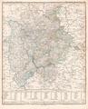
 Karte des Forstreviers Elgershausen.tif 4,006 × 2,878; 33.27 MB
-