
Category:1840s maps of Bavaria
Federal states of Germany:
Subcategories
This category has the following 2 subcategories, out of 2 total.
- 1846 maps of Bavaria (4 F)
.
- 1840s maps of Augsburg (5 F)
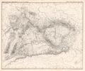
Media in category "1840s maps of Bavaria"
The following 3 files are in this category, out of 3 total.
-
 Karte der Pfarre St. Marienkirchen im Decanate Scheerding 1845.png 654 × 517; 925 KB
-
 Plateau von Deutschland Platt 1848.pdf 2,858 × 2,375; 737 KB
-
 Karte vom Königreich Bayern Platt 1848.pdf 2,397 × 2,993; 1.14 MB
