Category:16th-century maps of the Iberian Peninsula
Jump to navigation
Jump to search
Subcategories
This category has the following 13 subcategories, out of 13 total.
*
Media in category "16th-century maps of the Iberian Peninsula"
The following 9 files are in this category, out of 9 total.
-

-
 Print, book-illustration, map (BM 1982,U.2457).jpg 1,600 × 908; 399 KB
-
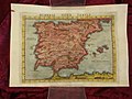
 Tabula Europae II (Spain, Portugal).jpg 800 × 600; 139 KB
-

-
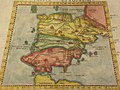
 Hispania Nuova Tavola (Spain).jpg 800 × 600; 124 KB
-
 Mapa de Alonso de Santa Cruz. Atlas de El Escorial (c. 1538-1554).jpg 1,453 × 1,302; 1.63 MB
-
 Mapa de España y Portugal (Forlani de Veronese).jpg 2,855 × 2,313; 7.36 MB
-
 Península Ibérica no atlas portolano de Bartolomeo Olives (1585-1599).jpg 2,437 × 1,939; 3.48 MB
-
 Península Ibérica no atlas portolano de Joan Oliva (c. 1590-1615).jpg 3,391 × 2,244; 3.28 MB
.jpg)
.jpg)
.jpg)

.jpg)
.jpg)
.jpg)
.jpg)
.jpg)