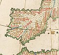
Category:1510s maps of the Iberian Peninsula
Jump to navigation
Jump to search
| 16th-century maps of the Iberian Peninsula: ← 1500s 1510s 1520s 1530s 1540s 1550s 1560s 1570s 1580s 1590s → |
Media in category "1510s maps of the Iberian Peninsula"
The following 4 files are in this category, out of 4 total.
-
Tabula Moderna et Nova Hispanie. Martin Waldseemüller (1513).jpg 5,863 × 4,384; 5.09 MB
-
AtlasMiller BNF Euromed Ispania.jpg 1,105 × 732; 171 KB
-
Península Ibérica no Atlas Miller (c. 1519).jpg 4,583 × 3,251; 6.31 MB
-
Península Ibérica no portolano de Visconte Maggiolo (1511).jpg 951 × 885; 565 KB


