Category:20th-century maps of the Iberian Peninsula
Jump to navigation
Jump to search
Subcategories
This category has the following 14 subcategories, out of 14 total.
*
- 20th-century maps of Gibraltar (13 F)
Media in category "20th-century maps of the Iberian Peninsula"
The following 7 files are in this category, out of 7 total.
-
 Butler Hispania.jpg 2,501 × 2,036; 1.72 MB
-
 Brockhaus and Efron Jewish Encyclopedia e8 367-0.jpg 1,591 × 1,072; 447 KB
-
 D349- N° 374. Espagne et Maurétanie. - liv3-ch11.png 1,436 × 1,594; 327 KB
-
 D468- N° 286. Toponymie arabe en Espagne. -liv3-ch4.png 1,447 × 1,559; 162 KB
-
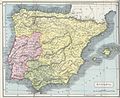
 Mediæval and modern history (1902) (14798549903).jpg 2,512 × 1,904; 491 KB
-

-
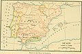 The dawn of American history in Europe (1912) (14761242581).jpg 2,368 × 1,570; 362 KB


_(14798549903).jpg)
_(14784411852).jpg)
_(14761242581).jpg)