Category:1570s maps of the Iberian Peninsula
Jump to navigation
Jump to search
| 16th-century maps of the Iberian Peninsula: ← 1500s 1510s 1520s 1530s 1540s 1550s 1560s 1570s 1580s 1590s → |
Subcategories
This category has the following 2 subcategories, out of 2 total.
P
Media in category "1570s maps of the Iberian Peninsula"
The following 8 files are in this category, out of 8 total.
-
 UBBasel Map 1571 Kartenslg AA 13-14.tif 17,637 × 9,729, 2 pages; 966.71 MB
-

-

-
 MAPA DE ESPAÑA EN 1570.jpg 2,710 × 2,020; 1.21 MB
-
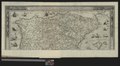
 Mapa-Abraham-Ortelius.jpg 1,024 × 782; 1.38 MB
-
 Península Ibérica no portolano de Diogo Homem (1570).jpg 740 × 508; 200 KB
-
 Regni Hispaniae post omnium editiones locupletissima descriptio - Abraham Ortelius.jpg 2,976 × 2,313; 2.27 MB
-
 Stefano Bonsignori - Spain - Google Art Project.jpg 6,577 × 6,738; 22.57 MB


.jpg)

