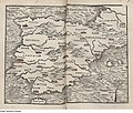
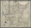
Category:1550s maps of the Iberian Peninsula
Jump to navigation
Jump to search
| 16th-century maps of the Iberian Peninsula: ← 1500s 1510s 1520s 1530s 1540s 1550s 1560s 1570s 1580s 1590s → |
Subcategories
This category has the following 3 subcategories, out of 3 total.
P
- 1550s maps of Portugal (2 F)
S
- 1550s maps of Spain (3 F)
Media in category "1550s maps of the Iberian Peninsula"
The following 25 files are in this category, out of 25 total.
-
Cc-1230-r 0001 1 t24-C-R0150.jpg 4,944 × 3,372; 2.14 MB
-
Spain and Portugal RMG F1415.tiff 6,475 × 5,481; 101.54 MB
-
Spain and western Mediterranean RMG F1413.tiff 6,427 × 5,474; 100.65 MB
-
Geographiae Claudii Ptolemaei Alexandrini (Münster, 1552) 34.jpg 10,470 × 6,650; 6.58 MB
-
Fotothek df tg 0005102 Geographie ^ Karte.jpg 800 × 678; 296 KB
-
Tabula moderna Hispanie - btv1b525114422.jpg 8,284 × 6,592; 6.08 MB
-
Tabula moderna Hispanie - btv1b55004993j.jpg 7,486 × 6,091; 4.5 MB
-
Tabula moderna Hispanie - btv1b84947392.jpg 8,991 × 6,780; 9.75 MB
-
Tabula moderna Hispanie. RRA 3= 72. Pièce 45.jpg 2,322 × 1,768; 940 KB
-
Nova descriptio Hispaniae (Cock, 1553).jpg 2,794 × 2,313; 4.98 MB
-
1554 map of France and the Iberian Peninsula.jpg 11,818 × 9,452; 27.01 MB
-
Hispanien RMG F1730.tiff 7,417 × 4,831; 102.51 MB
-
Hispania brevis descriptio, ad chorographiae studiosos. N. S. RRA 3= 72. Pièce 46.jpg 2,067 × 1,871; 1.07 MB
-
Hispaniae descriptio - btv1b52511463b.jpg 9,290 × 9,247; 11.42 MB
-
Hispaniae descriptio - btv1b55004988c.jpg 7,420 × 5,827; 6.15 MB
-
Hispaniae Descriptio de Vincenzo Luchini (1559).jpg 8,145 × 6,009; 44.92 MB
-
Diogo Homen 1559 Espagne.jpg 2,408 × 1,791; 1.21 MB
-
Península Ibérica no portolano de Angelo de Conte Freducci (1555).jpg 3,822 × 2,912; 9.53 MB
-
Península Ibérica no portolano de Jacobo Russo (c. 1550).jpg 762 × 550; 410 KB
-
Península Ibérica no Queen Mary Atlas de Diogo Homem (1558).jpg 8,032 × 5,243; 16.99 MB


