Category:1650s maps of Bavaria
Jump to navigation
Jump to search
|
Federal states of Germany: |
Media in category "1650s maps of Bavaria"
The following 9 files are in this category, out of 9 total.
-

-

-

-
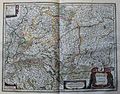
 Ober Bayern oder Ober Pfalz ca.1658 von Joannis Janßonius.jpg 1,233 × 1,114; 434 KB
-
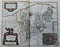
 "Palatinatus Bavariae" (22245708522).jpg 3,840 × 3,009; 2.88 MB
-
 "Sueviae nova tabula" (22267967841).jpg 3,648 × 2,869; 2.71 MB
-

-
 "Territorium norimbergense" (21634731204).jpg 3,651 × 2,863; 2.13 MB
-
 Augsburg-Gvstaua-Avgusta.jpg 843 × 741; 703 KB

.jpg)
.jpg)

.jpg)
.jpg)
.jpg)
.jpg)
