Category:1680s maps of Bavaria
Jump to navigation
Jump to search
|
Federal states of Germany: |
Media in category "1680s maps of Bavaria"
The following 10 files are in this category, out of 10 total.
-

-
 Historische Landkarte vom Schwäbische Reichskreis um 1680.jpg 4,000 × 2,606; 3.8 MB
-

-
 Karte - Gebiet um Hilpoltstein - Finckh - Blatt 9 - 1684.jpg 1,366 × 1,070; 450 KB
-

-

-

-
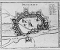 Festung Ingolstadt 1500.jpg 300 × 251; 32 KB
-
 Karte des fränkischen Reichskreises.jpg 4,982 × 4,200; 19.7 MB
-
 Karte Fränkischer Reichskreis.jpg 5,018 × 4,317; 25.91 MB
.jpg)


.jpg)
.jpg)


