Category:1650s maps of Hamburg
Jump to navigation
Jump to search
|
Federal states of Germany: |
Subcategories
This category has only the following subcategory.
Media in category "1650s maps of Hamburg"
The following 10 files are in this category, out of 10 total.
-
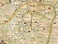
 Joh Mejer Stormarn 1650.jpg 5,216 × 3,762; 19.05 MB
-
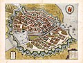
 Grundtriß der edlen weitberumbte Statt Hamburg Anno 1651.jpg 2,399 × 1,796; 1.22 MB
-
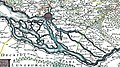
 Amt Tremsbüttel (1652).jpg 600 × 450; 117 KB
-
 Hamburg Trittow Mejer AD1652.jpg 2,511 × 1,930; 1.41 MB
-
 Bodleian Libraries, Map of Hamburg as Matthias Merian's Hamburgum.jpg 1,000 × 675; 182 KB
-
 PPN611193760 Hamburgum (1657).jpg 9,703 × 7,366; 16.06 MB
-
 PPN611193760 Hamburgum (1657).tif 9,722 × 8,083; 38.91 MB
-
 Elbinseln Joh Mejer 1650 (cropped).jpg 1,251 × 994; 350 KB
-
 Elbinseln Joh Mejer 1650.jpg 2,232 × 1,242; 789 KB
-
 Kartenausschnitt Hamburg 1651.PNG 899 × 776; 1.87 MB


.jpg)


.jpg)
.jpg)

