Category:1650s maps of Saxony
Jump to navigation
Jump to search
|
Federal states of Germany: |
Media in category "1650s maps of Saxony"
The following 7 files are in this category, out of 7 total.
-
 Ober-Sachsen, Laußnitz, und Meissen.jpg 4,520 × 4,018; 5.91 MB
-
-
 "Lusatia superior - Barthol. Sculteto Gorlitio" (21635619044).jpg 3,815 × 3,066; 2.56 MB
-
 "Misnia marchionatus = Meissen" (22232354136).jpg 3,978 × 3,079; 2.7 MB
-
 "Saxonia superior & Hall Episcopatus" (22268899321).jpg 3,812 × 3,116; 2.41 MB
-
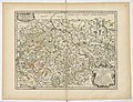
 "Saxonia superior, cum Lusatia et misnia" (22245558972).jpg 3,752 × 2,943; 2.55 MB
-
 Haute Saxe ou Estats du Duc et Eslecteur.png 9,242 × 7,261; 132.72 MB

.jpg)
.jpg)
.jpg)
.jpg)
.jpg)
