Category:1600s maps of Bavaria
Jump to navigation
Jump to search
|
Federal states of Germany: |
Media in category "1600s maps of Bavaria"
The following 11 files are in this category, out of 11 total.
-
 Maps of the territory of Basel and of the Swabian Circle by Abraham Ortelius.jpeg 1,589 × 1,189; 599 KB
-
 Karta över Bayern, från 1600-talet - Skoklosters slott - 97977.tif 3,587 × 5,188; 53.26 MB
-
 Map of Bavaria North East 1600.jpg 800 × 600; 168 KB
-
 Map of Bavaria-Franconia North West 1600.jpg 800 × 600; 169 KB
-
 Map of Bavaria-Franconia Small.jpg 800 × 600; 160 KB
-
 Map of Bavaria-Franconia South East 1600.jpg 800 × 600; 170 KB
-
 Map of Bavaria-Franconia South West 1600.jpg 800 × 600; 168 KB
-
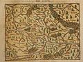
 Map of Bavaria1600.jpg 800 × 600; 136 KB
-
 Map of Swabia, Bavaria, Odenwald (1600).jpg 800 × 600; 134 KB
-
 Map of Swabia, Bavaria, Odenwald NE 1600.jpg 800 × 600; 166 KB
-
 Map of Swabia, Bavaria, Odenwald SE 1600.jpg 800 × 600; 163 KB


.jpg)

