User talk:Phoenix7777
|
Our first steps tour and our frequently asked questions will help you a lot after registration. They explain how to customize the interface (for example the language), how to upload files and our basic licensing policy (Wikimedia Commons only accepts free content). You don't need technical skills in order to contribute here. Be bold when contributing and assume good faith when interacting with others. This is a wiki. More information is available at the community portal. You may ask questions at the help desk, village pump or on IRC channel #wikimedia-commons (webchat). You can also contact an administrator on their talk page. If you have a specific copyright question, ask at the copyright village pump. |
|
Tip: Categorizing images[edit]

Thanks a lot for contributing to the Wikimedia Commons! Here's a tip to make your uploads more useful: Why not add some categories to describe them? This will help more people to find and use them.
Here's how:
1) If you're using the UploadWizard, you can add categories to each file when you describe it. Just click "more options" for the file and add the categories which make sense:

2) You can also pick the file from your list of uploads, edit the file description page, and manually add the category code at the end of the page.
[[Category:Category name]]
For example, if you are uploading a diagram showing the orbits of comets, you add the following code:
[[Category:Astronomical diagrams]][[Category:Comets]]
This will make the diagram show up in the categories "Astronomical diagrams" and "Comets".
When picking categories, try to choose a specific category ("Astronomical diagrams") over a generic one ("Illustrations").
Thanks again for your uploads! More information about categorization can be found in Commons:Categories, and don't hesitate to leave a note on the help desk.CategorizationBot (talk) 12:56, 6 February 2012 (UTC)
- Image:Japan air 123 route ja.svg was uncategorized on 5 February 2012 CategorizationBot (talk) 12:56, 6 February 2012 (UTC)
- Image:ShriGuruRavidasJikijai.png was uncategorized on 14 February 2012 CategorizationBot (talk) 15:09, 15 February 2012 (UTC)
Help Request[edit]
Hello, can you please help out here? its been a while since these maps and a few others have been posted. Thank you--باسم (talk) 09:18, 11 September 2012 (UTC)
- Sorry to ask often, but we need these maps ASAP and its been a whole months without any progress. Thank you--باسم (talk) 18:17, 4 October 2012 (UTC)
A Little Help With A Map[edit]
Hey, can I have a little help here please. It is a little urgent because of the recency in the Politics of Ghana.
(talk) 15:25, 23 December, 2012 (UTC)
Request[edit]
Hello, can you please help out here?--باسم (talk) 17:31, 30 December 2012 (UTC)
Dear Phoenix777,
I had nominated this map for deletion...and the uploader has no objections in the DR request. However, the map is rather heavily used on Czech wikipedia. It can be kept if someone like you can only upload the borders of South Sudan on it. The colours of the countries in Africa are all blue. Can you consider uploading the borders of South Sudan onto the old map showing a united North and South Sudan? Just curious. If you can then, I will withdraw this DR nomination and the map can continue to be used on wikipedia. If not, its OK. This is definitely my final request.
Thank you for reading this message. Best Regards, --Leoboudv (talk) 20:18, 30 December 2012 (UTC)
 Done―― Phoenix7777 (talk) 23:25, 30 December 2012 (UTC)
- Thanks for all your kind help here. I won't bother you with anymore map requests. PS: If you like native Indian art or European ceramic art wares, I have put a lot of my photos on my own Commons userpage from the University of BC in Vancouver, Canada! Enjoy them if you wish. Best Regards, --Leoboudv (talk) 00:51, 31 December 2012 (UTC)
File source is not properly indicated: File:Jozefina Topalli Signature.svg[edit]
| This media may be deleted. |
A file that you have uploaded to Wikimedia Commons, File:Jozefina Topalli Signature.svg, is missing information about where it comes from or who created it, which is needed to verify its copyright status. Please edit the file description and add the missing information, or the file may be deleted.
If you created the content yourself, enter If someone else created the content, or if it is based on someone else's work, the source should be the address to the web page where you found it, the name and ISBN of the book you scanned it from, or similar. You should also name the author, provide verifiable information to show that the content is in the public domain or has been published under a free license by its author, and add an appropriate template identifying the public domain or licensing status, if you have not already done so. Warning: Wikimedia Commons takes copyright violations very seriously and persistent violators will be blocked from editing. Please add the required information for this and other files you have uploaded before adding more files. If you need assistance, please ask at the help desk. Thank you! |
Denniss (talk) 20:32, 10 April 2013 (UTC)
- I added a source.[1] ―― Phoenix7777 (talk) 11:48, 11 April 2013 (UTC)
Some baklava for you![edit]

|
My pleasure to help your work... Anyway, thanx for the beer, I hope you aprriceate this pastry :-) ... Dэя-Бøяg 15:50, 25 August 2013 (UTC) |
Request[edit]
Dear Phoenix7777: I find the figure about "World MERS Outbreak" that is made by you. Can you tell me where can I find the original data? Or can you share the original data with me? I want to use the value to do some statistic studies. Thanks a lot!
[edit]
The dispute over this file's description page is discussed at COM:ANU. Thanks. -- とある白い猫 ちぃ? 23:24, 5 August 2015 (UTC)
Heads up on some information[edit]
The administrator who has started Commons:Administrators'_noticeboard/User_problems#File:Japanese_Special_Naval_Landing_Forces_in_Battle_of_Shanghai_1937.jpg (とある白い猫) has stated on IRC in #wikimedia-commons in relation to that discussion:
I want to stab someone
This administrator has been very vocal on conduct on IRC -- he claims that saying "bullshit" is harassment, but he obviously doesn't have the same thought of expressing to an open channel that he wishes to stab someone.
I am not getting involved in the nexus of that dispute at AN/U, but neither should this editor/admin. From here on out he should see himself as unnecessarily involved and should no longer use the tools in relation to you, or that file, given his "I want to stab someone" inflammatory commentary. 85.234.150.42 23:02, 12 August 2015 (UTC)

|
File:Sea of Japan Map en.png has been listed at Commons:Deletion requests so that the community can discuss whether it should be kept or not. We would appreciate it if you could go to voice your opinion about this at its entry.
If you created this file, please note that the fact that it has been proposed for deletion does not necessarily mean that we do not value your kind contribution. It simply means that one person believes that there is some specific problem with it, such as a copyright issue. Please see Commons:But it's my own work! for a guide on how to address these issues. |
58.226.218.81 14:24, 15 February 2016 (UTC)
Data from https://commons.wikimedia.org/wiki/File:U.S._adoption_of_Korean_children_by_year.svg[edit]
Hi Phoenikx7777,
Where did you get the figure in orange on your graph of total number of Korean children adopted in 1998 of 230,324? I'd like to cite that, but I can't find any references.
Thanks, WikiGod0101 (talk) 09:15, 22 August 2016 (UTC)
- I am sorry. I can't remember where the number came from. I corrected the charts.―― Phoenix7777 (talk) 22:38, 22 August 2016 (UTC)
-
 U.S. adoption of Korean children by year
 -
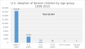 U.S. adoption of Korean children by age group


![[1]](https://commons.wikimedia.org/w/index.php?title=File:Jozefina_Topalli_Signature.svg&curid=18871863&diff=94350735&oldid=94328630)
Bummer, I was really hoping you had a resource for that. Thanks for updating the graphs.
WikiGod0101 (talk) 21:59, 23 August 2016 (UTC)
2016 Berlin attack route map.svg[edit]
The approach from the Hardenberstraße onto Breitscheitplatz could be a bit S-shaped as the driver had to maneuver slightly to the right between a lamp post with signs and a pedestrian light to enter the pedestrian area between the booths before swerving to the left again to continue the mayhem. Today’s Tagesspiegel online has a good aerial view where even the tread marks are visible, marked by the police. I was also there in person. --Alandeus (talk) 16:11, 21 December 2016 (UTC)
- @Alandeus: could you provide a link to the Tagesspiegel article so that I can verify the route and update the map?―― Phoenix7777 (talk) 21:43, 21 December 2016 (UTC)
- I think I found the photograph and updated the map. Next question is where the truck came from.―― Phoenix7777 (talk) 23:20, 21 December 2016 (UTC)
- That defiantly is the correct photo. And the truck defiantly came from Hardenbergstraße. Hardenbergstraße turns into Budapester Straße at this intersection. You can see the “Kantstraße” street sign on the lamppost on the bottom right. No way that semi could have even come out of the Kantstraße and made it around that corner into the market anyway. Was there this morning again, and they are putting up massiv concrete barriers around the corner now. Alandeus (talk) 09:15, 22 December 2016 (UTC)
- I think I found the photograph and updated the map. Next question is where the truck came from.―― Phoenix7777 (talk) 23:20, 21 December 2016 (UTC)
Thanks for the new map, by the way. I re-inserted it for the faulty one that was there this morning. Alandeus (talk) 10:06, 22 December 2016 (UTC)
Hi Phoenix7777,
may you please add Q4/2016 ? It's not yet published, but the guidance is.--Schiggie (talk) 23:49, 18 January 2017 (UTC)
- The press release does not provide the segment information. So I will update the chart after the Q4 Earnings Release scheduled on January 24. Please be patient.―― Phoenix7777 (talk) 03:39, 19 January 2017 (UTC)
Lancaster West Estate[edit]
Thanks for adding the map- can you give me a two paragraph how-to on the method with tips on what not to do. But... if you look at the map I drew lower down on the page taken from the 1972 map you will see what you have drawn is only half of the estate. (Phase 1) .. The estate includes Clarendon Walk, Camelford Walk etc going upto Ladbroke Crescent. 19:11, 2 July 2017 (UTC)ClemRutter (talk)
- Thank you for correcting the caption of the map. I knew nothing about the w:Lancaster West Estate until this edit was added to w:Grenfell Tower fire. I realized the map I added was "phase 1" but I couldn't find the information about the later phase of construction. So I just described the map as "Lancaster West Estate".―― Phoenix7777 (talk) 20:44, 2 July 2017 (UTC)
- I have not been editing GTfire-as NPOV would have been a problem- instead I have spent the last two weeks working on GT and LWE- so we could have available background- getting the information has been akin to forensics! But what is the trick with uploading Open Street Maps?ClemRutter (talk) 01:19, 3 July 2017 (UTC)
Would you like to produce a few alternative to your Grenfell Tower focused map. The new revision does not work for the Lancaster West Estatepage- the previous one did. You should consider the unique roofing pattern thrown up by each of the finger blocks as can be seen in some of the ariel press photos. I need new maps to illustrate the Kensington Leisure Centre and the Kensington Aldridge Academy and it would be good to show the whole of Lancaster West Estate including the eastern blocks Clarendon etc. A side question- you changed the font from a san-serif to a serif. Do you know of any MOS advice on fonts in maps? ClemRutter (talk) 08:29, 14 July 2017 (UTC)
Hi Phoenix7777,
this maps has some artifacts: The exactness of the coordinates is limited, so many epicenters are placed on a string of beads.--DCKH (talk) 09:57, 17 July 2017 (UTC)
- Thanks for the heads-up. I corrected the map. From 2000 to 2004, original data has only 4 significant figures (one decimal place: ex. 127.70). From 2005, the data has 5 significant figures (two decimal places: ex. 130.39). I used the precision of one decimal places for all the data. I changed to use two decimal places.―― Phoenix7777 (talk) 22:07, 17 July 2017 (UTC)
Code[edit]
Hi. Would you like to publish your code and procedings, especially for the aftershake diagrams? --Itu (talk) 10:07, 24 September 2017 (UTC)
- Hi Itu, I don't use any code for earthquake charts. I am using Excel scatter chart to create them. For a magnitude chart, time is used for X-axis and magnitude for Y-axis. For an earthquake map, longitude is used for X-axis and latitude for Y-axis. For a large map, Latitude-Mercator conversion is required. After creating a chart in Excel, it is exported to PDF and then converted to SVG by Inkscape.―― Phoenix7777 (talk) 11:48, 24 September 2017 (UTC)
Central Mexico map[edit]
Great map. Thank you.
It is Zitácuaro, eh. (The Purépecha language likes to put its accents there.)
Cheers, Varlaam (talk) 04:40, 25 September 2017 (UTC)
Hi Phoenix7777, thank you for the image! Can you please provide the origin of the underlaying map you used? --78.52.158.82 00:59, 3 October 2017 (UTC)
- OpenStreetMap―― Phoenix7777 (talk) 02:52, 3 October 2017 (UTC)
- Thank you for fixing it. --78.52.158.82 04:04, 3 October 2017 (UTC)
Hwasong-15[edit]
Hello Phoenix7777, thanks for the extension of the trajectory of the Hwasong-14 with the Hwasong-15. However, the picture is horizontally and vertically not equally scaled. Can you make an image with equal scales, so that we can see so how lofted the trajectories really are? People can get a better feeling for the range of the missiles then too.
- Thank you for the suggestion. Corrected.―― Phoenix7777 (talk) 13:25, 29 November 2017 (UTC)
- Perfect! Thanks!
I noticed that you created this map, and I really like it. Would you consider creating similar maps for previous years (such as 2016)? I think that such maps could be useful graphical representations of the earthquakes that occur annually. Master of Time (talk) 03:16, 7 January 2018 (UTC)
Regarding File:Carr fire and Hirz fire 24-08-18.png and File:Mendocino Complex Fire on 24-08-18.png[edit]
It is my understanding that the en:National Interagency Fire Center is a government agency, and therefore should be a "work is in the public domain in the United States because it is a work prepared by an officer or employee of the United States Government as part of that person’s official duties under the terms of Title 17, Chapter 1, Section 105 of the US Code". The copyright notice on this page that you linked only indicates that the "NWCG complies with existing laws and directives that address the digital, copyrights, trademark, and patent rights of the public.". Their copyright notice does not contradict that their work is in the public domain. Please ping me when you reply as I am generally active only on EN wiki. Insertcleverphrasehere (talk) 04:57, 24 August 2018 (UTC)
File:Animation of Kīlauea Lower East Rift Zone Fissures and Flows.gif[edit]
Several more map images added to this gif animation would make it complete for the foreseeable future. Thanks. — Preceding unsigned comment was added by 64.228.167.136 (talk) 01:42, 29 August 2018 (UTC)
- Updated to August 14.―― Phoenix7777 (talk) 13:11, 30 August 2018 (UTC)
New Horizons flyby - Hydra missing.[edit]

▇ Pluto · ▇ Charon · ▇ Styx · ▇ Nix · ▇ Kerberos · ▇ New Horizons


On your New Horizons flyby of Pluto image, the outermost moon Hydra is missing. Дрейгорич (talk) 19:34, 2 January 2019 (UTC) ...Hello? Дрейгорич (talk) 23:46, 9 January 2019 (UTC)
- @Дрейгорич: It is a restriction of animation software. The program can draw a maximum of five objects and one spacecraft.―― Phoenix7777 (talk) 00:39, 10 January 2019 (UTC)
- @Phoenix7777: Is it possible to do two animations and merge/stitch them together somehow? Дрейгорич (talk) 01:24, 10 January 2019 (UTC)
- @Phoenix7777: What software are you using to render these animations? (main reason i've stumbled onto your talk page)
- @Дрейгорич: It depends on the software used for post-processing/creating the GIFs; The GIMP can be used to merge multiple image layers into a single GIF, although it is extremely tedious to do without automating the process with Python scripts. --dsprc (talk) 03:11, 10 January 2019 (UTC)
- I wrote the program. I don't think the outer most moon is necessary for a flyby animation. There is an animation showing the five moons of Pluto.―― Phoenix7777 (talk) 10:00, 10 January 2019 (UTC)
- What libraries are you using for it? --dsprc (talk) 20:01, 10 January 2019 (UTC)
- Where can I get that program? Anonymous7002 (talk) 07:54, 21 October 2021 (UTC)
- I wrote the program. I don't think the outer most moon is necessary for a flyby animation. There is an animation showing the five moons of Pluto.―― Phoenix7777 (talk) 10:00, 10 January 2019 (UTC)
- @Phoenix7777: Is it possible to do two animations and merge/stitch them together somehow? Дрейгорич (talk) 01:24, 10 January 2019 (UTC)
The last part of the trajectory after the second rendezvous with the Moon looks unbelievable. The spacecraft having, as stated, a limited amount of fuel could not make such abrupt change in the direction of motion (as on 1998-06-13 02:38 - 1998-06-14 01:38 frames) and loop (as on 1998-06-15 22:38 frame).--Yellow Horror (talk) 14:47, 31 July 2019 (UTC)
|
|
File:PRC National Road.jpg has been listed at Commons:Deletion requests so that the community can discuss whether it should be kept or not. We would appreciate it if you could go to voice your opinion about this at its entry.
If you created this file, please note that the fact that it has been proposed for deletion does not necessarily mean that we do not value your kind contribution. It simply means that one person believes that there is some specific problem with it, such as a copyright issue. Please see Commons:But it's my own work! for a guide on how to address these issues. |
Jcb (talk) 18:39, 23 August 2019 (UTC)
Floor plan[edit]

Hallo Phoenix7777, I saw you created the floor plan of the Jo-an, thank you for that. May I ask you to please create another one, this one for the Sarumen Chaseki (猿面望嶽茶席)? The file can be found here [2]. Please omit the walkway to the neighbouring building in the right. Thank you very much. Gryffindor (talk) 00:35, 26 November 2019 (UTC)
- Hi Gryffindor, I created the drawing but much of the details are unknown especially the light blue area.―― Phoenix7777 (talk) 23:15, 26 November 2019 (UTC)

There seems to be something wrong with the last 10 seconds or so of the animation. After the spacecraft passes the orbit of Neptune, little ever-longer vertical lines can be seen "coming out of" the craft's path. Same problem in the previous version, uploaded on 1 December 2018. When you changed the aspect ratio, something must've gone wrong. - dcljr (talk) 16:03, 26 November 2019 (UTC)
- Hi dcljr , The drop lines show the distance from the ecliptic plane. Voyager 2 was leaving the ecliptic plane downward. See the image right.―― Phoenix7777 (talk) 23:25, 26 November 2019 (UTC)
- Might want to explain that in the description of the image. - dcljr (talk) 09:43, 28 November 2019 (UTC)
- Displaying the drop lines are common practice for astronomical objects whose orbital inclination is large. See NASA JPL Small-Body Database Browser for example..―― Phoenix7777 (talk) 11:48, 28 November 2019 (UTC)
- It might be "common practice" in such animations, but I bet an overwhelming majority of people looking at the image don't know that. It would be nice to clue more of them into that convention. After all, how are they going to learn about it if it's never pointed out? - dcljr (talk) 01:20, 29 November 2019 (UTC)
- You can add an explanation to the animation if you wish. Please note that there are hundreds of images which have drop lines in Wikimedia Commons.―― Phoenix7777 (talk) 05:55, 29 November 2019 (UTC)
- Then there should be hundreds of image pages that either explain or link to an explanation of the convention. Since I didn't even know about it, I'm sure you (or someone else) could do a better job of that than I. If you don't want to do anything about this, I guess I could just post about it on COM:VP. (BTW, I suppose it's out of the question to mention what's happening in the animation itself—e.g., "leaving ecliptic plane at [whatever angle]", or some such.) - dcljr (talk) 01:46, 1 December 2019 (UTC)
- I just came here to ask about the lines on the Voyager 11 animation (used in https://bigthink.com/starts-with-a-bang/another-einstein-or-newton/). How about a "standard practice for astronomical illustrations" template, which says something like "See this article to understand why this illustration looks the way it does". Scott McNay (talk) 14:31, 12 June 2022 (UTC)
- Then there should be hundreds of image pages that either explain or link to an explanation of the convention. Since I didn't even know about it, I'm sure you (or someone else) could do a better job of that than I. If you don't want to do anything about this, I guess I could just post about it on COM:VP. (BTW, I suppose it's out of the question to mention what's happening in the animation itself—e.g., "leaving ecliptic plane at [whatever angle]", or some such.) - dcljr (talk) 01:46, 1 December 2019 (UTC)
- You can add an explanation to the animation if you wish. Please note that there are hundreds of images which have drop lines in Wikimedia Commons.―― Phoenix7777 (talk) 05:55, 29 November 2019 (UTC)
- It might be "common practice" in such animations, but I bet an overwhelming majority of people looking at the image don't know that. It would be nice to clue more of them into that convention. After all, how are they going to learn about it if it's never pointed out? - dcljr (talk) 01:20, 29 November 2019 (UTC)
- Displaying the drop lines are common practice for astronomical objects whose orbital inclination is large. See NASA JPL Small-Body Database Browser for example..―― Phoenix7777 (talk) 11:48, 28 November 2019 (UTC)
- Might want to explain that in the description of the image. - dcljr (talk) 09:43, 28 November 2019 (UTC)
SARS Data[edit]
Hello, Thank you for your SARS cumulative case graph (https://commons.wikimedia.org/wiki/File:2003_Probable_cases_of_SARS_-_Worldwide.svg). Do you have the raw data used to generate this, or a link to it? Warm regards. Eb.eric (talk) 19:38, 9 February 2020 (UTC)
Will you be updating the Tesla Financial charts?[edit]
Hi. Will you be updating the Tesla Financial charts on https://en.wikipedia.org/wiki/Tesla,_Inc., so that they represent data through December 31, 2019 (instead of ending in 2018)? If not, can you provide the source material for the 2010 - 2018 numbers so that someone else can update the charts? With the recent jump in Tesla stock price, I believe more people will be looking at their financials. — Preceding unsigned comment added by ReferenceMan (talk • contribs) 02:12, 23 February 2020 (UTC)
- @ReferenceMan: Updated.―― Phoenix7777 (talk) 03:13, 23 February 2020 (UTC)
image[edit]
Minor thing but File:2020 coronavirus cases outside China.svg should have WHO in brackets as (WHO).
- I will modify tomorrow. Thank you for your suggestion.―― Phoenix7777 (talk) 21:58, 4 March 2020 (UTC)
Same Y scale[edit]
Wondering if we can just use one Y scale on this[3] Doc James (talk · contribs · email) 19:02, 4 March 2020 (UTC)
![[3]](https://en.wikipedia.org/wiki/File:2020_coronavirus_cases_outside_China.svg)
- Modified. Thank you for your suggestion.―― Phoenix7777 (talk) 21:55, 4 March 2020 (UTC)
A barnstar for you![edit]

|
The Graphic Designer's Barnstar |
| Thanks for all your work on coronavirus visualizations :-) Doc James (talk · contribs · email) 00:42, 5 March 2020 (UTC) |
Graph[edit]

Wondering if you can move the legend to below the table? Doc James (talk · contribs · email) 21:41, 11 March 2020 (UTC)
- @Doc James: Why? I think it is intuitive that a legend is immediately right of bars.―― Phoenix7777 (talk) 03:09, 12 March 2020 (UTC)
- It will allow the columns to take up the whole width and thus make it easier to see as time goes on. Also we do not really need the top details as that goes in the caption. Just my thoughts. Doc James (talk · contribs · email) 03:25, 12 March 2020 (UTC)
Hi! Thank you for upgrading the graph. I have just three things how to improve it:
1) It would be much better if you add a right axis. The total number of cases will go up, which means that the line of new cases will be early invisible and straighter (I would say unreadable). Right axis could solve this. I would add it in proportion left : right, 10 000 = 2 000 (or 1 000?).
2) The number of total cases in Spain and in South Korea is going to be the same. Furthermore, South Korea is getting to stagnate, but Spain is rising more sharply. These two reasons indicate that you should add Spain separately to the graph as you have done it with Italy, S. K. and Iran. Four countries will be still well arranged and category "Others" will be smaller (which is always good).
3) Plus, I agree with James - legend should be below the table. It is more common :-)
Thank you again! — Preceding unsigned comment added by Adamecjan111 (talk • contribs) 08:23, 16 March 2020 (UTC)
- Looks much better IMO now :-) Doc James (talk · contribs · email) 02:13, 17 March 2020 (UTC)
Updating the chart[edit]
Hey,
can you update the 2020 coronavirus cases by date of report [4], 18 March 2020 according to WHO [5], there were 15,123 new confirmed cases, but in your chart that number in 18 march is ~12,000 thx,Natanieluz (talk) 14:21, 19 March 2020 (UTC)
![[4]](https://commons.wikimedia.org/wiki/File:2020_coronavirus_cases_by_date_of_report.svg)
- WHO reports are inconsistent. The report on 18 March says 191,127 (15,123), while the report on 17 March says 179,111, 179,111 subtracted from 191,127 is 12,016. I plot the totals on the graph. So I chose to use the latter for consistency.―― Phoenix7777 (talk) 20:57, 19 March 2020 (UTC)
IRNSS animations[edit]
Those animations of IRNSS constellation are very nice! I noticed IRNSS-1D is left out though it appears to be active. Thanks! Ohsin (talk) 02:07, 5 May 2020 (UTC)
- @Ohsin: Current animation program has a limitation of maximum six satellites. IRNSS-1D overlaps IRNSS-1B's orbit. So I excluded it.―― Phoenix7777 (talk) 02:31, 5 May 2020 (UTC)
COVID cases in world[edit]
in this chart, check better the days. i think you might have inverted some. the 180k peack is today, not 3 days ago. --Dwalin (talk) 23:27, 20 June 2020 (UTC)
- @Dwalin: See this WHO chart.―― Phoenix7777 (talk) 23:57, 20 June 2020 (UTC)
- uhm...........strange. other sources does not report that peak.
- see you. bye ^_^ --Dwalin (talk) 09:21, 21 June 2020 (UTC)
Update request on COVID-19 cases worldwide[edit]
Hello there! Seems like it has been a long time since you updated for the last time the daily COVID-19 cases worldwide. WHO decided now to report the new cases weekly, but the daily cases still can be seen in this link: https://covid19.who.int/ Good editing!--Fernandokaiserbr (talk) 19:33, 1 September 2020 (UTC)
File:EPSON AQUA STADIUM.JPG[edit]
Excuse me. I don't understand English, so I will write it in Japanese. File:EPSON AQUA STADIUM.JPGについて「著作権を侵害している」と、Phoenix7777さんが指摘しました。しかし、このファイルは、私自身が撮影したものです。このファイルが、著作権を侵害した理由を教えてください。--星組背番号10 (talk) 10:43, 4 October 2020 (UTC)
|
|
File:José Antonio Abreu at TED in 2009.jpg has been listed at Commons:Deletion requests so that the community can discuss whether it should be kept or not. We would appreciate it if you could go to voice your opinion about this at its entry.
If you created this file, please note that the fact that it has been proposed for deletion does not necessarily mean that we do not value your kind contribution. It simply means that one person believes that there is some specific problem with it, such as a copyright issue. Please see Commons:But it's my own work! for a guide on how to address these issues. |
Wilfredor (talk) 12:37, 6 October 2020 (UTC)
File tagging File:Castellano-Español-en.png[edit]
This media may be deleted.
|
Thanks for uploading File:Castellano-Español-en.png. This media is missing permission information. A source is given, but there is no proof that the author or copyright holder agreed to license the file under the given license. Please provide a link to an appropriate webpage with license information, or ask the author or copyright holder to send an email with copy of a written permission to VRT (permissions-commons@wikimedia.org). You may still be required to go through this procedure even if you are the author yourself; please see Commons:But it's my own work! for more details. After you emailed permission, you may replace the {{No permission since}} tag with {{subst:PP}} on file description page. Alternatively, you may click on "Challenge speedy deletion" below the tag if you wish to provide an argument why evidence of permission is not necessary in this case.
Please see this page for more information on how to confirm permission, or if you would like to understand why we ask for permission when uploading work that is not your own, or work which has been previously published (regardless of whether it is your own). Warning: unless the permission information is given, the file may be deleted after seven days. Thank you. |
User who nominated the file for deletion (Nominator) : Lucho365.
I'm a computer program; please don't ask me questions but ask the user who nominated your file(s) for deletion or at our Help Desk. //Deletion Notification Bot (talk) 23:59, 30 November 2020 (UTC)
Modification of File:Chang-e-5-zh-2.png[edit]
Hi. I've noticed your Modification of File:Chang-e-5-zh-2.png .You added English descriptions on the image, and I wonder where's the source of translation? According to the article from Planetary Society [6] or the picture File:Chang'e-5 mission profile.png, some of the names are different. These differences confused me. Thanks. ——ClayM300 (talk) 14:18, 7 December 2020 (UTC)
- Planetary Society uses different terms for the modules even in its articles: a service module, a lander, an ascent vehicle, and an Earth return module and Descender, Lander, Re-entry capsule and Orbiter. I used the terms from XINHUANET. As you know, Xinhua is the official state-run press agency of PRC.―― Phoenix7777 (talk) 20:52, 7 December 2020 (UTC)
- China National Space Administration uses an orbiter, a returner, an ascender and a lander or orbiter, return capsule, lander and ascender.―― Phoenix7777 (talk) 21:33, 7 December 2020 (UTC)
- I've noticed with your help, thanks. ——ClayM300 (talk) 16:47, 13 December 2020 (UTC)
 |
⭐ A file you uploaded is on the main page! ⭐
File:Animation of 109P/Swift–Tuttle orbit.gif, that you uploaded, is on the main page today. Thank you for your contributions to this project. |
//EatchaBot (talk) 00:00, 12 January 2021 (UTC)
Thank you ![edit]
I see your name on every orbit animation on wikipedia. Thank you for your work !--LazyAssed Contender (talk) 16:41, 8 July 2021 (UTC)
Orbit visualization software[edit]
What software do you use to visualize the orbits of Solar System bodies? Anonymous7002 (talk) 14:56, 12 September 2021 (UTC)
Question about image replacement[edit]
Hi Phoenix7777,
I noticed that the image File:JWSTDeployment.jpg has been replaced by a newer version that contains less detailed information that the original file that was uploaded in 2017. I've started a discussion on it's talk page and I would request for some follow-up to my question. I think it would be best if the two images are separate and be used independently.
Thanks,
--Stux (talk) 14:58, 26 December 2021 (UTC)
- @Stux: Answered at File talk:JWSTDeployment.jpg#Rationale for image replacement.―― Phoenix7777 (talk) 20:53, 26 December 2021 (UTC)
- Thanks @Phoenix7777: ! I've updated my response to you and @Windino there. --Stux (talk) 23:18, 27 December 2021 (UTC)
Rename[edit]
hi @User:phoenix7777 based on,
"The Janus mission will send two identical, lightweight, low-cost spacecraft to encounter two different binary asteroid systems using the Psyche launch opportunity. The Serenity spacecraft will visit asteroid 175706 (1996 FG3) and the Mayhem spacecraft will fly by asteroid 35107 (1991 VH). Using the visible and IR imaging camera science instruments, the spacecraft will perform a rigorous remote sensing campaign both when the object is a point source, and when resolved."
from this can you rename janus a and b in your trajectory gifs please.Chinakpradhan (talk) 9:45, 9 May 2022 (UTC)
EF5/F5 interactive map missing marking for 2013 Moore EF5[edit]
I'm guessing this was a mistake, but the map you made displaying every EF5/F5 tornado in the United States is missing a marking for the Moore EF5 tornado from 2013, although the line for it is there. Could you mark it please? ChessEric (talk) 23:06, 16 September 2022 (UTC)
- @ChessEric: I created the map using QGIS. If I zoom-in the map in QGIS, the text appears properly. However current scale of the map, the text disappears. So it is difficult to fix the problem. You can see Detailed map in the caption of the map. If you zoom-in the detailed map and hover the mouse on the line, the cursor becomes a black hand. Then click the mouse, you can see the date and time (2013-05-20 13:56:00).―― Phoenix7777 (talk) 00:08, 17 September 2022 (UTC)
- I added the text to the map, but preview file is not updated yet.―― Phoenix7777 (talk) 05:33, 17 September 2022 (UTC)
Notification about possible deletion[edit]
|
|
Some contents have been listed at Commons:Deletion requests so that the community can discuss whether they should be kept or not. We would appreciate it if you could go to voice your opinion about this at their entry.
If you created these pages, please note that the fact that they have been proposed for deletion does not necessarily mean that we do not value your kind contribution. It simply means that one person believes that there is some specific problem with them, such as a copyright issue. Please see Commons:But it's my own work! for a guide on how to address these issues. |
Affected:
Yours sincerely, Wcam (talk) 13:53, 22 October 2022 (UTC)
 |
File:Rainfall 17012023-01022023 in New Zealand.png has been marked as a possible copyright violation. Wikimedia Commons only accepts free content—that is, images and other media files that can be used by anyone, for any purpose. Traditional copyright law does not grant these freedoms, and unless noted otherwise, everything you find on the web is copyrighted and not permitted here. For details on what is acceptable, please read Commons:Licensing. You may also find Commons:Copyright rules useful, or you can ask questions about Commons policies at the Commons:Help desk. If you are the copyright holder and the creator of the file, please read Commons:But it's my own work! for tips on how to provide evidence of that.
The file you added may soon be deleted. If you have written permission from the copyright holder, please replace the copyvio tag with {{subst:OP}} and have them send us a free license release via COM:VRT. If you disagree that the file is a copyright violation for any other reason, please replace the copyvio tag with a regular deletion request. Warning: Wikimedia Commons takes copyright violations very seriously and persistent violators will be blocked from editing.
|
gadfium (talk) 00:09, 2 February 2023 (UTC)
- I've reverted that speedy. See https://niwa.co.nz/climate/daily-climate-maps where there's a clear CC-by 4.0 statement. Andy Dingley (talk) 00:13, 2 February 2023 (UTC)
- I apologise. I saw the "All rights reserved" notice at the bottom of the page and missed the CC Attrib at the top.-gadfium (talk) 00:15, 2 February 2023 (UTC)
Thanks[edit]
Thanks for "Velocity of Parker Solar Probe wide.svg", nicely done! Jayanta Sen (talk) 01:18, 15 February 2023 (UTC)
Spirit rover[edit]
Hey, thanks a lot for great trajectory animations! I find your File:Animation of Opportunity trajectory.gif - maybe you can create another one for Spirit? I'm trying to rewrite both articles on enwiki, and noticed that there are no trajectory for one of the rovers. Thanks! Artem.G (talk) 15:55, 23 April 2023 (UTC)
- Added to Spirit (rover).―― Phoenix7777 (talk) 06:06, 24 April 2023 (UTC)
- great, thanks a lot! Artem.G (talk) 11:55, 24 April 2023 (UTC)
A Little Help With A Map[edit]
Hello @Phoenix7777 You've created a map on w:2023 Canadian wildfires(on Wikipedia) can you do that on [7] there is information on [8]. CostalCal (talk) 03:12, 10 August 2023 (UTC)
- @CostalCal: The fires started very recently, so perimeter data is not yet available. It will take a day or more. If the data become available, I will try to create the perimeter map.―― Phoenix7777 (talk) 05:00, 10 August 2023 (UTC)
- Where is it released @Phoenix7777, all I want to do is make Wikipedia a more reliable place. CostalCal (talk) 23:46, 11 August 2023 (UTC)
- @CostalCal: I usually use National Interagency Fire Center to create perimeters for wildfires. However until they provide the data, I created using Fire Information for Resource Management System and added to the article[9].―― Phoenix7777 (talk) 11:11, 12 August 2023 (UTC)
- Where is it released @Phoenix7777, all I want to do is make Wikipedia a more reliable place. CostalCal (talk) 23:46, 11 August 2023 (UTC)
A barnstar for you![edit]
|
|
The Graphic Designer's Barnstar |
| Thank you for your orbital path animations! Wittylama (talk) 09:44, 29 September 2023 (UTC) |
How did you do this?[edit]
Hello! I saw you created Data:2024 Noto Peninsula earthquake.map for the https://en.wikipedia.org/wiki/2024_Sea_of_Japan_earthquake article and was wondering in what format did you download the data and how did you format it for this map? Thanks! Sapiann (talk) 04:34, 2 January 2024 (UTC)
- @Sapiann: I downloded the data from USGS. By scrolling down the left pane,"DOWNLOAD" button will appear. Click the button, and a "Download" window will appear. Click on "GeoJson". Then edit the file by adding "title", "description" and "marker-color/size/symbol" and so on. I created a mini-program to do all the work.―― Phoenix7777 (talk) 09:03, 2 January 2024 (UTC)
- See collections of my work.―― Phoenix7777 (talk) 09:33, 2 January 2024 (UTC)
Please can yo help?[edit]
you can add Armenia to the map of Nobel Prize by countries, because Armenia has already had 1 Nobel Prize laureate in medicine  Armen888 (talk) 08:28, 25 March 2024 (UTC)