User:Nilfanion/Maps
Ordnance Survey released a large quantity of data in April 2010 as part of the UK government's "Making Public Data Public" initiative. The OpenData licence is explicitly designed to be compatible with free Creative Commons licences, so data released under it can be used by Wikimedia projects.
I've been working with this data for a few months, and this page provides details of what I have produced. This page also gives help on how to create adaptations of my maps.
Please go to the talk page for any comments, and for links to discussions relevant to these maps on Wikipedia and Commons.
Summary[edit]
The purpose of this mapping is to provide a high quality standard of maps across the United Kingdom, with a consistent approach nationally. Ultimately these will help to illustrate tens of thousands of articles on Wikipedia - if not more.
In addition, as these are SVG files, this also makes creating simple derivatives much easier, see the section on derivatives for information on this.
These are a major types of map that I have produced to date, some are "complete" and some only have a few examples:
- Location maps: These maps show administrative subdivisions, transportation links and urban areas. These are designed for use in Location map templates, and in article infoboxes. These are currently available for the following areas:
- English counties, Welsh counties and Scottish council areas
- Scottish council areas
- National Parks
- Additionally, a few districts/unitary authorities have location maps.
- Blank maps: These show various subdivisions of each region and can be used to illustrate these. They can also be used as a substitute for the location maps when a blank map is preferred. However, their primary role is to allow the creation of derivative works. Blank maps are available for:
- English counties, Welsh counties and Scottish council areas
- The whole of Great Britain, or a one (or two) of the constituent countries
- Locator maps: These are derived from the blank maps and show the location of specific areas within the larger region, and can be used in the appropriate articles for this purpose. There will hopefully be a bot run in the near future to ensure every subdivision of a county has a locator map showing its location within the county.
- Political maps: These are derived from the blank maps and can show the political representation of an area.
- Maps showing rivers and roads: These maps depict the route of a road, or the course of a river (and its tributaries) within the larger area, and can be used to depict the articles on their subjects.
-
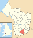
 Location map of Buckinghamshire
 -
 Ceremonial counties of England
 -
 Blank map of parishes of West Sussex
 -
 Hengrove ward in Bristol
 -
 Wards in Plymouth
 -
 The Lake District
 -
 A38 route map


.svg)


Coverage[edit]
My work is primarily concentrated on Great Britain. I cannot really help with Irish maps at this time, sorry. Reason for this is the OS data covers Great Britain only. If anyone has access to free Irish data please let me know!
I'm also working on obtaining free release of data from other organisations to complement the OS data, I will list any here.
Colours[edit]
The colours are based on the conventions on Wikipedia, with a few tweaks reflecting UK mapping norms.
| Subject | Colorimetry (RGB/hex) |
|---|---|
| Borders | #646464
R:100 V:100 B:100 A:1 |
| Subject's area (county, district) | #FEFEE9
R:254 V:254 B:233 A:1 |
| Other areas within constituent country | #F6E1B9
R:246 V:225 B:185 A:1 |
| Coasts, rivers, sea coasts | #0978AB
R:9 V:120 B:171 A:1 |
| Ocean, sea, lake | #B2DAF7
R:178 V:218 B:247 A:1 |
| Area of interest | #D40000
R:212 V:0 B:0 A:1 |
| National Parks | #A0F090
R:160 V:240 B:144 A:1 |
| Urban areas | #999999
R:160 V:240 B:144 A:1 |
| Motorways |
#667FFF
R:102 V:127 B:255 A:1 #FFFFFF
R:255 V:255 B:255 A:1 |
| Primary routes | #6AB35A
R:106 V:179 B:90 A:1 |
| Non-primary A roads | #FC6A3F
R:252 V:106 B:63 A:1 |
| Railways | #484848
R:72 V:72 B:72 A:1 |
Available maps[edit]
Category:Maps by Nilfanion contains all maps I have uploaded to date, a total of 2,022 files.
The blank maps are available within the following categories:
- Category:Blank maps of counties of England
- Category:Blank maps of counties of Wales
- Category:Blank maps of council areas of Scotland
The county-level location maps are available in the subcategories of Category:Locator maps of counties of the United Kingdom.
The other maps are appropriately categorised within the category tree. For example, if you are after a map of a specific district the easiest place to look is the category for that district.
I've also created a number of tables displaying the maps at the size they are used in articles:
- Location maps - location maps of each of the counties and council areas
- English counties - Blank maps of English ceremonial counties and individual districts, showing all relevant subdivisions.
- Welsh counties - Blank maps of Welsh counties, administrative and preserved, showing all relevant subdivisions.
- Scottish council areas - Blank maps of Scottish council areas and regions, showing all relevant subdivisions.
- National - Blank maps of the whole of Great Britain, or the constituent countries, showing various subdivisions.
Election maps[edit]
Many of the blanks are suitable for articles on elections, however as the boundaries frequently change it is useful to know which are actually valid at present. User:Nilfanion/Maps/Elections contains all maps uploaded by me that are suitable for the 2017 electoral cycle.
Creating maps[edit]
Creating maps similar to the ones I have made requires a program capable of reading GIS data. A text editor and a SVG editor such as Inkscape help to fine-tune the output of the GIS package and make it suitable for upload.
If you do not have access to a GIS package, or the skills to use it effectively, my maps can also be used as a basis for derivative works. As the maps are highly detailed, a cropped map will still produce satisfactory results. For example a county locator could be converted to a district locator. This process will require a SVG editor.
A simpler task is to convert one of my blank maps to a map showing data; for example to show political representation. To do this all you need is a text editor, and the source data you want to display.
New maps[edit]
The source data is in shapefile format and is available for download from Ordnance Survey (here). Working with shapefiles requires a GIS package such as those listed in List of geographic information systems software.
I will provide a detailed example of how to produce a file using a specific free package.
Derivative maps[edit]
The SVG files are relatively "easy" to modify and can be done with no software apart from a text editor. However, an image editor such as Inkscape makes things much easier.
Each of the regions shown is clearly identified within the SVG file itself, by the id of its path. Altering the style parameter for that path will adjust the appearance of the region it describes.
I will provide detailed descriptions of creating a cropped version of a map and a political map later.
Requesting maps[edit]
If you are not able to create a map yourself, feel free to request it from me. I will try to fulfill the request quickly.
- Please make any requests here.
Errors[edit]
There may be some errors in the data, if you identify any please let me know and I will try to correct these. The road data is the most likely to have problems. For instance an A-road may be incorrectly identified as a primary route when its not, or vice versa.
- Please report any errors here.
Data sources[edit]
The primary source is Ordnance Survey OpenData, however this may be supplemented by other sources on some maps. The additional sources will be listed on the file page.
The main OpenData product used in my maps is the Boundary-Line product, with Meridian 2 being used for supplemental data. I may utilise further products, such as OS VectorMap District and Land-Form Panorama in future.
As an example of potential additional sources, the British Geological Society have freely released 1:625,000 scale geological map as a shapefile; this can be adapted.
Current tasks[edit]
I am going to work on improving layout of this section in near future. However as a priority, I will create new maps (if needed) for the following:
2016 wards for Knowsley, Sheffield, Bristol, Peterborough, Warrington, Cherwell, Colchester, Elmbridge, Exeter, Gloucester, Lincoln, Rochford, Stroud, Watford, Welwyn Hatfield, Wincheter, Woking- 2011 wards for Bedford, Central Bedfordshire, Cheshire East, Chester West and Chester, Stoke on Trent, Barrow in Furness, Mansfield, Northampton, Sedgemoor, South Derbyshire, Swale, Waveney, Wellingborough, West Lindsey, West Somerset
Current wards for Caerphilly, Pembrokeshire and Swansea- Northern Ireland - counties, current districts, ward-in-district, townlands-in-district and townlands-in-county
- Current ceremonial county ward maps
All maps needed for the 2016 elections will have highest priority. Please let me know if I've missed anything important