Category:Blank maps of counties of England
Jump to navigation
Jump to search
Subcategories
This category has only the following subcategory.
Media in category "Blank maps of counties of England"
The following 191 files are in this category, out of 191 total.
-
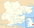
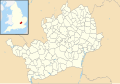
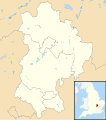 Bedfordshire UK constituency map (blank).svg 1,120 × 1,266; 723 KB
-
 Bedfordshire UK parish map (blank).svg 1,120 × 1,266; 1.33 MB
-
 Bedfordshire UK ward map (blank).svg 1,120 × 1,266; 1.13 MB
-
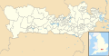
 Berkshire UK constituency map (blank).svg 1,425 × 741; 759 KB
-
 Berkshire UK parish map (blank).svg 1,425 × 741; 1.18 MB
-
 Berkshire UK ward map (blank).svg 1,425 × 741; 1.17 MB
-
 Bristol UK constituency map (blank).svg 1,138 × 1,266; 597 KB
-
 Bristol UK ward map (blank).svg 1,138 × 1,266; 709 KB
-
 Bristol UK ward map 2016 (blank).svg 1,138 × 1,266; 827 KB
-
 Buckinghamshire UK constituency map (blank).svg 1,070 × 1,266; 989 KB
-
 Buckinghamshire UK electoral division map (blank).svg 1,070 × 1,266; 1.33 MB
-
 Buckinghamshire UK electoral division map 2013 (blank).svg 1,070 × 1,266; 1.15 MB
-
 Buckinghamshire UK parish map (blank).svg 1,070 × 1,266; 2.05 MB
-
 Buckinghamshire UK ward map (blank).svg 1,070 × 1,266; 1.69 MB
-
 Cambridgeshire UK constituency map (blank).svg 1,125 × 1,266; 938 KB
-
 Cambridgeshire UK electoral division map (blank).svg 1,125 × 1,266; 1.34 MB
-
 Cambridgeshire UK electoral division map 2013 (blank).svg 1,125 × 1,266; 1.16 MB
-
 Cambridgeshire UK electoral division map 2017 (blank).svg 1,125 × 1,266; 1.29 MB
-
 Cambridgeshire UK parish map (blank).svg 1,125 × 1,266; 2.11 MB
-
 Cambridgeshire UK ward map (blank).svg 1,125 × 1,266; 1.7 MB
-
 Cheshire UK constituency map (blank).svg 1,425 × 1,098; 1.14 MB
-
 Cheshire UK parish map (blank).svg 1,425 × 1,098; 2.63 MB
-
 Cheshire UK ward map (blank).svg 1,425 × 1,098; 1.64 MB
-
 Cornwall electoral division map 2021.svg 1,306 × 1,266; 1.79 MB
-
 Cornwall UK mainland constituency map (blank).svg 1,224 × 1,187; 1.23 MB
-
 Cornwall UK mainland electoral division map (blank).svg 1,224 × 1,187; 2.09 MB
-
 Cornwall UK mainland electoral division map 2013 (blank).svg 1,224 × 1,187; 1.65 MB
-
 Cornwall UK mainland parish map (blank).svg 1,224 × 1,187; 2.45 MB
-
 Cumbria UK constituency map (blank).svg 1,140 × 1,345; 1.24 MB
-
 Cumbria UK electoral division map (blank).svg 1,140 × 1,345; 2.07 MB
-
 Cumbria UK electoral division map 2013 (blank).svg 1,140 × 1,345; 1.61 MB
-
 Cumbria UK parish map (blank).svg 1,140 × 1,345; 3.26 MB
-
 Cumbria UK ward map (blank).svg 1,140 × 1,345; 2.5 MB
-
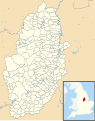
 Derbyshire UK constituency map (blank).svg 884 × 1,305; 1,017 KB
-
 Derbyshire UK electoral division map (blank).svg 884 × 1,305; 1.49 MB
-
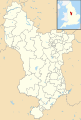 Derbyshire UK electoral division map 2013 (blank).svg 884 × 1,305; 1.17 MB
-
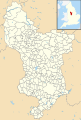 Derbyshire UK parish map (blank).svg 884 × 1,305; 2.32 MB
-
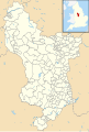 Derbyshire UK ward map (blank).svg 884 × 1,305; 1.95 MB
-
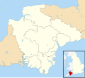 Devon UK constituency map (blank).svg 1,292 × 1,187; 1.45 MB
-
 Devon UK electoral division map (blank).svg 1,292 × 1,187; 2.06 MB
-
 Devon UK electoral division map 2017 (blank).svg 1,292 × 1,187; 2.03 MB
-
 Devon UK parish map (blank).svg 1,292 × 1,187; 3.63 MB
-
 Devon UK ward map (blank).svg 1,292 × 1,187; 2.89 MB
-
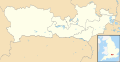
 Dorset UK constituency map (blank).svg 1,425 × 990; 1,011 KB
-
 Dorset UK electoral division map (blank).svg 1,425 × 990; 1.39 MB
-
 Dorset UK electoral division map 2017 (blank).svg 1,425 × 990; 1.4 MB
-
 Dorset UK parish map (blank).svg 1,425 × 990; 2.39 MB
-
 Dorset UK ward map (blank).svg 1,425 × 990; 1.87 MB
-
 Durham UK parish map (blank).svg 1,425 × 934; 1.8 MB
-
 Durham UK ward map (blank).svg 1,425 × 934; 1.41 MB
-
 East Riding of Yorkshire UK parish map (blank).svg 1,425 × 1,107; 1.68 MB
-
 East Riding of Yorkshire UK ward map (blank).svg 1,425 × 1,107; 1.1 MB
-
 East Sussex UK constituency map (blank).svg 1,425 × 928; 852 KB
-
 East Sussex UK electoral division map (blank).svg 1,425 × 928; 1.19 MB
-
 East Sussex UK electoral division map 2017 (blank).svg 1,425 × 928; 1.41 MB
-
 East Sussex UK parish map (blank).svg 1,425 × 928; 1.51 MB
-
 East Sussex UK ward map (blank).svg 1,425 × 928; 1.52 MB
-
 Essex UK constituency map (blank).svg 1,425 × 1,141; 1.5 MB
-
 Essex UK electoral division map (blank).svg 1,425 × 1,141; 2.06 MB
-
 Essex UK parish map (blank).svg 1,425 × 1,141; 3.18 MB
-
 Essex UK ward map (blank).svg 1,425 × 1,141; 2.97 MB
-
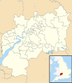
 Gloucestershire UK constituency map (blank).svg 1,089 × 1,266; 1.16 MB
-
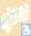
 Gloucestershire UK electoral division map (blank).svg 1,089 × 1,266; 1.62 MB
-
 Gloucestershire UK electoral division map 2013 (blank).svg 1,089 × 1,266; 1.33 MB
-
 Gloucestershire UK parish map (blank).svg 1,089 × 1,266; 2.84 MB
-
 Gloucestershire UK ward map (blank).svg 1,089 × 1,266; 2.26 MB
-
 Greater London UK assembly map (blank).svg 1,425 × 1,140; 953 KB
-
 Greater London UK constituency map (blank).svg 1,425 × 1,140; 1.29 MB
-
 Greater London UK ward map (blank).svg 1,425 × 1,140; 2.35 MB
-
 Greater Manchester UK constituency map (blank).svg 1,425 × 993; 1.03 MB
-
 Greater Manchester UK parish map (blank).svg 1,425 × 993; 963 KB
-
 Greater Manchester UK ward map (blank).svg 1,425 × 993; 1.79 MB
-
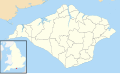
 Hampshire UK constituency map (blank).svg 1,425 × 1,213; 1.33 MB
-
 Hampshire UK electoral division map (blank).svg 1,425 × 1,213; 1.77 MB
-
 Hampshire UK electoral division map 2017 (blank).svg 1,425 × 1,213; 1.79 MB
-
 Hampshire UK parish map (blank).svg 1,425 × 1,213; 2.61 MB
-
 Hampshire UK ward map (blank).svg 1,425 × 1,213; 2.44 MB
-
 Herefordshire UK constituency map (blank).svg 999 × 1,266; 825 KB
-
 Herefordshire UK parish map (blank).svg 999 × 1,266; 2.52 MB
-
 Herefordshire UK ward map (blank).svg 999 × 1,266; 1.45 MB
-
 Herefordshire UK ward map 2015 (blank).svg 999 × 1,266; 1.6 MB
-
 Hertfordshire UK constituency map (blank).svg 1,425 × 992; 891 KB
-
 Hertfordshire UK electoral division map (blank).svg 1,425 × 992; 1.18 MB
-
 Hertfordshire UK electoral division map 2017 (blank).svg 1,425 × 992; 1.26 MB
-
 Hertfordshire UK parish map (blank).svg 1,425 × 992; 1.43 MB
-
 Hertfordshire UK ward map (blank).svg 1,425 × 992; 1.47 MB
-
 Isle of Wight UK parish map (blank).svg 1,425 × 868; 871 KB
-
 Isle of Wight UK ward map (blank).svg 1,425 × 868; 881 KB
-
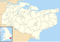
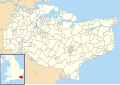
 Kent UK constituency map (blank).svg 1,425 × 1,000; 1.28 MB
-
 Kent UK electoral division map (blank).svg 1,425 × 1,000; 1.66 MB
-
 Kent UK electoral division map 2017 (blank).svg 1,425 × 1,000; 1.69 MB
-
 Kent UK parish map (blank).svg 1,425 × 1,000; 2.64 MB
-
 Kent UK ward map (blank).svg 1,425 × 1,000; 2.45 MB
-
 Lancashire UK constituency map (blank).svg 1,116 × 1,305; 1.3 MB
-
 Lancashire UK electoral division map (blank).svg 1,116 × 1,305; 1.78 MB
-
 Lancashire UK electoral division map 2017 (blank).svg 1,116 × 1,305; 1.72 MB
-
 Lancashire UK parish map (blank).svg 1,116 × 1,305; 2.45 MB
-
 Lancashire UK ward map (blank).svg 1,116 × 1,305; 2.5 MB
-
 Leicestershire UK electoral division map (blank).svg 1,425 × 1,123; 1.36 MB
-
 Leicestershire UK electoral division map 2017 (blank).svg 1,425 × 1,123; 1.39 MB
-
 Leicestershire UK parish map (blank).svg 1,425 × 1,123; 2.07 MB
-
 Leicestershire UK ward map (blank).svg 1,425 × 1,123; 1.78 MB
-
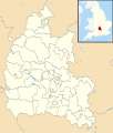
 Lincolnshire UK electoral division map (blank).svg 1,086 × 1,305; 1.87 MB
-
 Lincolnshire UK electoral division map 2017 (blank).svg 1,086 × 1,305; 1.75 MB
-
 Lincolnshire UK parish map (blank).svg 1,086 × 1,305; 3.7 MB
-
 Lincolnshire UK ward map (blank).svg 1,086 × 1,305; 2.43 MB
-
 Merseyside UK constituency map (blank).svg 1,231 × 1,305; 883 KB
-
 Merseyside UK parish map (blank).svg 1,231 × 1,305; 929 KB
-
 Merseyside UK ward map (blank).svg 1,231 × 1,305; 1.21 MB
-
 Norfolk UK constituency map (blank).svg 1,425 × 886; 1.19 MB
-
 Norfolk UK electoral division map (blank).svg 1,425 × 886; 1.77 MB
-
 Norfolk UK parish map (blank).svg 1,425 × 886; 3.09 MB
-
 Norfolk UK ward map (blank).svg 1,425 × 886; 2.27 MB
-
 North Yorkshire UK electoral division map (blank).svg 1,425 × 1,037; 1.97 MB
-
 North Yorkshire UK parish map (blank).svg 1,425 × 1,037; 4.3 MB
-
 North Yorkshire UK ward map (blank).svg 1,425 × 1,037; 2.67 MB
-
 Northamptonshire UK constituency map (blank).svg 1,106 × 1,266; 993 KB
-
 Northamptonshire UK electoral division map (blank).svg 1,106 × 1,266; 1.52 MB
-
 Northamptonshire UK electoral division map 2013 (blank).svg 1,106 × 1,266; 1.18 MB
-
 Northamptonshire UK parish map (blank).svg 1,106 × 1,266; 2.4 MB
-
 Northamptonshire UK ward map (blank).svg 1,106 × 1,266; 1.87 MB
-
 Northumberland UK constituency map (blank).svg 1,120 × 1,345; 926 KB
-
 Northumberland UK electoral division map (blank).svg 1,120 × 1,345; 1.49 MB
-
 Northumberland UK electoral division map 2013 (blank).svg 1,120 × 1,345; 1.19 MB
-
 Northumberland UK parish map (blank).svg 1,120 × 1,345; 2.27 MB
-
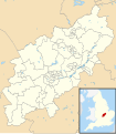
 Nottinghamshire UK constituency map (blank).svg 1,030 × 1,305; 931 KB
-
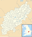
 Nottinghamshire UK electoral division map (blank).svg 1,030 × 1,305; 1.25 MB
-
 Nottinghamshire UK electoral division map 2017 (blank).svg 1,030 × 1,305; 1.22 MB
-
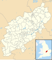
 Nottinghamshire UK parish map (blank).svg 1,030 × 1,305; 1.92 MB
-
 Nottinghamshire UK ward map (blank).svg 1,030 × 1,305; 1.66 MB
-
 Oxfordshire UK constituency map (blank).svg 1,077 × 1,266; 966 KB
-
 Oxfordshire UK electoral division map (blank).svg 1,077 × 1,266; 1.51 MB
-
 Oxfordshire UK electoral division map 2013 (blank).svg 1,077 × 1,266; 1.23 MB
-
 Oxfordshire UK parish map (blank).svg 1,077 × 1,266; 2.53 MB
-
 Oxfordshire UK ward map (blank).svg 1,077 × 1,266; 1.84 MB
-
 Penzance East electoral division map 2013.svg 1,227 × 1,190; 1.6 MB
-
 Rutland UK parish map (blank).svg 1,425 × 1,140; 936 KB
-
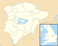 Rutland UK ward map (blank).svg 1,425 × 1,140; 745 KB
-
 Shropshire UK constituency map (blank).svg 1,198 × 1,305; 1.02 MB
-
 Shropshire UK parish map (blank).svg 1,198 × 1,305; 2.75 MB
-
 Shropshire UK ward map (blank).svg 1,198 × 1,305; 1.9 MB
-
 Somerset UK constituency map (blank).svg 1,425 × 901; 1.21 MB
-
 Somerset UK electoral division map (blank).svg 1,425 × 901; 1.69 MB
-
 Somerset UK electoral division map 2013 (blank).svg 1,425 × 901; 1.53 MB
-
 Somerset UK parish map (blank).svg 1,425 × 901; 3.08 MB
-
 Somerset UK ward map (blank).svg 1,425 × 901; 2.36 MB
-
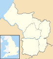
 South Yorkshire UK constituency map (blank).svg 1,425 × 974; 899 KB
-
 South Yorkshire UK parish map (blank).svg 1,425 × 974; 1.27 MB
-
 South Yorkshire UK ward map (blank).svg 1,425 × 974; 1.35 MB
-
 St Germans and Landulph electoral division map 2013.svg 1,227 × 1,190; 1.6 MB
-
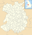
 Staffordshire UK constituency map (blank).svg 1,024 × 1,305; 1.11 MB
-
 Staffordshire UK electoral division map (blank).svg 1,024 × 1,305; 1.49 MB
-
 Staffordshire UK electoral division map 2013 (blank).svg 1,024 × 1,305; 1.21 MB
-
 Staffordshire UK parish map (blank).svg 1,024 × 1,305; 2.18 MB
-
 Staffordshire UK ward map (blank).svg 1,024 × 1,305; 1.99 MB
-
 Suffolk UK constituency map (blank).svg 1,425 × 927; 1.02 MB
-
 Suffolk UK electoral division map (blank).svg 1,425 × 927; 1.5 MB
-
 Suffolk UK parish map (blank).svg 1,425 × 927; 2.83 MB
-
 Suffolk UK ward map (blank).svg 1,425 × 927; 1.99 MB
-
 Surrey UK constituency map (blank).svg 1,425 × 1,081; 955 KB
-
 Surrey UK County Council Ward Map (Blank).png 869 × 574; 77 KB
-
 Surrey UK electoral division map (blank).svg 1,425 × 1,081; 1.36 MB
-
 Surrey UK electoral division map 2013 (blank).svg 1,425 × 1,081; 1.3 MB
-
 Surrey UK parish map (blank).svg 1,425 × 1,081; 1.47 MB
-
 Surrey UK ward map (blank).svg 1,425 × 1,081; 1.72 MB
-
 Tyne and Wear UK constituency map (blank).svg 1,425 × 1,252; 773 KB
-
 Tyne and Wear UK parish map (blank).svg 1,425 × 1,252; 748 KB
-
 Tyne and Wear UK ward map (blank).svg 1,425 × 1,252; 1.16 MB
-
 Warwickshire UK constituency map (blank).svg 1,042 × 1,266; 955 KB
-
 Warwickshire UK electoral division map (blank).svg 1,042 × 1,266; 1.33 MB
-
 Warwickshire UK electoral division map 2017 (blank).svg 1,042 × 1,266; 1.32 MB
-
 Warwickshire UK parish map (blank).svg 1,042 × 1,266; 2.04 MB
-
 Warwickshire UK ward map (blank).svg 1,042 × 1,266; 1.6 MB
-
 West Midlands UK constituency map (blank).svg 1,425 × 974; 902 KB
-
 West Midlands UK parish map (blank).svg 1,425 × 974; 802 KB
-
 West Midlands UK ward map (blank).svg 1,425 × 974; 1.36 MB
-
 West Sussex UK constituency map (blank).svg 1,425 × 995; 972 KB
-
 West Sussex UK electoral division map (blank).svg 1,425 × 995; 1.37 MB
-
 West Sussex UK electoral division map 2017 (blank).svg 1,425 × 995; 1.4 MB
-
 West Sussex UK parish map (blank).svg 1,425 × 995; 1.86 MB
-
 West Sussex UK ward map (blank).svg 1,425 × 995; 1.65 MB
-
 West Yorkshire UK constituency map (blank).svg 1,425 × 1,039; 1.05 MB
-
 West Yorkshire UK parish map (blank).svg 1,425 × 1,039; 1.35 MB
-
 West Yorkshire UK ward map (blank).svg 1,425 × 1,039; 1.57 MB
-
 Wiltshire UK constituency map (blank).svg 1,039 × 1,266; 905 KB
-
 Wiltshire UK parish map (blank).svg 1,039 × 1,266; 2.48 MB
-
 Wiltshire UK ward map (blank).svg 1,039 × 1,266; 1.72 MB
-
 Worcestershire UK constituency map (blank).svg 1,425 × 1,262; 939 KB
-
 Worcestershire UK electoral division map (blank).svg 1,425 × 1,262; 1.34 MB
-
 Worcestershire UK parish map (blank).svg 1,425 × 1,262; 2.04 MB
-
 Worcestershire UK ward map (blank).svg 1,425 × 1,262; 1.67 MB


.svg)
.svg)
.svg)
.svg)
.svg)
.svg)
.svg)
.svg)
.svg)
.svg)
.svg)
.svg)
.svg)
.svg)
.svg)
.svg)
.svg)
.svg)
.svg)
.svg)
.svg)
.svg)
.svg)
.svg)
.svg)
.svg)
.svg)
.svg)
.svg)
.svg)
.svg)
.svg)
.svg)
.svg)
.svg)
.svg)
.svg)
.svg)
.svg)
.svg)
.svg)
.svg)
.svg)
.svg)
.svg)
.svg)
.svg)
.svg)
.svg)
.svg)
.svg)
.svg)
.svg)
.svg)
.svg)
.svg)
.svg)
.svg)
.svg)
.svg)
.svg)
.svg)
.svg)
.svg)
.svg)
.svg)
.svg)
.svg)
.svg)
.svg)
.svg)
.svg)
.svg)
.svg)
.svg)
.svg)
.svg)
.svg)
.svg)
.svg)
.svg)
.svg)
.svg)
.svg)
.svg)
.svg)
.svg)
.svg)
.svg)
.svg)
.svg)
.svg)
.svg)
.svg)
.svg)
.svg)
.svg)
.svg)
.svg)
.svg)
.svg)
.svg)
.svg)
.svg)
.svg)
.svg)
.svg)
.svg)
.svg)
.svg)
.svg)
.svg)
.svg)
.svg)
.svg)
.svg)
.svg)
.svg)
.svg)
.svg)
.svg)
.svg)
.svg)
.svg)
.svg)
.svg)
.svg)
.svg)
.svg)
.svg)
.svg)
.svg)
.svg)
.svg)
.svg)
.svg)
.svg)
.svg)
.svg)
.svg)
.svg)
.svg)
.svg)
.svg)
.svg)
.svg)
.svg)
.svg)
.svg)
.svg)
.svg)
.svg)
.svg)
.svg)
.svg)
.svg)
.svg)
.png)
.svg)
.svg)
.svg)
.svg)
.svg)
.svg)
.svg)
.svg)
.svg)
.svg)
.svg)
.svg)
.svg)
.svg)
.svg)
.svg)
.svg)
.svg)
.svg)
.svg)
.svg)
.svg)
.svg)
.svg)
.svg)
.svg)
.svg)
.svg)
.svg)
.svg)