User:Giftzwerg 88/Fotoprojekt Sindelfingen, Gesundheitssektor
Jump to navigation
Jump to search
| This is a gallery of files created by Giftzwerg 88. |
- Sindelfingen
- Sindelfingen-Darmsheim
- Böblingen/Sindelfingen, Flugfeld
- Sindelfingen, Friedhöfe
- Sindelfingen, Gesundheitssektor
- Sindelfingen-Goldberg
- Sindelfingen-Hinterweil
- Sindelfingen, Kindergärten und Kitas
- Sindelfingen, Kirchen, Andachtsstätten
- Sindelfingen, Kunstwerke
- Sindelfingen-Maichingen
- Sindelfingen, Naturdenkmäler und Schutzgebiete
- Sindelfingen, Parks und Grünanlagen
- Sindelfingen, Schulen und Sportstätten
- Sindelfingen, Shopping Malls
- Sindelfingen, Spielplätze
- Sindelfingen, Stadtteile
- Sindelfingen, Ost
- Sindelfingen, Nord
- Sindelfingen, Strommasten, Umspannwerke und Transformatoren
- Sindelfingen, Viehweide
- Sindelfingen, Corona-Epidemie
Siehe auch Böblingen
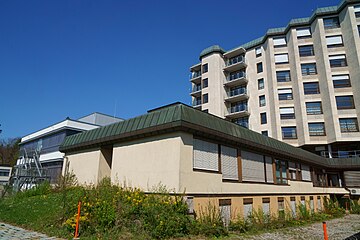
Klinikum Sindelfingen[edit]
| Object location | | View all coordinates using: OpenStreetMap |
|---|
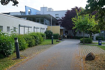
Seniorenstift Seemühlestraße[edit]
| Object location | | View all coordinates using: OpenStreetMap |
|---|
Altenpflegeheim Burghalde[edit]
| Object location | | View all coordinates using: OpenStreetMap |
|---|
DRK Pflegezentrum Wilhelm-Haspel-Straße[edit]
| Object location | | View all coordinates using: OpenStreetMap |
|---|
Altenheim Wolfstraße[edit]
| Object location | | View all coordinates using: OpenStreetMap |
|---|


