Category:Road signs in Peach County, Georgia
Jump to navigation
Jump to search
Counties of Georgia: Appling · Atkinson · Bacon · Baker · Banks · Barrow · Bartow · Ben Hill · Berrien · Brantley · Brooks · Bryan · Butts · Calhoun · Camden · Carroll · Charlton · Chatham · Chattooga · Cherokee · Clay · Clayton · Clinch · Cobb · Coffee · Colquitt · Columbia · Cook · Coweta · Crawford · Crisp · Dade · Dawson · Decatur · DeKalb · Dodge · Dooly · Dougherty · Douglas · Early · Effingham · Evans · Floyd · Forsyth · Franklin · Fulton · Gilmer · Glynn · Gordon · Grady · Greene · Gwinnett · Habersham · Hall · Haralson · Harris · Hart · Henry · Houston · Irwin · Jasper · Jeff Davis · Jefferson · Lamar · Lanier · Laurens · Lee · Liberty · Long · Lowndes · Lumpkin · Macon · Madison · Marion · McIntosh · Miller · Mitchell · Monroe · Montgomery · Murray · Peach · Pierce · Pike · Polk · Pulaski · Putnam · Randolph · Rockdale · Schley · Seminole · Spalding · Stephens · Stewart · Sumter · Talbot · Tattnall · Taylor · Telfair · Terrell · Thomas · Tift · Toombs · Towns · Troup · Turner · Upson · Walker · Ware · Wayne · Wheeler · White · Whitfield · Wilcox · Worth
City-counties: Athens–Clarke · Augusta–Richmond · Columbus–Muscogee · Georgetown–Quitman · Macon–Bibb · Preston–Webster · Statenville–Echols
City-counties: Athens–Clarke · Augusta–Richmond · Columbus–Muscogee · Georgetown–Quitman · Macon–Bibb · Preston–Webster · Statenville–Echols
Subcategories
This category has only the following subcategory.
Media in category "Road signs in Peach County, Georgia"
The following 31 files are in this category, out of 31 total.
-
 Fort Valley city limit GA 247 Connector WB.jpg 5,184 × 3,456; 4.57 MB
-
 Fort Valley city limit US341SB.jpg 5,184 × 3,456; 7.58 MB
-
 Fort Valley street clock on W Main St.JPG 4,320 × 3,240; 4.38 MB
-
 GA7 Connector EB end, Fort Valley.jpg 5,184 × 3,456; 8.73 MB
-
 Georgia I75nb Crawford County limit.jpg 5,184 × 3,456; 4.42 MB
-
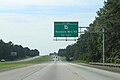
 Georgia I75nb exit 142 .5 mile.jpg 5,184 × 3,456; 4.13 MB
-
 Georgia I75nb exit 144 .5 mile.jpg 5,184 × 3,456; 4.78 MB
-
 Georgia I75nb exit 144 1 mile.jpg 5,184 × 3,456; 4.57 MB
-
 Georgia I75nb exit 146 .5 mile.jpg 5,184 × 3,456; 4.38 MB
-
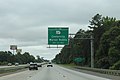
 Georgia I75nb exit 146 1 mile.jpg 5,184 × 3,456; 5.05 MB
-
 Georgia I75nb exit 146.jpg 5,184 × 3,456; 4.82 MB
-
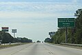
 Georgia I75nb exit 149 .5 mile.jpg 5,184 × 3,456; 4.71 MB
-
 Georgia I75nb exit 149 1 mile, White Road Overpass.jpg 5,184 × 3,456; 4.46 MB
-
 Georgia I75nb exit 149, GA49 Overpass.jpg 5,184 × 3,456; 4.87 MB
-
 Georgia I75sb Exit 142 .5 mile.jpg 5,184 × 3,456; 4.33 MB
-
 Georgia I75sb Exit 142 1 mile.jpg 5,184 × 3,456; 4.61 MB
-
 Georgia I75sb Exit 144 .5 mile.jpg 5,184 × 3,456; 4.71 MB
-
 Georgia I75sb Exit 144 1 mile.jpg 5,184 × 3,456; 4.67 MB
-
 Georgia I75sb Exit 146 .5 mile close.jpg 5,184 × 3,456; 4.43 MB
-
 Georgia I75sb Exit 146 .5 mile.jpg 5,184 × 3,456; 4.39 MB
-
 Georgia I75sb Exit 146 1 mile.jpg 5,184 × 3,456; 4.91 MB
-
 Georgia I75sb Exit 146.jpg 5,184 × 3,456; 4.45 MB
-
 Georgia I75sb Exit 149 .5 mile.jpg 5,184 × 3,456; 4.68 MB
-
 Georgia I75sb Exit 149 1 mile.jpg 5,184 × 3,456; 4.49 MB
-
 Georgia I75sb Exit 149.jpg 5,184 × 3,456; 4.55 MB
-
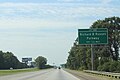
 Georgia I75sb Peach County limit.jpg 5,184 × 3,456; 4.86 MB
-
 Houston County border US341EB.JPG 5,152 × 3,864; 7.71 MB
-
 Houston County limit, GA7sb.JPG 4,320 × 3,240; 4.4 MB
-
 Peach County border US341WB.JPG 5,152 × 3,864; 7.89 MB
-
 Peach County limit US41SB.jpg 5,184 × 3,456; 7.04 MB
-
 Peach County limit, US341sb.JPG 4,320 × 3,240; 4.56 MB


