Category:Road signs in Dougherty County, Georgia
Jump to navigation
Jump to search
Counties of Georgia: Appling · Atkinson · Bacon · Baker · Banks · Barrow · Bartow · Ben Hill · Berrien · Brantley · Brooks · Bryan · Butts · Calhoun · Camden · Carroll · Charlton · Chatham · Chattooga · Cherokee · Clay · Clayton · Clinch · Cobb · Coffee · Colquitt · Columbia · Cook · Coweta · Crawford · Crisp · Dade · Dawson · Decatur · DeKalb · Dodge · Dooly · Dougherty · Douglas · Early · Effingham · Evans · Floyd · Forsyth · Franklin · Fulton · Gilmer · Glynn · Gordon · Grady · Greene · Gwinnett · Habersham · Hall · Haralson · Harris · Hart · Henry · Houston · Irwin · Jasper · Jeff Davis · Jefferson · Lamar · Lanier · Laurens · Lee · Liberty · Long · Lowndes · Lumpkin · Macon · Madison · Marion · McIntosh · Miller · Mitchell · Monroe · Montgomery · Murray · Peach · Pierce · Pike · Polk · Pulaski · Putnam · Randolph · Rockdale · Schley · Seminole · Spalding · Stephens · Stewart · Sumter · Talbot · Tattnall · Taylor · Telfair · Terrell · Thomas · Tift · Toombs · Towns · Troup · Turner · Upson · Walker · Ware · Wayne · Wheeler · White · Whitfield · Wilcox · Worth
City-counties: Athens–Clarke · Augusta–Richmond · Columbus–Muscogee · Georgetown–Quitman · Macon–Bibb · Preston–Webster · Statenville–Echols
City-counties: Athens–Clarke · Augusta–Richmond · Columbus–Muscogee · Georgetown–Quitman · Macon–Bibb · Preston–Webster · Statenville–Echols
Subcategories
This category has only the following subcategory.
Media in category "Road signs in Dougherty County, Georgia"
The following 31 files are in this category, out of 31 total.
-
 Albany City limit, US82WB.JPG 4,608 × 3,456; 4.72 MB
-
 Albany Municipal Auditorium (SE corner).JPG 4,320 × 3,240; 4.37 MB
-
 Albany U.S. 82 Business EB End.jpg 5,184 × 3,456; 7.77 MB
-
 Albany U.S. 82 Business NB End.jpg 5,184 × 3,456; 4.62 MB
-
 Arch over Dougherty Mitchell County line on Dixie Highway.JPG 4,608 × 3,456; 5.93 MB
-
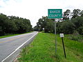 Baker County boundary, GA91SB.JPG 5,152 × 3,864; 7.88 MB
-
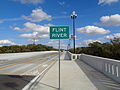 Broad Avenue Memorial Bridge, Flint River sign.JPG 5,152 × 3,864; 7.82 MB
-
 Dougherty County Albany City Limits, Palmyra Rd SB.jpg 5,184 × 3,456; 5.56 MB
-
 Dougherty County boundary, GA91NB.JPG 5,152 × 3,864; 7.87 MB
-
 Dougherty County Courthouse (East face).JPG 4,320 × 3,240; 4.4 MB
-
 Dougherty County Line, GA 133 NB.JPG 4,320 × 3,240; 4.45 MB
-
 GA 3 N US19 N.jpg 5,184 × 3,456; 4.45 MB
-
 GA133sRoadSign-EndGA234 (31008552985).jpg 2,400 × 1,600; 1.62 MB
-
 GA3 NB GA520 WB US19 NB US82 WB Albany.jpg 5,184 × 3,456; 4.71 MB
-
 GA300nGA520eUS82eSignsRoad (25372765459).jpg 2,400 × 1,600; 2.13 MB
-
 Headquarters of The Albany Herald, Albany, Georgia.jpg 1,600 × 1,200; 244 KB
-
 Pretoria limit, GA 62 EB.JPG 4,320 × 3,240; 4.54 MB
-
 Pretoria limit, GA 62 WB.JPG 4,320 × 3,240; 4.45 MB
-
 US 19 Exit 5.jpg 5,184 × 3,456; 4.79 MB
-
 US19 Blalock St Overpass.jpg 5,184 × 3,456; 4.14 MB
-
 US19 Exit 4.jpg 5,184 × 3,456; 4.2 MB
-
 US19 Exit 5 1 mile.jpg 5,184 × 3,456; 4.35 MB
-
 US19 Exit 6A next right.jpg 5,184 × 3,456; 4.46 MB
-
 US19 Exit 6A-B .75 mile.jpg 5,184 × 3,456; 4.54 MB
-
 US19 Exit 6A.jpg 5,184 × 3,456; 4.54 MB
-
 US19sGA3sGA133sGA300sSignsAlbany (30973178606).jpg 2,400 × 1,600; 1.82 MB
-
 US19sGA3sUS82eGA520eSignsRoad-Albany (25372789469).jpg 2,400 × 1,600; 1.5 MB
-
 US82bUS19bGA520bGA234signs-Albany (32529062330).jpg 2,400 × 1,600; 2.09 MB
-
 US82GA520-GA300US19BusOverhead-Exit2B (22830055708).jpg 2,400 × 1,600; 1.67 MB
-
 US82West-US82Business-AlbanyFatShields (30707036170).jpg 2,400 × 1,600; 1.82 MB
-
 Worth County Line, GA 133 SB.JPG 4,320 × 3,240; 4.49 MB

.JPG)


.JPG)


.jpg)

.jpg)


.jpg)
.jpg)
.jpg)
.jpg)
.jpg)
