Category:Road signs in Cook County, Georgia
Jump to navigation
Jump to search
Counties of Georgia: Appling · Atkinson · Bacon · Baker · Banks · Barrow · Bartow · Ben Hill · Berrien · Brantley · Brooks · Bryan · Butts · Calhoun · Camden · Carroll · Charlton · Chatham · Chattooga · Cherokee · Clay · Clayton · Clinch · Cobb · Coffee · Colquitt · Columbia · Cook · Coweta · Crawford · Crisp · Dade · Dawson · Decatur · DeKalb · Dodge · Dooly · Dougherty · Douglas · Early · Effingham · Evans · Floyd · Forsyth · Franklin · Fulton · Gilmer · Glynn · Gordon · Grady · Greene · Gwinnett · Habersham · Hall · Haralson · Harris · Hart · Henry · Houston · Irwin · Jasper · Jeff Davis · Jefferson · Lamar · Lanier · Laurens · Lee · Liberty · Long · Lowndes · Lumpkin · Macon · Madison · Marion · McIntosh · Miller · Mitchell · Monroe · Montgomery · Murray · Peach · Pierce · Pike · Polk · Pulaski · Putnam · Randolph · Rockdale · Schley · Seminole · Spalding · Stephens · Stewart · Sumter · Talbot · Tattnall · Taylor · Telfair · Terrell · Thomas · Tift · Toombs · Towns · Troup · Turner · Upson · Walker · Ware · Wayne · Wheeler · White · Whitfield · Wilcox · Worth
City-counties: Athens–Clarke · Augusta–Richmond · Columbus–Muscogee · Georgetown–Quitman · Macon–Bibb · Preston–Webster · Statenville–Echols
City-counties: Athens–Clarke · Augusta–Richmond · Columbus–Muscogee · Georgetown–Quitman · Macon–Bibb · Preston–Webster · Statenville–Echols
Subcategories
This category has only the following subcategory.
Media in category "Road signs in Cook County, Georgia"
The following 60 files are in this category, out of 60 total.
-
 Adel City Limit, GA 37 WB.JPG 4,320 × 3,240; 4.35 MB
-
 Adel City Limits, Coxstill Rd WB.JPG 4,320 × 3,240; 4.5 MB
-
 Adel Daylily Festival 2016 3.jpg 5,184 × 3,456; 8.21 MB
-
 Adel Welcome Signs, GA 37 WB.JPG 4,320 × 3,240; 4.46 MB
-
 BB&T Bank, Adel.JPG 4,320 × 3,240; 4.44 MB
-
 Citgo, GA 37 E of I-75, Adel.JPG 4,320 × 3,240; 4.48 MB
-
 Colquitt County limit, Kinard Bridge Rd.JPG 5,152 × 3,864; 7.92 MB
-
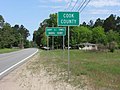
 Cook County border, GA37EB.jpg 5,184 × 3,456; 4.66 MB
-
 Cook County border, Hempstead Church Rd EB.jpg 5,184 × 3,456; 7.02 MB
-
 Cook County limit, US41NB.JPG 4,608 × 3,456; 6.07 MB
-
 Dollar General, Lenox.JPG 4,320 × 3,240; 4.53 MB
-
 Entrance to Red Roberts Landing.jpg 5,184 × 3,456; 8.31 MB
-
 Georgia I75nb Cecil city limit.JPG 4,320 × 3,240; 4.5 MB
-
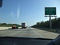 Georgia I75nb Exit 32 .5 mile.JPG 4,320 × 3,240; 4.41 MB
-
 Georgia I75nb Exit 37 .5 mile.JPG 4,320 × 3,240; 4.48 MB
-
 Georgia I75nb Exit 37 1 mile.JPG 4,320 × 3,240; 4.46 MB
-
 Georgia I75nb Exit 37 overpass Adel Quitman Rd, Adel city limit.JPG 4,320 × 3,240; 4.43 MB
-
 Georgia I75nb Exit 39 .5 mile.JPG 4,320 × 3,240; 4.49 MB
-
 Georgia I75nb Exit 39 1 mile.JPG 4,320 × 3,240; 4.52 MB
-
 Georgia I75nb Exit 39.JPG 4,320 × 3,240; 4.52 MB
-
 Georgia I75nb Exit 45 1 mile.JPG 4,320 × 3,240; 4.43 MB
-
 Georgia I75nb Exit 49 1 mile.JPG 4,320 × 3,240; 4.37 MB
-
 Georgia I75nb Tift County border.JPG 4,320 × 3,240; 4.42 MB
-
 Georgia I75sb Adel city limit.JPG 5,184 × 3,456; 4.29 MB
-
 Georgia I75SB Cecil city limit.jpg 5,184 × 3,456; 4.35 MB
-
 Georgia I75sb Cook County limit.jpg 5,184 × 3,456; 4.44 MB
-
 Georgia I75sb Exit 32 .5 mile.JPG 5,184 × 3,456; 4.35 MB
-
 Georgia I75sb Exit 32 1 mile.JPG 4,320 × 3,240; 4.5 MB
-
 Georgia I75sb Exit 37 .5 mile.JPG 5,184 × 3,456; 4.42 MB
-
 Georgia I75sb Exit 37 1 mile.JPG 4,320 × 3,240; 4.48 MB
-
 Georgia I75sb Exit 39 .5 mile.JPG 4,320 × 3,240; 4.52 MB
-
 Georgia I75sb exit 39 .5 mile.jpg 5,184 × 3,456; 4.29 MB
-
 Georgia I75sb Exit 39 1 mile.JPG 4,320 × 3,240; 4.48 MB
-
 Georgia I75sb Exit 41 .5 mile.JPG 4,320 × 3,240; 4.43 MB
-
 Georgia I75sb exit 41 .5 mile.jpg 5,184 × 3,456; 4.21 MB
-
 Georgia I75sb Exit 41 1 mile.JPG 4,320 × 3,240; 4.41 MB
-
 Georgia I75sb exit 41 1 mile.jpg 5,184 × 3,456; 4.09 MB
-
 Georgia I75sb Exit 45 .5 mile.JPG 4,320 × 3,240; 4.43 MB
-
 Georgia I75sb exit 45 .5 mile.jpg 5,184 × 3,456; 4.21 MB
-
 Georgia I75sb Exit 45 1 mile.JPG 4,320 × 3,240; 4.45 MB
-
 Georgia I75sb exit 45 1 mile.jpg 5,184 × 3,456; 4.01 MB
-
 Georgia I75sb Exit 49 .5 mile.JPG 4,320 × 3,240; 4.46 MB
-
 Georgia I75sb exit 49 .5 mile.jpg 5,184 × 3,456; 4.35 MB
-
 Georgia I75sb Exit 49 1 mile.JPG 4,320 × 3,240; 4.45 MB
-
 Georgia I75sb exit 49 1 mile.jpg 5,184 × 3,456; 4.23 MB
-
 Georgia I75sb Lenox limit.JPG 4,320 × 3,240; 4.49 MB
-
 Georgia I75Sb Lowndes County line.jpg 5,184 × 3,456; 4.09 MB
-
 Georgia I75sb Old Coffee Rd Overpass - Exit 32.jpg 5,184 × 3,456; 4.53 MB
-
 Georgia I75sb W Central Ave Overpass.jpg 5,184 × 3,456; 4.25 MB
-
 Lenox City Limit, E Central Ave WB.jpg 5,184 × 3,456; 6.77 MB
-
 Little River Water Trail, GA37 Cook County.jpg 5,184 × 3,456; 4.1 MB
-
 Lowndes County limit, Union Rd SB.JPG 4,608 × 3,456; 5.83 MB
-
 Lowndes County limit, US41SB.JPG 4,608 × 3,456; 5.6 MB
-
 Lowndes County welcome sign, Skipper Bridge Rd SB.JPG 4,608 × 3,456; 6.21 MB
-
 Lowndes County welcome sign, Val-Del Rd SB.JPG 4,608 × 3,456; 5.76 MB
-
 Old Lowndes County limit sign, US41SB.JPG 4,608 × 3,456; 4.7 MB
-
 Reed Bingham State Park Bridge and Colquitt County border.JPG 4,320 × 3,240; 4.44 MB
-
 SOWEGA Building, corner view, Adel, GA, US.jpg 6,010 × 3,694; 23.16 MB
-
 Sparks City Limit.JPG 3,072 × 2,304; 3.13 MB
-
 SR37 Bridge over Little River 7.JPG 5,184 × 3,456; 9.25 MB


