Category:Road signs in Crisp County, Georgia
Jump to navigation
Jump to search
Counties of Georgia: Appling · Atkinson · Bacon · Baker · Banks · Barrow · Bartow · Ben Hill · Berrien · Brantley · Brooks · Bryan · Butts · Calhoun · Camden · Carroll · Charlton · Chatham · Chattooga · Cherokee · Clay · Clayton · Clinch · Cobb · Coffee · Colquitt · Columbia · Cook · Coweta · Crawford · Crisp · Dade · Dawson · Decatur · DeKalb · Dodge · Dooly · Dougherty · Douglas · Early · Effingham · Evans · Floyd · Forsyth · Franklin · Fulton · Gilmer · Glynn · Gordon · Grady · Greene · Gwinnett · Habersham · Hall · Haralson · Harris · Hart · Henry · Houston · Irwin · Jasper · Jeff Davis · Jefferson · Lamar · Lanier · Laurens · Lee · Liberty · Long · Lowndes · Lumpkin · Macon · Madison · Marion · McIntosh · Miller · Mitchell · Monroe · Montgomery · Murray · Peach · Pierce · Pike · Polk · Pulaski · Putnam · Randolph · Rockdale · Schley · Seminole · Spalding · Stephens · Stewart · Sumter · Talbot · Tattnall · Taylor · Telfair · Terrell · Thomas · Tift · Toombs · Towns · Troup · Turner · Upson · Walker · Ware · Wayne · Wheeler · White · Whitfield · Wilcox · Worth
City-counties: Athens–Clarke · Augusta–Richmond · Columbus–Muscogee · Georgetown–Quitman · Macon–Bibb · Preston–Webster · Statenville–Echols
City-counties: Athens–Clarke · Augusta–Richmond · Columbus–Muscogee · Georgetown–Quitman · Macon–Bibb · Preston–Webster · Statenville–Echols
Subcategories
This category has only the following subcategory.
Media in category "Road signs in Crisp County, Georgia"
The following 56 files are in this category, out of 56 total.
-
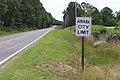 Arabi city limit, Arabi Warwick Rd EB.jpg 5,184 × 3,456; 8.62 MB
-
 Arabi city limit, US41SB.jpg 5,184 × 3,456; 5.73 MB
-
 Arabi limit, Hawpond Rd WB.jpg 5,184 × 3,456; 10.91 MB
-
 Arabi, Crisp County limit US41NB.jpg 5,184 × 3,456; 8.25 MB
-
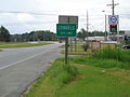
 Cordele City limit, 24th Ave W.jpg 5,184 × 3,456; 4.87 MB
-
 Cordele City limit, GA7SB.JPG 5,152 × 3,864; 7.98 MB
-
 Cordele City limit, Georgia I75nb.JPG 4,608 × 3,456; 3.57 MB
-
 Crisp County border GA257SB.JPG 5,152 × 3,864; 7.83 MB
-
 Crisp County border, GA7SB.JPG 5,152 × 3,864; 7.86 MB
-
 Crisp County border, Georgia Veterans State Park.jpg 5,184 × 3,456; 4.02 MB
-
 Dooly County border GA257NB.JPG 5,152 × 3,864; 7.92 MB
-
 Dooly County border, GA7NB.JPG 5,152 × 3,864; 7.88 MB
-
 GA 300wb US41 .5 mile.JPG 4,608 × 3,456; 3.73 MB
-
 GA300EndSignRoad-InvertedNumeralThree (25372766979).jpg 2,400 × 1,600; 1.63 MB
-
 GA33 Conn WB end, Crisp County.jpg 5,184 × 3,456; 8.55 MB
-
 GA33 NB end, Crisp County.jpg 5,184 × 3,456; 9.81 MB
-
 GA33ConnectorEnd-US41-GA7 (25372816239).jpg 2,400 × 1,600; 2.91 MB
-
 Georgia I75nb Arabi city limit.JPG 4,320 × 3,240; 4.45 MB
-
 Georgia I75nb Bedgood Rd Overpass.JPG 4,320 × 3,240; 4.46 MB
-
 Georgia I75nb Crisp County line.JPG 4,320 × 3,240; 4.43 MB
-
 Georgia I75nb Exit 101 .5 mile.JPG 4,608 × 3,456; 3.72 MB
-
 Georgia I75nb Exit 101 1 mile.JPG 4,608 × 3,456; 3.74 MB
-
 Georgia I75nb Exit 102 .5 mile.JPG 4,320 × 3,240; 4.37 MB
-
 Georgia I75nb Exit 104 .5 mile.JPG 4,320 × 3,240; 4.47 MB
-
 Georgia I75nb Exit 104 1 mile.JPG 4,320 × 3,240; 4.43 MB
-
 Georgia I75nb Exit 92 .5 mile.JPG 4,320 × 3,240; 4.45 MB
-
 Georgia I75nb Exit 92 1 mile.JPG 4,320 × 3,240; 4.38 MB
-
 Georgia I75nb Exit 97 .5 mile.JPG 4,320 × 3,240; 4.48 MB
-
 Georgia I75nb Exit 97 1 mile.JPG 4,320 × 3,240; 4.48 MB
-
 Georgia I75nb Exit 99 .5 mile.JPG 4,608 × 3,456; 3.69 MB
-
 Georgia I75nb Exit 99 1 mile.JPG 4,320 × 2,160; 2.08 MB
-
 Georgia I75nb Mile Marker 100.JPG 4,608 × 3,456; 3.61 MB
-
 Georgia I75sb 24th Ave E Overpass, Cordele.JPG 4,320 × 3,240; 4.51 MB
-
 Georgia I75sb Exit 101 .5 mile.JPG 5,184 × 3,456; 3.97 MB
-
 Georgia I75sb Exit 101 1 mile.JPG 5,184 × 3,456; 3.95 MB
-
 Georgia I75sb Exit 102 .5 mile.JPG 5,184 × 3,456; 4.19 MB
-
 Georgia I75sb Exit 102 1 mile.JPG 5,184 × 3,456; 4.42 MB
-
 Georgia I75sb Exit 104 .5 mile.JPG 5,184 × 3,456; 4.28 MB
-
 Georgia I75sb Exit 104 1 mile.JPG 5,184 × 3,456; 3.76 MB
-
 Georgia I75sb Exit 92 .5 mile.JPG 5,184 × 3,456; 4.73 MB
-
 Georgia I75sb Exit 92 1 mile.JPG 5,184 × 3,456; 4.64 MB
-
 Georgia I75sb Exit 97 .5 mile.JPG 5,184 × 3,456; 4.07 MB
-
 Georgia I75sb Exit 97 1 mile.JPG 5,184 × 3,456; 4.09 MB
-
 Georgia I75sb Exit 99 .5 mile.JPG 5,184 × 3,456; 4.27 MB
-
 Georgia I75sb Exit 99 1 mile.JPG 5,184 × 3,456; 4.56 MB
-
 Georgia I75sb Farmers Market Rd Overpass.jpg 5,184 × 3,456; 3.94 MB
-
 Georgia I75sb Old Hatley Rd Overpass.JPG 5,184 × 3,456; 4.2 MB
-
 Georgia I75sb Turner County line.JPG 5,184 × 3,456; 4.36 MB
-
 Int75nRoad-Exit97-GA33ConnectorSign (25372777459).jpg 2,400 × 1,600; 1.6 MB
-
 Int75sRoad-Exit99-GA300sSign (25372767719).jpg 2,400 × 1,588; 1.54 MB
-
 Lambtown limit GA257NB.JPG 5,152 × 3,864; 7.87 MB
-
 Turner County limit US41SB.jpg 5,184 × 3,456; 9.05 MB
-
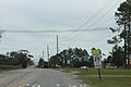
 US280EB, Crisp County.jpg 5,184 × 3,456; 4.3 MB
-
 US280WB, Flint River, Crisp County.jpg 5,184 × 3,456; 4.41 MB
-
 US280WB, Sumter County.jpg 5,184 × 3,456; 4.95 MB
-
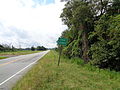
 Worth County border, GA300SB.jpg 5,184 × 3,456; 5.44 MB


.jpg)


.jpg)


.jpg)
.jpg)


