Category:Old maps of the Canary Islands
Jump to navigation
Jump to search
Autonomous communities of Spain: Andalusia · Aragon · Asturias · Balearic Islands · Canary Islands · Cantabria · Castile and León · Castile-La Mancha · Catalonia · Extremadura · Galicia · Community of Madrid · Region of Murcia · Navarre · Valencian Community · Autonomous cities: Ceuta · Melilla
Countries of Africa: Algeria · Angola · Benin · Botswana · Burkina Faso · Burundi · Cameroon · Cape Verde · Central African Republic · Chad · Comoros · Democratic Republic of the Congo · Republic of the Congo · Djibouti · Egypt‡ · Equatorial Guinea · Eritrea · Eswatini · Ethiopia · Gabon · The Gambia · Ghana · Guinea · Guinea-Bissau · Ivory Coast · Kenya · Lesotho · Liberia · Libya · Madagascar · Malawi · Mali · Mauritania · Mauritius · Morocco · Mozambique · Namibia · Niger · Nigeria · Rwanda · São Tomé and Príncipe · Senegal · Sierra Leone · Somalia · South Africa · South Sudan · Sudan · Tanzania · Togo · Tunisia · Uganda · Zambia · Zimbabwe
Limited recognition: Puntland · Somaliland – Other areas: Canary Islands · Ceuta · Madeira · Mayotte · Melilla · Réunion
‡: partly located in Africa
Limited recognition: Puntland · Somaliland – Other areas: Canary Islands · Ceuta · Madeira · Mayotte · Melilla · Réunion
‡: partly located in Africa
Use the appropriate category for maps showing all or a large part of Canary Islands. See subcategories for smaller areas:
| If the map shows | Category to use |
|---|---|
| Canary Islands on a recently created map | Category:Maps of the Canary Islands or its subcategories |
| Canary Islands on a map created more than 70 years ago | Category:Old maps of the Canary Islands or its subcategories |
| the history of Canary Islands on a recently created map | Category:Maps of the history of Canary Islands or its subcategories |
| the history of Canary Islands on a map created more than 70 years ago | Category:Old maps of the history of Canary Islands or its subcategories |
Subcategories
This category has the following 10 subcategories, out of 10 total.
*
- Ptolemy's 1st African Map (47 F)
F
- Old maps of Fuerteventura (7 F)
G
- Old maps of La Gomera (5 F)
H
- Old maps of El Hierro (2 F)
L
- Old maps of Lanzarote (8 F)
P
- Old maps of La Palma (6 F)
T
Media in category "Old maps of the Canary Islands"
The following 89 files are in this category, out of 89 total.
-
 1534 - Isolario di Benedetto Bordone - Canarias y Cabo Verde.jpg 796 × 478; 94 KB
-

-
 Numidiae pars ... Nigritarum terrae - (Livio Sanuto) - btv1b8595464n.jpg 8,736 × 6,843; 9.81 MB
-
 Atlante Veneto Volume 2 104.jpg 10,557 × 7,083; 7.15 MB
-
 Ar.Gbis-T.4-C.1 2 (2).jpg 8,425 × 6,062; 8.44 MB
-
 Carta reducida de las islas de Canaria - T. Lopez - btv1b53177502v.jpg 10,740 × 5,248; 6.43 MB
-

-

-
-
-

-

-

-

-
 A chart of the Canarie & Madera Islands - btv1b531688523.jpg 6,498 × 5,320; 5.84 MB
-
 A chart of the Canarie and Madera Islands (ca. 1702-1707).jpg 760 × 615; 97 KB
-
 A chart of the CANARIE and MADERA Islands NYPL1640659.tiff 7,230 × 5,428; 112.28 MB
-

-

-

-

-
 A chart of the coast of BARBARIA with the Western, Canaria and Cape de Verd, Isles NYPL1640676.tiff 7,230 × 5,428; 112.28 MB
-

-
 A New Chart of the Madeira and Canary Islands (8250888598).jpg 2,000 × 1,634; 2.83 MB
-
-
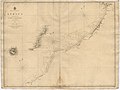
 Admiralty Chart No 1 Portsmouth to Canary Islands, Published 1914.jpg 8,752 × 15,120; 12.56 MB
-

-

-
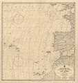
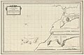
 Admiralty Chart No 1229 Sta. Cruz to Cape Bojador, Published 1844.jpg 8,098 × 6,090; 7.96 MB
-
 AFR V3 D080 The Canary islands - left side of map in colour.jpg 2,866 × 4,594; 1.39 MB
-
 AFR V3 D080-081 The Canary islands- in colour.jpg 5,685 × 4,273; 2.87 MB
-
 AFR V3 D081 The Canary islands - right side of map in colour.jpg 2,866 × 4,594; 1.34 MB
-
 AFR V3 D091 General view of Santa-Cruz - Teneriffe.jpg 3,480 × 2,372; 1.41 MB
-
 Archipelagus atlanticus cum suis insulis Canariis, Hesperidibus et Azoribus (5960813003).jpg 2,000 × 1,245; 2.27 MB
-
 ATLAS JUSTUS PERTHES 10.jpg 4,557 × 3,949; 10.9 MB
-
 Atlas Van der Hagen-KW1049B13 068-INSULAE CANARIAE Alias FORTUNATAE dictae.jpeg 5,500 × 4,279; 3.12 MB
-
 Canarias.jpg 1,024 × 679; 136 KB
-
-

-

-

-
-
 Carte des isles Canaries - (Bellin) - btv1b8595818s.jpg 3,826 × 3,065; 1.69 MB
-

-

-

-

-

-

-
 Description de l'univers (1683) (14597622169).jpg 1,726 × 2,826; 858 KB
-
 EB1911 - Canary Islands Map.jpg 514 × 286; 36 KB
-
 ETH-BIB-Islas Canarias, Situation Détail-Dia 247-Z-00185.tif 3,668 × 2,991; 31.49 MB
-

-
 Globo Coronelli 1688 Museo Naval Madrid detalle Canarias.jpg 2,448 × 3,264; 1.86 MB
-
 Histoire des deux Indes-Atlas-d20-C03-Canaries.png 2,233 × 1,703; 984 KB
-
 Iles Canaries... - Herisson, delt - btv1b8439311h.jpg 6,599 × 4,621; 3.6 MB
-

-
-

-

-

-

-

-
-
-

-
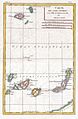
 Islands In The Atlantic.jpg 4,747 × 5,614; 7.32 MB
-
 Islas Canarias.JPG 956 × 410; 164 KB
-
 Item 53141.jpg 600 × 373; 32 KB
-

-
 Map - Special Collections University of Amsterdam - OTM- HB-KZL 33.20.07.tif 8,008 × 6,864; 157.26 MB
-
 Map of Tenerife.jpg 800 × 640; 115 KB
-
 Map of the Canary Islands, 1683.jpg 725 × 1,078; 175 KB
-
 Marokko Küste 003.jpg 2,684 × 2,361; 464 KB
-
 Meyer‘s Zeitungsatlas 095 – Africa.jpg 7,344 × 6,217; 13.86 MB
-
-

-
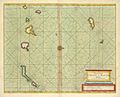
 Overo Fortunate.jpg 1,504 × 885; 284 KB
-

-

-
 Paskaart van de cust van Portugal, Barbaria en Genehoa (2675481524).jpg 2,000 × 1,765; 3.24 MB
-
 Pizzigani brothers 1367 map (Atlantic detail).jpg 515 × 497; 23 KB
-
 Rigobert-Bonne-Atlas-de-toutes-les-parties-connues-du-globe-terrestre MG 9989.tif 3,499 × 5,219; 52.28 MB
-
 Sankt-Brendan-Insel und Kanarische Inseln 1707.jpg 2,059 × 677; 769 KB
-

-
 The Bell System technical journal (1922) (14755680032).jpg 3,426 × 2,778; 2.02 MB
-
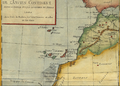
 The Canary Islands, with Madeira and Porto Santo (1780).jpg 408 × 600; 42 KB
-
 UBBasel Map Kanarische Inseln 1656 Kartenslg Mappe 252-46.tif 6,029 × 3,622, 2 pages; 62.5 MB
-
 UBBasel Map Kanarische Inseln Madeiragruppe 1679 Kartenslg Mappe 252-47.tif 5,955 × 3,731, 2 pages; 63.59 MB

.jpg)
_-_btv1b8595464n.jpg)

.jpg)

.jpg)
.jpg)


.jpg)
.jpg)
.jpg)
.jpg)

.jpg)
.jpg)


_GEO._GLAS_in_1759_%26_1760,_and_those_of_Mon(sieur)_DE..._-_btv1b59664365_(1_of_2).jpg)
_-_btv1b85957972.jpg)
.jpg)
_and_the_Azores_(A%C3%A7%C3%B4res),_Published_1946.jpg)


.jpg)


_Armada..._-_btv1b5966449s.jpg)

_-_btv1b8595818s.jpg)


.jpg)
.jpg)
_et_les_Isles_Canaries,_seconde_feuille_Depuis..._-_btv1b10678512f_(1_of_2).jpg)

_(14597622169).jpg)


,_Amesterd%C3%A3o,_Holanda_-_Image_240482.jpg)

.jpg)
.jpg)
%27_(11225171934).jpg)
%27_(16588944851).jpg)
%27_(11235359023).jpg)
_-_publicada_por_los_SS._Hardisson,_hermanos_-_btv1b53064535t.jpg)


.jpg)


.jpg)

.jpg)
,_RP-P-1896-A-19368-2994.jpg)
.jpg)
.jpg)

_(14755680032).jpg)
.jpg)
.jpg)