Category:Old maps of Andalusia
Jump to navigation
Jump to search
Autonomous communities of Spain: Andalusia · Aragon · Asturias · Balearic Islands · Canary Islands · Cantabria · Castile and León · Castile-La Mancha · Catalonia · Extremadura · Galicia · Community of Madrid · Region of Murcia · Navarre · Valencian Community · Autonomous cities: Ceuta · Melilla
Use the appropriate category for maps showing all or a large part of Andalusia. See subcategories for smaller areas:
| If the map shows | Category to use |
|---|---|
| Andalusia on a recently created map | Category:Maps of Andalusia or its subcategories |
| Andalusia on a map created more than 70 years ago | Category:Old maps of Andalusia or its subcategories |
| the history of Andalusia on a recently created map | Category:Maps of the history of Andalusia or its subcategories |
| the history of Andalusia on a map created more than 70 years ago | Category:Old maps of the history of Andalusia or its subcategories |
Subcategories
This category has the following 2 subcategories, out of 2 total.
*
M
Media in category "Old maps of Andalusia"
The following 80 files are in this category, out of 80 total.
-
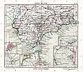
 Andalusia (1588).jpg 800 × 581; 152 KB
-

-
 Portugalliae Regnum," 1597 a closer view.jpg 800 × 600; 189 KB
-
 Portugalliae Regnum," 1597.jpg 800 × 600; 182 KB
-
 "Andaluzia continens Sevillam et Cordubam" (21632764213).jpg 3,856 × 2,974; 2.51 MB
-
 1696 map of Andalusia by Giacomo Cantelli da Vignola.jpg 11,001 × 13,959; 29.04 MB
-

-
 1730 map of Andalusia and Gibraltar by Matthaus Seutter.jpg 1,850 × 1,600; 811 KB
-

-
-

-
 Mapa del Reyno de Jaén... - por Tomas López... - btv1b53226981m (1 of 2).jpg 7,206 × 5,404; 3.65 MB
-

-

-

-

-
 Andalusia e Granada Di Novissima Projezione.jpg 10,603 × 8,288; 12.49 MB
-
 1780 - P Santini - Map Gibraltar.jpg 1,379 × 1,600; 522 KB
-
 1899 map - Karte der Sierra Nevada.jpg 8,345 × 6,065; 7.42 MB
-
 MTN50-0986-1917-nnn-Marchena.jpg 7,874 × 5,007; 13.89 MB
-

-
 Andalucia-Carte-des-Routes-Didot.jpg 850 × 657; 180 KB
-
 Andaluzia - Gabriel Bodenehr.jpg 1,020 × 644; 121 KB
-
 Andaluzia continens Seuillam et Cordubam - CBT 5880843.jpg 5,532 × 4,267; 6.16 MB
-
 Andaluzia continens Sevillam et Cordubam (8343734736).jpg 800 × 657; 113 KB
-
 Andaluzia continens Sevillam et Cordubam - btv1b53194482c (2 of 3).jpg 8,508 × 6,264; 7.85 MB
-
 Andaluzia. NYPL1632139.tiff 7,230 × 5,428; 112.28 MB
-
 ATLAS JUSTUS PERTHES 07.jpg 4,525 × 3,965; 13.07 MB
-
 ATLAS JUSTUS PERTHES 08.jpg 4,547 × 3,933; 10.25 MB
-
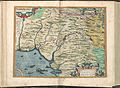 Atlas Ortelius KB PPN369376781-014av-014br.jpg 3,000 × 2,194; 4.66 MB
-
 Atlas Van der Hagen-KW1049B12 011-GRANATA ET MVRCIA REGNA.jpeg 5,500 × 4,250; 3.36 MB
-
 Andaluzia (NYPL b15404146-1632139).jpg 7,230 × 5,428; 5.98 MB
-
 Bahía Algeciras.jpg 1,565 × 2,330; 1.03 MB
-
 Betica.jpg 842 × 619; 192 KB
-

-
 Bulletin de la Société géologique de France (1888) (20430048402).jpg 2,912 × 2,079; 1.81 MB
-

-
 Cadiz 1625.jpg 713 × 1,170; 145 KB
-
 Carte de la baye de Gibraltar (1762).jpg 3,000 × 2,133; 1.78 MB
-
 Carte des présides espagnols.jpg 5,500 × 3,484; 2.28 MB
-
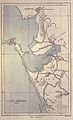
 El Río Guadalquivir en el siglo XVIII.jpg 4,500 × 1,967; 5.83 MB
-
 Fuertes de la linea3.jpg 1,158 × 572; 185 KB
-
 Geografía Blaviana, v. 9 (Mapa).jpg 741 × 572; 166 KB
-
 Gibraltar and Bay map 1750.jpg 2,049 × 2,750; 877 KB
-
 Gibraltar e istmo en 1786.jpg 440 × 920; 115 KB
-
 Granada by Piri Reis.jpg 813 × 539; 560 KB
-
 Granada-y-Murcia-Bleau.jpg 1,850 × 1,446; 487 KB
-
 "Granata et Murcia regna" (22271038571).jpg 3,825 × 2,974; 2.34 MB
-
 Granata et Murcia regna - CBT 5880848.jpg 5,382 × 4,324; 6.25 MB
-
 GRANATA ET MURCIA REGNA.jpg 4,000 × 2,971; 2.47 MB
-
-
-
 Joseph Roux, Carte de la Mer Mediterranée (FL13730740 3369739).jpg 13,578 × 9,590; 180.46 MB
-

-

-

-

-
 Kitab-i Bahriye Kingdom of Granada.png 5,742 × 3,754; 35.12 MB
-
 Lange diercke sachsen europaeische landschaften gibraltar.jpg 1,251 × 1,052; 664 KB
-
 Les Royaumes de Grenade et d'Andalousie.jpg 9,080 × 6,701; 18.08 MB
-
 Map - Special Collections University of Amsterdam - OTM- HB-KZL 32.23.59.tif 7,928 × 6,724; 152.52 MB
-
 Map - Special Collections University of Amsterdam - OTM- HB-KZL 32.23.66.tif 6,800 × 5,600; 108.95 MB
-
 Map - Special Collections University of Amsterdam - OTM- HB-KZL 34.25.05.tif 10,187 × 6,637; 193.44 MB
-
 Map of the diocese of Seville in Andalusia by Abraham Ortelius.jpeg 1,541 × 1,203; 594 KB
-
 Mapa andaluz.jpg 2,433 × 1,902; 734 KB
-
 Mapa de Andaluzia, Petrus Bertius y Jodocus Hondius.jpg 3,088 × 2,557; 5.07 MB
-
 MAPA DE FRANCISCO ZARZANA2 Xerez 1787.jpg 1,600 × 1,373; 952 KB
-

-
 Mapa itinerario del distrito militar de Andalucia - btv1b53098808c.jpg 10,673 × 8,769; 11.02 MB
-
 Mapa itinerario del Distrito militar de Granada - btv1b53098807x.jpg 10,889 × 8,301; 10.74 MB
-
 MapaRomano-Golfo de Cádis.jpg 466 × 593; 99 KB
-

-

-

-
 Reilly 543.jpg 407 × 313; 44 KB
-
 Reilly 545.jpg 1,288 × 1,106; 582 KB
-
 Reino de Sevilla 1748.jpg 6,941 × 5,333; 6.45 MB
-
 Spain and Portugal- handbook for travellers (1901) (14776665575).jpg 1,396 × 1,988; 977 KB
-

-
 T1000001.jpg 900 × 621; 137 KB
.jpg)
es_Aurigarius_Inventor_;_Ioannes_%C3%A0_Doetecum_fecit_-_btv1b53194504b_(2_of_3).jpg)


.jpg)

,_BI-B-FM-090-60.jpg)

_-_Geographicus_-_Andalusia-ratelband-1747.jpg)
.jpg)
.jpg)
.jpg)
.jpg)
.jpg)
.jpg)
.jpg)


.jpg)
.jpg)


.jpg)


_(20430048402).jpg)


.jpg)


.jpg)


.jpg)


_(14582446899).jpg)

.jpg)
_Les_Forces_de_l%27Europe,_Asie,_Afrique_et_Amerique_Comme_aussi_les_Cartes_des_C%C3%B4tes_de_France_et_d%27Esp,_RP-P-OB-83.035-135.jpg)
_Les_Forces_de_l%27Europe,_Asie,_Afrique_et_Amerique,_ou_description_des_principales_villes_avec_leu,_RP-P-OB-83.034-311.jpg)
,_RP-P-OB-83.035-134.jpg)


_(14776665575).jpg)

