Category:Old maps of Angola
Jump to navigation
Jump to search
Countries of Africa: Algeria · Angola · Benin · Botswana · Burkina Faso · Burundi · Cameroon · Cape Verde · Central African Republic · Chad · Comoros · Democratic Republic of the Congo · Republic of the Congo · Djibouti · Egypt‡ · Equatorial Guinea · Eritrea · Eswatini · Ethiopia · Gabon · The Gambia · Ghana · Guinea · Guinea-Bissau · Ivory Coast · Kenya · Lesotho · Liberia · Libya · Madagascar · Malawi · Mali · Mauritania · Mauritius · Morocco · Mozambique · Namibia · Niger · Nigeria · Rwanda · São Tomé and Príncipe · Senegal · Sierra Leone · Somalia · South Africa · South Sudan · Sudan · Tanzania · Togo · Tunisia · Uganda · Zambia · Zimbabwe
Limited recognition: Puntland · Somaliland – Other areas: Canary Islands · Ceuta · Madeira · Mayotte · Melilla · Réunion
‡: partly located in Africa
Limited recognition: Puntland · Somaliland – Other areas: Canary Islands · Ceuta · Madeira · Mayotte · Melilla · Réunion
‡: partly located in Africa
Use the appropriate category for maps showing all or a large part of Angola. See subcategories for smaller areas:
| If the map shows | Category to use |
|---|---|
| Angola on a recently created map | Category:Maps of Angola or its subcategories |
| Angola on a map created more than 70 years ago | Category:Old maps of Angola or its subcategories |
| the history of Angola on a recently created map | Category:Maps of the history of Angola or its subcategories |
| the history of Angola on a map created more than 70 years ago | Category:Old maps of the history of Angola or its subcategories |
Subcategories
This category has the following 5 subcategories, out of 5 total.
- 17th-century maps of Angola (9 F)
- 18th-century maps of Angola (5 F)
Media in category "Old maps of Angola"
The following 11 files are in this category, out of 11 total.
-
-
 AMH-7957-KB Map of part of the Angolan coast.jpg 2,400 × 1,913; 677 KB
-
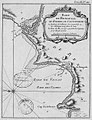
 Carte de la Rade de Benguela et Riviere de Cantonbelle RMG F0420.tiff 6,847 × 5,196; 101.79 MB
-
 Icones ornithopterorum (Plate C. map (2nd)) (7704028510).jpg 2,096 × 1,532; 362 KB
-
 Map of the Bay of Benguela and the Cantonbelle River WDL1207.png 1,490 × 1,024; 2.52 MB
-
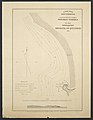 Plano Hydrographico Da Enseada Do Quicembo.jpg 4,217 × 5,460; 4.79 MB
-
 Planta Topográfica da Catumbela 1900.jpg 1,264 × 883; 163 KB
-
 Rade de Benguela.jpg 959 × 1,241; 578 KB
-
 Reconheceimento hydrographico da Ponta Banana Á Bahia De Cabinda.jpg 4,881 × 6,097; 5.46 MB
-
 Regna Congo et Angola - CBT 6620958.jpg 5,704 × 4,716; 6.26 MB
-
 Tanganjika-Loanda.JPG 3,926 × 2,375; 1.25 MB
,_from-_Angola-South-West_Africa_boundary._LOC_84692090_(cropped).jpg)

)_(7704028510).jpg)


