Category:Old maps of Rhode Island
Jump to navigation
Jump to search
States of the United States: Alabama · Alaska · Arizona · Arkansas · California · Colorado · Connecticut · Delaware · Florida · Georgia · Hawaii · Idaho · Illinois · Indiana · Iowa · Kansas · Kentucky · Louisiana · Maine · Maryland · Massachusetts · Michigan · Minnesota · Mississippi · Missouri · Montana · Nebraska · Nevada · New Hampshire · New Jersey · New Mexico · New York · North Carolina · North Dakota · Ohio · Oklahoma · Oregon · Pennsylvania · Rhode Island · South Carolina · South Dakota · Tennessee · Texas · Utah · Vermont · Virginia · Washington · West Virginia · Wisconsin · Wyoming – District of Columbia: Washington, D.C.
Guam · Northern Mariana Islands · Puerto Rico
Guam · Northern Mariana Islands · Puerto Rico
Subcategories
This category has the following 6 subcategories, out of 6 total.
C
Media in category "Old maps of Rhode Island"
The following 100 files are in this category, out of 100 total.
-
 Tierra nveva (NYPL b13868891-484204).jpg 4,776 × 3,646; 3.16 MB
-
 Tierra nveva (NYPL b15307938-434490)(c).jpg 4,160 × 2,912; 1.93 MB
-
 Tierra nveva (NYPL b15307938-434490).jpg 4,899 × 3,856; 2.54 MB
-
 Tierra nveva (NYPL b15307938-434490).tiff 4,899 × 3,856; 54.08 MB
-
 Tierra nveva. NYPL434490.tiff 5,251 × 4,256; 63.98 MB
-
 Tierra nveva (NYPL b15307937-434500)(c).jpg 4,416 × 3,320; 2.62 MB
-
 Tierra nveva (NYPL b15307937-434500).jpg 5,251 × 4,256; 3.4 MB
-
 Tierra nveva (NYPL b15307937-434500).tiff 5,251 × 4,256; 63.98 MB
-
 1827 Finley Map of Rhode Island - Geographicus - RhodeIsland-finley-1827.jpg 2,314 × 3,000; 1.67 MB
-
 A plan of the town of Newport in Rhode Island. LOC 74692104.jpg 4,685 × 4,390; 4.08 MB
-
 A plan of the town of Newport in Rhode Island. LOC 74692104.tif 4,685 × 4,390; 58.84 MB
-
 A plan of the town of Newport in Rhode Island. LOC 74692105.jpg 5,443 × 4,304; 4.39 MB
-
 A plan of the town of Newport in Rhode Island. LOC 74692105.tif 5,443 × 4,304; 67.02 MB
-
-
-
-
-

-
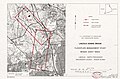
 GreysRaid.png 3,648 × 2,695; 20.75 MB
-

-
 J. H. Colton's School Atlas, 1860 - DPLA - 9afa4d40de861bb7b2a7e024bba61c0e (page 14).jpg 4,093 × 4,918; 2.26 MB
-
 LarkAndCerberusWreckMap.jpg 600 × 450; 72 KB
-
-

-
 Manuscript map of coast from Maine to Delaware (2674786657).jpg 2,000 × 1,696; 2.33 MB
-
-

-
 Map of Newport & vicinity, or Rhode Island. LOC 2013593286.jpg 7,024 × 9,896; 8.43 MB
-
 Map of Newport & vicinity, or Rhode Island. LOC 2013593286.tif 7,024 × 9,896; 198.87 MB
-
 Map of Newport & vicinity, or Rhode Island. LOC 2013593287.jpg 7,334 × 9,980; 8.49 MB
-
 Map of Newport & vicinity, or Rhode Island. LOC 2013593287.tif 7,334 × 9,980; 209.41 MB
-
 Map of Newport County, Rhode Island LOC 2013591358.jpg 12,111 × 9,505; 16.25 MB
-
 Map of Newport, R.I. (10176175695).jpg 637 × 800; 122 KB
-
 Map of Providence County, Rhode Island, with some of the adjacent towns LOC 2013591359.jpg 15,938 × 11,954; 25.37 MB
-
 Map of the city of Providence and town of North Providence LOC 00555737.jpg 8,667 × 6,092; 8.62 MB
-
 Map of the city of Providence and town of North Providence LOC 00555737.tif 8,667 × 6,092; 151.06 MB
-
 Map of the State of Rhode Island and Providence Plantations. LOC 97683598.jpg 9,376 × 12,832; 16.6 MB
-
 Map of the State of Rhode Island and Providence Plantations. LOC 97683598.tif 9,376 × 12,832; 344.22 MB
-
 Map of the town of Providence - from actual survey LOC 2011589249.jpg 10,279 × 6,963; 9.1 MB
-
 Map of Washington and Kent Counties, R.I. LOC 80693470.jpg 2,115 × 3,017; 935 KB
-
 Map of Washington and Kent Counties, R.I. LOC 80693470.tif 2,115 × 3,017; 18.26 MB
-
 Marche de l'armée française de Providence à la Rivière du Nord. LOC gm71002161.jpg 6,261 × 4,004; 3.46 MB
-
 Marche de l'armée française de Providence à la Rivière du Nord. LOC gm71002161.tif 6,261 × 4,004; 71.72 MB
-
-

-
 New dollar atlas of the United States and Dominion of Canada (1884) (14787080963).jpg 3,120 × 1,846; 1.24 MB
-
 Newport, R.I. - view from Fort Wolcott, Goat Island LOC 2003620502.jpg 10,862 × 4,165; 5.21 MB
-
 Newport, R.I. - view from Fort Wolcott, Goat Island LOC 2003620502.tif 10,862 × 4,165; 129.43 MB
-
 Newport, R.I. 1878. LOC 75696563.jpg 10,164 × 8,328; 8.92 MB
-
 Newport, R.I. 1878. LOC 75696563.tif 10,164 × 8,328; 242.17 MB
-
 NIE 1905 Rhode Island.jpg 1,569 × 2,516; 1.54 MB
-

-

-

-
-
-
-

-
-

-

-

-
-
 Plan de Rhodes-Island, et position de l'armée françoise a Newport. LOC gm71002156.jpg 14,222 × 7,091; 10.51 MB
-
 Plan de Rhodes-Island, et position de l'armée françoise a Newport. LOC gm71002156.tif 14,222 × 7,091; 288.53 MB
-
 Plan of the city of Providence (7537853110).jpg 2,000 × 1,691; 2.77 MB
-
-

-

-

-

-

-
 Providence harbor, Rhode Island LOC 79695301.jpg 4,987 × 6,762; 4.75 MB
-
 Providence harbor, Rhode Island LOC 79695301.tif 4,987 × 6,762; 96.48 MB
-
 Providence in colonial times (1912) (14596206368).jpg 2,688 × 1,610; 610 KB
-
 Providence original home-lots (spliced).jpg 1,720 × 1,225; 587 KB
-
 Providence original home-lots.pdf 1,552 × 2,054, 2 pages; 400 KB
-
 Providence, R.I. (2675103453).jpg 10,048 × 7,544; 13.34 MB
-
-
 Quatre positions de la flotte française et positions de la flotte anglaise. LOC gm71002160.tif 4,019 × 5,591; 64.29 MB
-

-
 Rhode Island 1660.jpg 1,405 × 1,701; 512 KB
-
 Rhode Island conservation district map LOC 82693109.jpg 2,482 × 3,264; 977 KB
-
 Rhode Island conservation district map LOC 82693109.tif 2,482 × 3,264; 23.18 MB
-
 Rhode Island LOC 2011589271.jpg 5,918 × 7,930; 6 MB
-
 Rhode Island LOC 2011589271.tif 5,918 × 7,930; 134.27 MB
-
 Rhode Island; county subdivisions, towns and places. 1970. LOC gm72003071.jpg 2,882 × 4,228; 859 KB
-
 Rhode Island; county subdivisions, towns and places. 1970. LOC gm72003071.tif 2,882 × 4,228; 34.86 MB
-
 Rhode-island-map.jpg 6,230 × 4,705; 3.28 MB
-
 Road map of the island of Rhode Island or Aquidneck LOC 2012593354.jpg 3,470 × 5,641; 2.5 MB
-
 Road map of the island of Rhode Island or Aquidneck LOC 2012593354.tif 3,470 × 5,641; 56 MB
-

-
 Stillwater mill beers map 1870.jpg 1,210 × 1,428; 1.24 MB
-
-

-
-
 View of the city of Providence as seen from the dome of the new State House. LOC 75696565.tif 7,048 × 4,920; 99.21 MB
-
 View of Westerly, R.I. 1877. LOC 73694687.jpg 8,256 × 6,464; 9.02 MB
-
 Warren, Rhode Island (10139332825).jpg 800 × 609; 107 KB
-
 Wickford, Rhode Island, 1888. LOC 2010589385.jpg 10,094 × 7,077; 10.62 MB
.jpg)
(c).jpg)
.jpg)
(c).jpg)
.jpg)


.jpg)
.jpg)


.jpg)
.jpg)


.jpg)
.jpg)
.jpg)


.jpg)


_(14787080963).jpg)


.jpg)
.jpg)


.jpg)

.jpg)
.jpg)
.jpg)
.jpg)

_(14596206368).jpg)
.jpg)
.jpg)


.jpg)

_of_salt_meadow_together_with_severall_(i.e._several)_hummuks_(i.e._hummocks)_of_upland_therein_contained_lying_in_the_township_of_Westerly_belonging_to_Mr._LOC_2008624258.jpg)


.jpg)
