Category:Old maps of North Dakota
Jump to navigation
Jump to search
States of the United States: Alabama · Alaska · Arizona · Arkansas · California · Colorado · Connecticut · Delaware · Florida · Georgia · Hawaii · Idaho · Illinois · Indiana · Iowa · Kansas · Kentucky · Louisiana · Maine · Maryland · Massachusetts · Michigan · Minnesota · Mississippi · Missouri · Montana · Nebraska · Nevada · New Hampshire · New Jersey · New Mexico · New York · North Carolina · North Dakota · Ohio · Oklahoma · Oregon · Pennsylvania · Rhode Island · South Carolina · South Dakota · Tennessee · Texas · Utah · Vermont · Virginia · Washington · West Virginia · Wisconsin · Wyoming – District of Columbia: Washington, D.C.
Guam · Northern Mariana Islands · Puerto Rico
Guam · Northern Mariana Islands · Puerto Rico
Subcategories
This category has the following 11 subcategories, out of 11 total.
C
O
R
Media in category "Old maps of North Dakota"
The following 26 files are in this category, out of 26 total.
-
-
 1886rail-usgenweb-mapproject.jpg 1,772 × 2,092; 1.16 MB
-
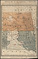
 1895 Railroad Map of North Dakota (3495432623).jpg 2,473 × 1,681; 2.88 MB
-

-
 A biological survey of North Dakota (1926) (20354530006).jpg 2,036 × 1,280; 490 KB
-

-

-

-

-
-

-
 Collier's 1921 North Dakota.jpg 2,283 × 1,850; 1.11 MB
-
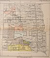
 Dakotas 1 Indian Land Cessions.jpg 770 × 880; 203 KB
-
 EB1911 North Dakota.jpg 2,505 × 1,828; 2.18 MB
-
 Map of Sargent County, North Dakota LOC 2011590016.jpg 13,486 × 12,150; 24.85 MB
-
 Map showing the plat of Blabon, Steele County, North Dakota.jpg 1,200 × 1,455; 295 KB
-
 Map showing the plat of Sherbrooke, Steele County, North Dakota.jpg 1,200 × 1,224; 305 KB
-
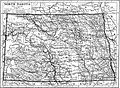
 NIE 1905 North and South Dakota.jpg 2,022 × 2,510; 2.34 MB
-

-

-

-

-
 Rice's sectional map of Dakota Territory. LOC 2012593215.jpg 11,578 × 14,820; 17.27 MB
-
 Rice's sectional map of Dakota Territory. LOC 2012593215.tif 11,578 × 14,820; 490.91 MB
-

-


.jpg)
.jpg)
_(20354530006).jpg)
_(18739355764).jpg)
_(18739358564).jpg)
_(19174255980).jpg)
_(19355783042).jpg)
_(19355803162).jpg)
_(19361904475).jpg)


_(14787272553).jpg)


