Category:Old maps of Indiana
Jump to navigation
Jump to search
States of the United States: Alabama · Alaska · Arizona · Arkansas · California · Colorado · Connecticut · Delaware · Florida · Georgia · Hawaii · Idaho · Illinois · Indiana · Iowa · Kansas · Kentucky · Louisiana · Maine · Maryland · Massachusetts · Michigan · Minnesota · Mississippi · Missouri · Montana · Nebraska · Nevada · New Hampshire · New Jersey · New Mexico · New York · North Carolina · North Dakota · Ohio · Oklahoma · Oregon · Pennsylvania · Rhode Island · South Carolina · South Dakota · Tennessee · Texas · Utah · Vermont · Virginia · Washington · West Virginia · Wisconsin · Wyoming – District of Columbia: Washington, D.C.
Guam · Northern Mariana Islands · Puerto Rico
Guam · Northern Mariana Islands · Puerto Rico
Subcategories
This category has the following 43 subcategories, out of 43 total.
B
C
D
F
G
H
J
K
L
M
N
O
P
S
T
V
W
Media in category "Old maps of Indiana"
The following 63 files are in this category, out of 63 total.
-

-

-
 2cornisland.gif 450 × 359; 90 KB
-
 4 of 'History of La Porte County, Indiana, and it townships, etc' (11111842114).jpg 1,283 × 1,962; 742 KB
-
 800-c-Reg4-B-1836b.jpg 6,958 × 5,582; 8.37 MB
-

-

-

-
 Diagram of Falls of the Ohio and Portland Canal in 1916.jpg 1,281 × 823; 178 KB
-
 Edward's map of Starke Co., Indiana LOC 2013593165.jpg 15,623 × 12,327; 26.83 MB
-
 Edward's map of Starke Co., Indiana LOC 2013593165.tif 15,623 × 12,327; 550.99 MB
-
 Electric railway journal (1910) (14574235388).jpg 2,981 × 2,302; 1.04 MB
-
 Elizabeth Map.jpg 239 × 222; 22 KB
-
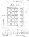
 Elizabethtown Plat Map.jpg 395 × 317; 96 KB
-
 Evansville, Indiana map, c. 1916.jpg 2,000 × 2,667; 1.15 MB
-
 Falls of the Ohio - NARA - 122668718.jpg 9,472 × 6,773; 3.01 MB
-
 Flinn Township, Lawrence County, Indiana map 1890.jpg 656 × 626; 86 KB
-

-
 Indiana - NARA - 109186526.jpg 5,804 × 8,406; 4.29 MB
-
 Indiana - NARA - 66799143.jpg 7,104 × 10,523; 5.21 MB
-
 Indiana 90.jpg 764 × 1,118; 476 KB
-
 Indiana Historical Society publications (1897) (14596376700).jpg 1,872 × 1,404; 238 KB
-
 Indiana- Index to Field Notes - NARA - 84785988.jpg 7,136 × 10,530; 5.49 MB
-
 IndianaUnionTractionCo.1904map.jpg 985 × 1,136; 79 KB
-
 Map of Putnam Co., Indiana LOC 2013593177.jpg 15,696 × 14,143; 32.46 MB
-
 Map of Putnam Co., Indiana LOC 2013593177.tif 15,696 × 14,143; 635.11 MB
-
 Map of Randolph Co., Indiana LOC 2013593178.jpg 16,951 × 12,966; 32.71 MB
-
 Map of the county of Rush Ind. LOC 2013593179.jpg 12,252 × 16,238; 24.47 MB
-
 Map of the county of Rush Ind. LOC 2013593179.tif 12,252 × 16,238; 569.19 MB
-

-

-

-

-
 Map of Vermillion County, Indiana LOC 2013593167.jpg 7,596 × 17,973; 18.5 MB
-
 Map of Vigo County, Indiana LOC 2013593168.jpg 17,950 × 15,607; 39.71 MB
-
 Map of Vigo County, Indiana LOC 2013593168.tif 17,950 × 15,607; 801.5 MB
-
 Map of Wabash County, Indiana LOC 2013593169.tif 16,004 × 16,359; 749.04 MB
-
 Map of Whitley County, Ind. and business directory LOC 2013593201.jpg 11,662 × 16,706; 34.25 MB
-
 Map of Whitley County, Ind. and business directory LOC 2013593201.tif 11,662 × 16,706; 557.4 MB
-
 MedaryvillePlat.jpg 2,384 × 3,050; 564 KB
-
 Morgan County, Ind. LOC 2013593199.jpg 14,822 × 12,609; 32.58 MB
-
 Morgan County, Ind. LOC 2013593199.tif 14,822 × 12,609; 534.7 MB
-
 NIE 1905 Indiana.jpg 1,615 × 2,001; 1.17 MB
-

-
 Railroad map of Indiana, by Col. Thomas A. Morris, Civil Engineer, LOC 98688469.jpg 5,664 × 6,992; 5.49 MB
-
 Railroad map of Indiana, by Col. Thomas A. Morris, Civil Engineer, LOC 98688469.tif 5,664 × 6,992; 113.3 MB
-
 Railroad map of Indiana. LOC 98688471.jpg 5,241 × 6,518; 4.59 MB
-
 Railroad map of Indiana. LOC 98688471.tif 5,241 × 6,518; 97.74 MB
-
 Railroad map of Indiana. LOC 98688475.jpg 6,736 × 10,304; 14.32 MB
-
 Railroad map of Indiana. LOC 98688475.tif 6,736 × 10,304; 198.58 MB
-
 Rapids of Ohio River by Hutchins.png 905 × 739; 1.28 MB
-

-
 South Bend, Ind. 1890. LOC 75693227.jpg 12,704 × 8,704; 21.7 MB
-
 South Bend, Ind. 1890. LOC 75693227.tif 12,704 × 8,704; 316.36 MB
-
 South Bend, Indiana 1866. LOC 73693388.jpg 8,816 × 6,848; 11.85 MB
-
 South Bend, Indiana 1874. LOC 73693389.jpg 8,192 × 6,704; 9.81 MB
-

-

-
 The city of Richmond, Indiana 1884. LOC 75693226.jpg 12,240 × 8,848; 21.3 MB
-

-
 The Street railway journal (1902) (14780878543).jpg 2,464 × 3,512; 788 KB
-
 View of Tell City, Perry County, Indiana - Praemie zum Tell City Anzeiger LOC 91681501.jpg 8,645 × 6,865; 13.11 MB
-
 View of Tell City, Perry County, Indiana - Praemie zum Tell City Anzeiger LOC 91681501.tif 8,645 × 6,865; 169.8 MB
_LOC_2012591022.jpg)

.jpg)


_(18434981305).jpg)


_(14574235388).jpg)


_(14596376700).jpg)


.jpg)
.jpg)


.jpg)


_(14783208702).jpg)


_(14597937158).jpg)
_(14578798768).jpg)

.jpg)
_(14780878543).jpg)
