Category:Aerial photographs of Tokushima prefecture
Jump to navigation
Jump to search
Media in category "Aerial photographs of Tokushima prefecture"
The following 50 files are in this category, out of 50 total.
-
 1 Chome Okinohamahigashi, Tokushima-shi, Tokushima-ken 770-8053, Japan - panoramio.jpg 4,592 × 3,448; 7.57 MB
-
 31-OCT-2023 - MM712 ICN-KIX (JA205P - A320neo) (03).jpg 2,890 × 2,168; 2.75 MB
-
 Aerial photograph of Donari interchange.jpg 600 × 450; 177 KB
-
 Anan city center area Aerial photograph.2013.jpg 6,166 × 4,624; 9.46 MB
-
 Anan power station - aerial.jpg 947 × 842; 219 KB
-
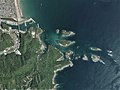
 Aoshima Island, Anan Tokushima Aerial photograph.2013.jpg 1,801 × 1,351; 380 KB
-
 Asan Circuit Aerial photograph.2009.jpg 1,058 × 793; 345 KB
-
 Bentenjima Island, Anan Tokushima Aerial photograph.2014.jpg 1,110 × 833; 238 KB
-
 Bizan Country Club, Tokushima Tokushima Aerial photograph.2009.jpg 2,335 × 1,779; 1.92 MB
-
 Ebigaike air 2.jpg 2,081 × 1,961; 3.74 MB
-
 Ebigaike air.jpg 972 × 882; 1.19 MB
-
 F-GSQB FLIGHT CDG-KIX (7169608957).jpg 2,881 × 1,920; 4.05 MB
-
 Ikeda district Miyoshi city center area Aerial photograph.2009.jpg 4,967 × 3,726; 6.36 MB
-
 Ishima Island Anan Tokushima Aerial photograph.2014.jpg 5,748 × 4,311; 6.21 MB
-
 Ishima Island Anan-city Aerial photograph.1976.jpg 5,359 × 3,161; 11.17 MB
-
 Kamojima district Yoshinogawa city center area Aerial photograph.2014.jpg 3,203 × 2,403; 2.68 MB
-
 Kirihata district Awa city halls area Aerial photograph.2014.jpg 2,260 × 1,694; 1.34 MB
-
 Kokatsujima Island and Tachibanawan Power Plants, Anan Tokushima Aerial photograph.2014.jpg 4,130 × 3,098; 3.55 MB
-
 Komatsushima city center area Aerial photograph.2009.jpg 5,133 × 3,850; 6.94 MB
-
 Maikoshima Island, Anan Tokushima Aerial photograph.2014.jpg 2,907 × 2,180; 1.76 MB
-
 Mainaka river island of Yoshino River Aerial photograph.2009.jpg 3,164 × 2,374; 2.57 MB
-
 Mitoko Bay, Kaiyo Tokushima Aerial photograph.2017.jpg 3,831 × 2,874; 2.66 MB
-
 Mugi-Oshima Island Aerial photograph.1975.jpg 2,600 × 1,879; 2.39 MB
-
 Nagashima Island, Anan Tokushima Aerial photograph.2013.jpg 1,476 × 1,107; 247 KB
-
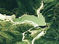 Nagoro Dam survey 1976.jpg 777 × 582; 108 KB
-
 Nakatori river island of Yoshino River Aerial photograph.2009.jpg 923 × 690; 257 KB
-
 Nakatsushima Island, Anan Tokushima Aerial photograph.2013.jpg 1,441 × 1,081; 257 KB
-
 Naruto city center area Aerial photograph.2009.jpg 6,970 × 8,187; 20.53 MB
-
 Naruto Country Club, Naruto Tokushima Aerial photograph.2009.jpg 4,317 × 3,238; 4.46 MB
-
 Nasa Bay, Kaiyo Tokushima Aerial photograph.2017.jpg 7,154 × 5,365; 12.2 MB
-
 Nono-shima Island, Anan Tokushima Aerial photograph.2014.jpg 2,138 × 1,604; 1.18 MB
-
 Port of Kannoura and Takegashima Island Aerial photograph.1975.jpg 4,631 × 3,353; 14.05 MB
-
 Takashima Island, Anan Tokushima Aerial photograph.2014.jpg 2,954 × 2,215; 2.08 MB
-
 Teba-jima Island Aerial photograph.1975.jpg 2,705 × 1,957; 3.15 MB
-
 The Otsuka Museum of Art20s3203-B-T.jpg 3,000 × 2,000; 6.75 MB
-
 The Otsuka Museum of Art20s3203.jpg 5,616 × 3,744; 14.82 MB
-
 Tokushima Airport (TKS-RJOS).jpg 1,959 × 2,049; 3.21 MB
-
 Tokushima Airport Aerial photograph.2009.jpg 6,960 × 4,200; 7.17 MB
-
 Tokushima Castle air.jpg 2,420 × 2,000; 6.98 MB
-
 Tokushima city center area Aerial photograph.2009.jpg 13,086 × 9,869; 44.23 MB
-
 Tokushima Country Club, Tokushima Tokushima Aerial photograph.2013.jpg 3,854 × 2,890; 4.04 MB
-
 Tokushima Golf Club, Tokushima Tokushima Aerial photograph.2009.jpg 2,176 × 1,633; 859 KB
-
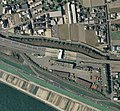 Tokushima toll gate.jpg 606 × 559; 306 KB
-
 Udojima Island, Anan Tokushima Aerial photograph.2013.jpg 620 × 466; 74 KB
-
 Urumejima Island, Anan Tokushima Aerial photograph.2014.jpg 848 × 636; 168 KB
-
 Wakimachi and Anabuki district Mima city Aerial photograph.2009.jpg 4,389 × 3,292; 4.69 MB
-
 Yoshino River Daiju-zeki weir Aerial photograph.1974.jpg 4,061 × 2,939; 8.55 MB
-
 YoshinoGawa.jpg 1,280 × 960; 201 KB
-
 YoshinoGawaKakou.jpg 1,280 × 960; 175 KB
-
 Zen-nyuji river island of Yoshino River Aerial photograph.2014.jpg 6,262 × 3,516; 7.09 MB
_(03).jpg)


.jpg)


.jpg)