Category:Aerial photographs of Gifu prefecture
Jump to navigation
Jump to search

Media in category "Aerial photographs of Gifu prefecture"
The following 76 files are in this category, out of 76 total.
-
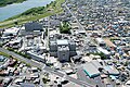
 Aerial photo of Kani 10-Aug-2019.jpg 4,342 × 2,999; 2.61 MB
-
 Aerial Photo of Kanō Castle.jpg 869 × 652; 202 KB
-
 Aerial photograph of Gifu city north gymnasium.jpg 450 × 300; 79 KB
-
 Aerial photograph of Gifu Prefectural Ceramics Research Institute.jpg 450 × 450; 168 KB
-
 Aerial photograph of Kakamigahara Baseball Park.jpg 683 × 578; 182 KB
-
 Aerial photograph of Miki park, Ogaki.jpg 750 × 450; 219 KB
-
 Aerial photograph of Mitake town B&G center.jpg 600 × 450; 173 KB
-
 Aerial photograph of Ogaki city south athletic ground.jpg 300 × 300; 92 KB
-
 Aerial photograph of Ogaki interchange.jpg 1,200 × 900; 615 KB
-
 Aerial photograph of the Itoshiro district.jpg 2,770 × 2,072; 1.78 MB
-

-
 Aerial photographs of Giyo gymnasium.jpg 360 × 360; 106 KB
-
 Aerial view of Ena, Gifu.jpg 3,264 × 2,448; 3.27 MB
-
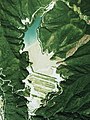
 Asaida Dam 1977.jpg 800 × 599; 653 KB
-
 Ena city center area Aerial photograph.1976.jpg 4,466 × 3,410; 23.15 MB
-
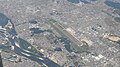
 Flight Haneda-Hanoi 02 Airport and rail station in Japan.jpg 3,264 × 2,448; 1.05 MB
-
 Fuji Country Kani Club Kani Golf Course, Kani Gifu Aerial photograph.2018.jpg 3,882 × 5,107; 6.33 MB
-
 Fuji Country Kani Club Mino Golf Course, Kani Gifu Aerial photograph.2018.jpg 3,159 × 2,370; 2.56 MB
-
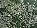
 Fuji Country Kani Club Two entire course, Kani Gifu Aerial photograph.2018.jpg 5,669 × 5,076; 9.16 MB
-
 Gero spa town district Aerial photograph.1977.jpg 3,495 × 2,520; 7.37 MB
-
 Gifu airbase aerial shoot.jpg 3,648 × 2,736; 6.33 MB
-
 Gifu airfiled.JPG 2,504 × 1,407; 1.46 MB
-
 Gifu city center area Aerial photograph.1987.jpg 7,881 × 8,118; 53.24 MB
-
 Gifu Country Club, Kakamigahara Gifu Aerial photograph.2008.jpg 3,117 × 2,337; 2.66 MB
-
 Gifu Seki Country Club, Seki Gifu Aerial photograph.2008.jpg 4,181 × 3,136; 5.5 MB
-
 Gifu University aerial shoot.jpg 3,648 × 2,736; 8.5 MB
-
 Golf 5 Country Mizunami Course, Mizunami Gifu Aerial photograph.2018.jpg 3,754 × 2,814; 3.35 MB
-
 Gujohachiman town district Aerial photograph.1977.jpg 2,458 × 1,778; 4.09 MB
-
 Hachiman-ike water reservoir in Sakahogi-town Aerial photograph.1987.jpg 1,266 × 925; 1,003 KB
-
 Hashima city center area Aerial photograph.1987.jpg 5,753 × 5,575; 26.67 MB
-
 Hida Air Park Airfields Aerial photograph.2008.jpg 2,117 × 1,588; 1.34 MB
-
 Hida High School, CCB20077-C10-22.jpg 387 × 407; 83 KB
-
 Hida-Furukawa town district Aerial photograph.1977.jpg 2,962 × 2,372; 6.42 MB
-
 Iwamura Castle air.jpg 1,944 × 1,613; 1.76 MB
-
-
 Kakamigahara city center area Aerial photograph.1987.jpg 14,101 × 3,137; 33.43 MB
-
 Kakamigahara City Fukushi-no-sato.jpg 750 × 750; 585 KB
-
 Kaminogo, Mitake, Kani District, Gifu Prefecture 505-0107, Japan - panoramio.jpg 3,448 × 4,592; 7.77 MB
-
 Kani city center area Aerial photograph.1987.jpg 3,921 × 6,049; 18.61 MB
-
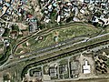
 Kasamatsu Racecourse Aerial photograph.1987.jpg 3,060 × 2,211; 6.61 MB
-
 Kinka zan.jpg 3,072 × 2,304; 2.77 MB
-
 Kotozuka-Kofun CCB1987-1C7B19.jpg 457 × 545; 49 KB
-
 Kurono Castle CCB1987-1C4B11.jpg 853 × 601; 112 KB
-
 Lake Green Golf Club, Mitake Gifu Aerial photograph.2018.jpg 5,774 × 3,849; 7.19 MB
-
 Matsunami General Hospital.jpg 3,992 × 2,242; 7.69 MB
-
 Mino city center area Aerial photograph.1982.jpg 4,109 × 5,335; 15.99 MB
-
 Mino-Kokubunji CCB1987-1C9A2.jpg 663 × 871; 84 KB
-
 Minokamo city center area Aerial photograph.1987.jpg 8,902 × 3,305; 22.93 MB
-
 Mizunami city center area Aerial photograph.1987.jpg 5,423 × 6,122; 24.74 MB
-
 Mount Kinshō-Aerial photography 45,64,82,06.gif 1,028 × 1,411; 3.65 MB
-
 Nagaragawa Country Club, Gifu Aerial photograph.2008.jpg 2,132 × 1,599; 1.52 MB
-
 Nagoya Castle aerial photo.jpg 3,078 × 3,322; 10 MB
-
 Nakatsugawa city center area Aerial photograph.1976.jpg 4,108 × 3,523; 10.89 MB
-
 NakatsugawaCity.jpg 2,816 × 2,112; 1.95 MB
-
 Nihon Rhine Golf Club, Kani Gifu Aerial photograph.2000.jpg 1,158 × 1,572; 636 KB
-
 No kofun Group CCB1987-1C2A9.jpg 838 × 903; 132 KB
-
 Ogaki city center area Aerial photograph.1987.jpg 9,076 × 5,953; 39.24 MB
-
 Ogase-IKE CCB1987-1C7B28.jpg 1,460 × 2,245; 592 KB
-
 Oshirakawa Dam lake survey 1977.jpg 2,138 × 1,601; 788 KB
-
 Seki city center area Aerial photograph.1987.jpg 7,403 × 3,320; 18.64 MB
-
 Senbon-Matsubara Kaizu, Gifu Aerial photograph.2009.jpg 5,993 × 6,780; 8.46 MB
-
 Shinhotaka Ropeway pathway Aerial photograph.1977.jpg 3,322 × 3,293; 7.13 MB
-
 Spring Field Golf Club, Tajimi Gifu Aerial photograph.1987.jpg 2,303 × 1,728; 1.29 MB
-
 Suzuran Resort Golf Club, Takayama Gif Aerial photograph.1977.jpg 1,517 × 1,139; 794 KB
-
 Tajimi city center area Aerial photograph.1987.jpg 6,128 × 4,626; 20.66 MB
-
 Takayama city center area Aerial photograph.1977.jpg 4,255 × 5,011; 15.54 MB
-
 Takayama.JPG 1,600 × 1,200; 506 KB
-
 Tanigumi Country Club, Ibigawa Gifu Aerial photograph.1991.jpg 1,602 × 1,202; 789 KB
-
 Token Shuga Country Club, Kani Gifu Aerial photograph.2000.jpg 1,402 × 1,052; 555 KB
-
 Toki city center area Aerial photograph.1987.jpg 7,055 × 5,640; 32.17 MB
-
 Tsukechi, Nakatsugawa 10-Aug-2019.jpg 4,494 × 3,287; 2.78 MB
-
 Wasabo tailings dam.jpg 1,257 × 1,674; 506 KB
-
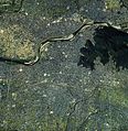
 木曽川とライン大橋.jpg 590 × 594; 143 KB
-
 松波総合病院 外観1.jpg 6,000 × 4,000; 18.09 MB
-
 松波総合病院.jpg 4,288 × 2,848; 8.48 MB
-
 立体視画像 馬籠宿周辺.jpg 1,255 × 1,050; 582 KB


