Category:Aerial photographs of Gunma prefecture
Jump to navigation
Jump to search

Media in category "Aerial photographs of Gunma prefecture"
The following 46 files are in this category, out of 46 total.
-
 Aerial photograph of Ogo Castle.png 1,500 × 1,127; 2.57 MB
-
 Agatsuma Gorge Aerial photograph.jpg 4,592 × 3,448; 9.26 MB
-

-
 Annaka banner.jpg 7,307 × 1,021; 6.22 MB
-
 Annaka city center area Aerial photograph.1975.jpg 7,307 × 3,375; 21.79 MB
-
 Central Hashiemachi Isesaki City 1986.jpg 3,349 × 3,437; 10.92 MB
-
 Central Imaizumicho Isesaki City 1986.jpg 3,173 × 3,339; 12.15 MB
-
 CKT20091-C1-7 Sakai Hirazuka, Isesaki - Tokugawa, Ota.jpg 1,828 × 1,028; 358 KB
-
 Fujioka city center area Aerial photograph.1986.jpg 4,973 × 5,549; 25.38 MB
-
 Fujioka city center area Aerial photograph.2020.jpg 11,163 × 10,056; 88.69 MB
-
 FujiTonegawa.jpg 1,280 × 960; 248 KB
-
 Isesaki city center area Aerial photograph.1986.jpg 8,290 × 5,892; 38.77 MB
-
 Isesaki Kezoji Athletic Stadium.jpg 1,879 × 1,010; 875 KB
-
 Itakura Golf Course, Itakura Gunma Aerial photograph.2009.jpg 3,330 × 2,497; 2.28 MB
-
 Kanra Country Club, Kanra Gunma Aerial photograph.1975.jpg 2,240 × 1,679; 1.04 MB
-
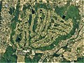 Kanra Country Club, Kanra Gunma Aerial photograph.2015.jpg 1,330 × 997; 513 KB
-
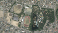 Kezoji Athletic Stadium.png 1,012 × 570; 1.28 MB
-
 Kiryu city center area Aerial photograph.1986.jpg 8,783 × 7,430; 53.92 MB
-
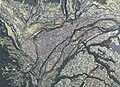
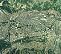
 Lake Nozori Aerial photograph.1977.jpg 4,076 × 3,058; 4.07 MB
-
 Maebashi Castle air.jpg 2,000 × 2,158; 986 KB
-
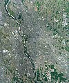
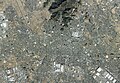
 Maebashi city center area Aerial photograph.1986.jpg 8,732 × 7,867; 61.79 MB
-
 Maebashi city center area Aerial photograph.2020.jpg 12,531 × 14,999; 191.46 MB
-
 Myosanji-Numa water reservoir Aerial photograph.1986.jpg 1,066 × 771; 385 KB
-
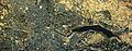
 Nanakoshiyama kohun aerial.jpg 480 × 440; 40 KB
-
 Northern Country Club Akagi Golf course, Shibukawa Gunma Aerial photograph.2019.jpg 2,382 × 1,787; 1.74 MB
-
 NozoriKo.jpg 1,280 × 960; 184 KB
-
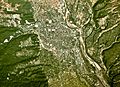
 Numata city center area Aerial photograph.1975.jpg 4,333 × 3,749; 15.5 MB
-
 Numata city center area Aerial photograph.2019.jpg 8,752 × 6,357; 42.07 MB
-
 Onishi privately owned runwey Aerial photograph.1986.jpg 2,431 × 1,761; 3.45 MB
-
 Ota, Gunma city center area Aerial photograph.1986.jpg 7,068 × 5,922; 34.53 MB
-
 Ota, Gunma city center area Aerial photograph.2023.jpg 13,374 × 9,301; 94.69 MB
-
 Raysum Golf & Spa Resort, Annaka Gunma Aerial photograph.1996.jpg 1,242 × 932; 560 KB
-
 Rose Bay Country Club, Annaka Gunma Aerial photograph.1975.jpg 2,902 × 2,176; 2.43 MB
-
 Shibukawa city center area Aerial photograph.1975.jpg 4,382 × 3,173; 11.6 MB
-
 Shimonita town center area Aerial photograph.1975.jpg 4,456 × 3,382; 10.76 MB
-
 Takasaki Castle air.jpg 1,400 × 1,632; 438 KB
-
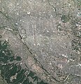
 Takasaki city center area Aerial photograph.1986.jpg 9,439 × 5,587; 43.38 MB
-
 Takasaki city center area Aerial photograph.2010.jpg 10,634 × 11,020; 83.84 MB
-
 Takasaki city center area Aerial photograph.2020.jpg 13,353 × 14,999; 200.23 MB
-
 Takasaki Racecourse Aerial photograph.1986.jpg 3,119 × 2,255; 7.1 MB
-
 Tatebayashi city center area Aerial photograph.1986.jpg 8,571 × 3,358; 21.18 MB
-
 TB-Higashi Koizumi Station Aerial photography 48,60,75,80,10.gif 1,189 × 476; 1.88 MB
-
 Tomioka, Gunma city center area Aerial photograph.1975.jpg 6,851 × 3,118; 19.52 MB
-
 Tomioka, Gunma city center area Aerial photograph.2017.jpg 13,126 × 11,744; 122.38 MB
-
 WataraseYusuichi.jpg 2,816 × 2,112; 1.46 MB
-
 Yagisawa Dam Lake Aerial photograph.1976.jpg 6,009 × 4,957; 27.89 MB


