Category:20th-century maps of Poland
Jump to navigation
Jump to search
Countries of Europe: Albania · Armenia‡ · Austria · Azerbaijan‡ · Belarus · Belgium · Bosnia and Herzegovina · Bulgaria · Croatia · Cyprus‡ · Czech Republic · Denmark · Estonia · Finland · France‡ · Georgia‡ · Germany · Greece · Hungary · Iceland · Republic of Ireland · Italy · Kazakhstan‡ · Latvia · Lithuania · Luxembourg · Moldova · Montenegro · Netherlands‡ · North Macedonia · Norway · Poland · Portugal‡ · Romania · Russia‡ · Serbia · Slovakia · Slovenia · Spain‡ · Sweden · Switzerland · Turkey‡ · Ukraine · United Kingdom
Specific status: Gibraltar · Isle of Man – Limited recognition: Abkhazia‡
‡: partly located in Europe
Specific status: Gibraltar · Isle of Man – Limited recognition: Abkhazia‡
‡: partly located in Europe
Subcategories
This category has the following 10 subcategories, out of 10 total.
*
- 20th-century maps of Silesia (23 F)
Media in category "20th-century maps of Poland"
The following 4 files are in this category, out of 4 total.
-
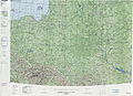 Operational Navigation Chart E-3, 6th edition.jpg 9,254 × 6,671; 20.94 MB
-
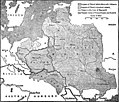 Kingdom of Poland.jpg 1,757 × 1,499; 494 KB
-
 Plan Nowego Obozu Hopehill.png 1,200 × 900; 115 KB
-
 Kopia dokumentu traktatu pokojowego z dnia 7 maja 1919 (68904954).jpg 12,771 × 17,879; 29.51 MB


.jpg)