Category:20th-century maps of Georgia
Jump to navigation
Jump to search
Countries of Europe: Albania · Armenia‡ · Austria · Azerbaijan‡ · Belarus · Belgium · Bosnia and Herzegovina · Bulgaria · Croatia · Cyprus‡ · Czech Republic · Denmark · Estonia · Finland · France‡ · Georgia‡ · Germany · Greece · Hungary · Iceland · Republic of Ireland · Italy · Kazakhstan‡ · Latvia · Lithuania · Luxembourg · Moldova · Montenegro · Netherlands‡ · North Macedonia · Norway · Poland · Portugal‡ · Romania · Russia‡ · Serbia · Slovakia · Slovenia · Spain‡ · Sweden · Switzerland · Turkey‡ · Ukraine · United Kingdom
Specific status: Gibraltar · Isle of Man – Limited recognition: Abkhazia‡
‡: partly located in Europe
Specific status: Gibraltar · Isle of Man – Limited recognition: Abkhazia‡
‡: partly located in Europe
Countries of Asia: Afghanistan · Armenia‡ · Azerbaijan‡ · Bangladesh · Cambodia · People's Republic of China · Cyprus‡ · Egypt‡ · Georgia‡ · India · Indonesia‡ · Iran · Iraq · Israel · Japan · Jordan · Kazakhstan‡ · Kyrgyzstan · Laos · Lebanon · Malaysia · Mongolia · Myanmar · Nepal · North Korea · Oman · Pakistan · Philippines · Russia‡ · Saudi Arabia · Singapore · South Korea · Sri Lanka · Syria · Tajikistan · Thailand · Turkey‡ · Turkmenistan · United Arab Emirates · Uzbekistan · Vietnam · Yemen
Limited recognition: Abkhazia‡ · Taiwan · State of Palestine
‡: partly located in Asia
Limited recognition: Abkhazia‡ · Taiwan · State of Palestine
‡: partly located in Asia
Subcategories
This category has the following 7 subcategories, out of 7 total.
-
Media in category "20th-century maps of Georgia"
The following 12 files are in this category, out of 12 total.
-
 Georgia Javaxisvili.jpg 7,370 × 3,967; 15.57 MB
-
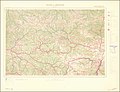
 1940 German military map - Batum und Umgebung - Sheet 1.jpg 15,105 × 12,986; 39.56 MB
-
 1940 German military map - Batum und Umgebung - Sheet 2.jpg 18,528 × 14,254; 49.56 MB
-
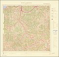 1940 German military map - Batum und Umgebung - Sheet 3.jpg 15,197 × 14,616; 47.91 MB
-
 1940 German military map - Batum und Umgebung - Sheet 4.jpg 18,561 × 14,428; 54.77 MB
-
 Gardiner814 (A).JPG 523 × 426; 88 KB
-
 Gruzinskaja SSR (1944-1955).jpg 999 × 578; 331 KB
-
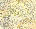
 Khanates.jpg 2,271 × 1,661; 3.26 MB
-
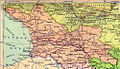
 Map of Georgia (Kvariani).jpg 3,292 × 1,847; 1.84 MB
-
 Shepherd-c-020 cropped Armenia.jpg 451 × 423; 90 KB
-
 TreatyofKarsMap-es.svg 872 × 731; 323 KB
-
 USSR map Europe Caucasus.jpg 973 × 681; 153 KB


.JPG)
.jpg)

.jpg)


