Category:20th-century maps of Montenegro
Jump to navigation
Jump to search
Countries of Europe: Albania · Armenia‡ · Austria · Azerbaijan‡ · Belarus · Belgium · Bosnia and Herzegovina · Bulgaria · Croatia · Cyprus‡ · Czech Republic · Denmark · Estonia · Finland · France‡ · Georgia‡ · Germany · Greece · Hungary · Iceland · Republic of Ireland · Italy · Kazakhstan‡ · Latvia · Lithuania · Luxembourg · Moldova · Montenegro · Netherlands‡ · North Macedonia · Norway · Poland · Portugal‡ · Romania · Russia‡ · Serbia · Slovakia · Slovenia · Spain‡ · Sweden · Switzerland · Turkey‡ · Ukraine · United Kingdom
Specific status: Gibraltar · Isle of Man – Limited recognition: Abkhazia‡
‡: partly located in Europe
Specific status: Gibraltar · Isle of Man – Limited recognition: Abkhazia‡
‡: partly located in Europe
Media in category "20th-century maps of Montenegro"
The following 10 files are in this category, out of 10 total.
-
 Plevlje - 37-43.jpg 3,685 × 4,988; 3.45 MB
-
 Kassner Das Regenreichste Gebiet Europas 1904.jpg 2,059 × 2,714; 1.56 MB
-
 1914 - General-Karte von Dalmatien, Bosnien und der Hercegovina.jpg 10,664 × 8,568; 18.57 MB
-
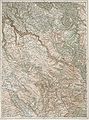
 Montenegro BV042770384.jpg 3,747 × 2,598; 2.01 MB
-
 Walnys Verkehrskarte von Bosnien-Hercegovina und den angrenzenden Ländern.jpg 9,484 × 6,663; 12.41 MB
-

-
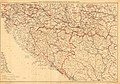
 Montenegro BV042528146.jpg 2,141 × 1,640; 1.05 MB
-
 Central balkan pol98.jpg 1,114 × 1,396; 282 KB
-
 Cvijic Boka 1909.gif 537 × 548; 171 KB
-
 EB1911 Montenegro.jpg 842 × 1,090; 644 KB


