Category:1920s maps of Poland
Jump to navigation
Jump to search
Countries of Europe: Albania · Armenia‡ · Austria · Azerbaijan‡ · Belarus · Belgium · Bosnia and Herzegovina · Bulgaria · Croatia · Czech Republic · Denmark · Estonia · Finland · France‡ · Georgia‡ · Germany · Greece · Hungary · Iceland · Republic of Ireland · Italy · Latvia · Lithuania · Luxembourg · Montenegro · Netherlands‡ · Norway · Poland · Portugal‡ · Romania · Russia‡ · Serbia · Slovenia · Spain‡ · Sweden · Switzerland · Turkey‡ · Ukraine · United Kingdom
‡: partly located in Europe
‡: partly located in Europe
Subcategories
This category has the following 3 subcategories, out of 3 total.
- 1920 maps of Poland (2 F)
- 1923 maps of Poland (2 F)
- 1929 maps of Poland (3 F)
Media in category "1920s maps of Poland"
The following 15 files are in this category, out of 15 total.
-
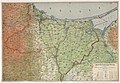
 Polen BV042612906.jpg 10,951 × 15,846; 20.46 MB
-
 Polesie 1920.jpg 1,433 × 879; 332 KB
-
 Polen BV042517568.jpg 10,247 × 16,413; 10.53 MB
-
 Polen BV042517611.jpg 11,245 × 16,480; 12.76 MB
-
 Karte der freien Stadt Danzig (2. Auflage) - Bearbeitet von R. Manteau - btv1b53063326r (1 of 2).jpg 10,928 × 7,568; 16.42 MB
-
 Województwo śląskie.png 974 × 2,317; 4.34 MB
-
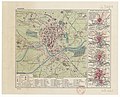 Kraków - btv1b84587025 (1 of 2).jpg 6,189 × 5,027; 4.74 MB
-
 Слобідка 1924.png 861 × 487; 801 KB
-
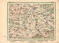 1925 Busk Krasne.jpg 5,540 × 4,037; 3.41 MB
-
 Nad Niemnem mapa.jpg 1,175 × 991; 488 KB
-

-
 Mapa Polska. Jagielnica. 1923.jpg 4,681 × 3,922; 3.35 MB
-
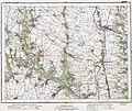
 Mapa z miejscowością Łancew Ług.jpg 6,152 × 5,318; 6.88 MB
-
 Marianów na mapie z 1925r.png 880 × 892; 882 KB
-
 Polen BV042551878.jpg 15,857 × 10,664; 26.17 MB


_-_Bearbeitet_von_R._Manteau_-_btv1b53063326r_(1_of_2).jpg)

.jpg)


_(14759287716).jpg)


