Category:18th-century maps of Georgia
Jump to navigation
Jump to search
Countries of Europe: Albania · Armenia‡ · Austria · Azerbaijan‡ · Belarus · Belgium · Bosnia and Herzegovina · Bulgaria · Croatia · Cyprus‡ · Czech Republic · Denmark · Estonia · Finland · France‡ · Georgia‡ · Germany · Greece · Hungary · Iceland · Republic of Ireland · Italy · Latvia · Lithuania · Luxembourg · Malta · Moldova · Montenegro · Netherlands‡ · Norway · Poland · Portugal‡ · Romania · Russia‡ · Serbia · Slovakia · Slovenia · Spain‡ · Sweden · Switzerland · Republic of Türkiye‡ · Ukraine · United Kingdom
Specific status: Isle of Man – Limited recognition: Abkhazia‡
‡: partly located in Europe
Specific status: Isle of Man – Limited recognition: Abkhazia‡
‡: partly located in Europe
Countries of Asia: Afghanistan · Armenia‡ · Azerbaijan‡ · Bangladesh · Cambodia · People's Republic of China · Cyprus‡ · Egypt‡ · Georgia‡ · India · Indonesia‡ · Iran · Iraq · Japan · Jordan · Lebanon · Malaysia · Mongolia · Myanmar · Pakistan · Philippines · Russia‡ · Singapore · Sri Lanka · Syria · Thailand · Republic of Türkiye‡ · Turkmenistan · Uzbekistan · Vietnam · Yemen
Limited recognition: Abkhazia‡ · Taiwan · State of Palestine
‡: partly located in Asia
Limited recognition: Abkhazia‡ · Taiwan · State of Palestine
‡: partly located in Asia
Subcategories
This category has the following 11 subcategories, out of 11 total.
- 1700s maps of Georgia (2 F)
-
Media in category "18th-century maps of Georgia"
The following 13 files are in this category, out of 13 total.
-
 D'Anville. Carte huilée de la Géorgie et de l'Arménie.XVIIIe siècle.A.jpg 7,353 × 5,611; 3.19 MB
-
 D'Anville. Carte huilée de la Géorgie et de l'Arménie.XVIIIe siècle.B.jpg 7,353 × 5,611; 4.41 MB
-
 D'Anville. Carte huilée de la Géorgie et de l'Arménie.XVIIIe siècle.C.jpg 5,902 × 3,255; 1.27 MB
-
 D'Anville. Carte huilée de la Géorgie et de l'Arménie.XVIIIe siècle.D.jpg 1,649 × 1,189; 394 KB
-
 D'Anville. Carte huilée de la Géorgie et de l'Arménie.XVIIIe siècle.jpg 5,440 × 4,012; 2.99 MB
-
 Kobuleti sea port in 1723.jpg 800 × 464; 410 KB
-

-

-

-
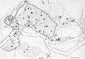 Plan of Tbilisi. 18th century.jpg 566 × 393; 57 KB
-
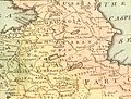 Safavid Persian Empire cropped - Caucasus.jpg 396 × 301; 59 KB
-

-


.E.jpg)
.EA.jpg)
.EB.jpg)


.jpg)
.jpg)