Commons:Wiki Loves Monuments in Switzerland/Aargau/L-N
Jump to navigation
Jump to search
Laufenburg
Leibstadt
| Location | Upload | Photo | Object | Cat. | Coordinates | KGS-Nr | |
|---|---|---|---|---|---|---|---|
| Leibstadt | 
|
Bernau, Loretokapelle | B | 47°35′45″N 8°10′21″E / 47.59596°N 8.17244°E | 154 | ||
| Leibstadt | 
|
Markus Schraner Haus (sog. Kappelerhaus) | B | 47°34′56″N 8°10′33″E / 47.58235°N 8.17585°E | 15517 | ||
Leimbach
| Location | Upload | Photo | Object | Cat. | Coordinates | KGS-Nr | |
|---|---|---|---|---|---|---|---|
| Leimbach | 
|
Strohdachhaus | A | 47°16′36″N 8°10′25″E / 47.2766031°N 8.173609232°E | 155 | ||
Lengnau
| Location | Upload | Photo | Object | Cat. | Coordinates | KGS-Nr | |
|---|---|---|---|---|---|---|---|
| Lengnau | 
|
Gasthaus Zum weissen Rössli | B | 47°31′26″N 8°19′29″E / 47.52385°N 8.32464°E | 15520 | ||
| Lengnau | 
|
Jüdisches Badehaus | B | 47°31′18″N 8°19′51″E / 47.521686°N 8.330866°E | 15521 | ||
| Lengnau | 
|
Kapelle St. Fridolin | B | 47°32′26″N 8°19′17″E / 47.54051°N 8.32149°E | 15518 | ||
| Lengnau | 
|
Römisch-katholische Pfarrkirche | B | 47°31′12″N 8°19′45″E / 47.51996°N 8.32921°E | 15519 | ||
| Lengnau | 
|
Husen | ISOS | 47°30′39″N 8°20′21″E / 47.5107°N 8.3391°E | |||
| Lengnau | 
|
Husen | ISOS | 47°30′39″N 8°20′21″E / 47.5107°N 8.3391°E | |||
| Lengnau | 
|
Vogelsang | ISOS | 47°32′12″N 8°20′31″E / 47.5368°N 8.342°E | |||
| Lengnau | 
|
Vogelsang | ISOS | 47°32′12″N 8°20′31″E / 47.5368°N 8.342°E | |||
| Lengnau | 
|
Synagoge | A | 47°31′15″N 8°19′50″E / 47.52096371°N 8.330594483°E | 156 | ||
| Lengnau | 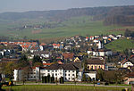
|
Lengnau | ISOS | 47°31′20″N 8°19′50″E / 47.522222222°N 8.330555555°E | |||
Lenzburg
Leuggern
| Location | Upload | Photo | Object | Cat. | Coordinates | KGS-Nr | |
|---|---|---|---|---|---|---|---|
| Leuggern | 
|
Hettenschwil | ISOS | 47°34′35″N 8°11′57″E / 47.5765°N 8.19919°E | |||
| Leuggern | 
|
Eisenbahnviadukt Koblenz-Felsenau | A | 47°35′52″N 8°13′16″E / 47.59763897°N 8.221053146°E | 10514 | ||
| Leuggern | 
|
Eisenbahnviadukt Koblenz-Felsenau | A | 47°35′52″N 8°13′16″E / 47.59763897°N 8.221053146°E | 9875 | ||
| Leuggern | 
|
Im Sand-Felsenau, Teil der spätrömischen Rheinbefestigung | A | 47°36′39″N 8°13′17″E / 47.61079456°N 8.221446455°E | 11675 | ||
| Leuggern | 
|
Kapelle in Gippingen | B | 47°35′20″N 8°13′25″E / 47.588784466°N 8.223740853°E | 15556 | ||
| Leuggern | 
|
Katholische Kirche St. Peter und Paul | B | 47°34′48″N 8°13′02″E / 47.57997°N 8.2173°E | 166 | ||
| Leuggern | 
|
Sebastians- und Rochuskapelle | B | 47°34′39″N 8°11′57″E / 47.577381809°N 8.199194671°E | 15555 | ||
Leutwil
| Location | Upload | Photo | Object | Cat. | Coordinates | KGS-Nr | |
|---|---|---|---|---|---|---|---|
| Leutwil | 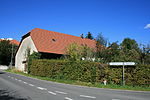
|
Bauernhaus Baumann | A | 47°18′40″N 8°10′23″E / 47.31119184°N 8.173080259°E | 9876 | ||
Magden
| Location | Upload | Photo | Object | Cat. | Coordinates | KGS-Nr | |
|---|---|---|---|---|---|---|---|
| Magden | 
|
Strick, paläolithische/neolithische Siedlungen | A | 47°32′01″N 7°49′35″E / 47.53373103°N 7.826414991°E | 9539 | ||
| Magden | 
|
Christkatholische Kirche | B | 47°31′51″N 7°48′39″E / 47.53094°N 7.81093°E | 167 | ||
| Magden | 
|
Christkatholisches Pfarrhaus | B | 47°31′52″N 7°48′38″E / 47.5311°N 7.8106°E | 15560 | ||
| Magden | 
|
Pächterhaus | B | 47°30′37″N 7°49′24″E / 47.51034°N 7.82346°E | 15562 | ||
| Magden | 
|
Pfarrscheune | B | 47°31′52″N 7°48′39″E / 47.53115°N 7.81085°E | 15561 | ||
| Magden | 
|
St. Nikolauskapelle | B | 47°30′37″N 7°49′20″E / 47.51017°N 7.82209°E | 15564 | ||
| Magden | 
|
Wohnhaus | B | 47°31′29″N 7°48′51″E / 47.52479°N 7.81414°E | 15563 | ||
Mägenwil
| Location | Upload | Photo | Object | Cat. | Coordinates | KGS-Nr | |
|---|---|---|---|---|---|---|---|
| Mägenwil | 
|
Loretokapelle | B | 47°24′36″N 8°13′43″E / 47.410033°N 8.228524°E | 15558 | ||
Mandach
| Location | Upload | Photo | Object | Cat. | Coordinates | KGS-Nr | |
|---|---|---|---|---|---|---|---|
| Mandach | 
|
Mandach | ISOS | 47°32′54″N 8°11′09″E / 47.548333333°N 8.185833333°E | |||
Meisterschwanden
| Location | Upload | Photo | Object | Cat. | Coordinates | KGS-Nr | |
|---|---|---|---|---|---|---|---|
| Meisterschwanden | 
|
Reformierte Kirche Meisterschwanden | B | 47°17′42″N 8°14′05″E / 47.295094444°N 8.234619444°E | 168 | ||
| Meisterschwanden | 
|
Villa Fischer | A | 47°17′40″N 8°13′53″E / 47.29441722°N 8.231392939°E | 169 | ||
| Meisterschwanden | 
|
Hallwilgedenkstein | B | 47°18′22″N 8°13′57″E / 47.306027°N 8.23246°E | 15567 | ||
| Meisterschwanden | 
|
Sog. Statthalterhaus | B | 47°18′25″N 8°13′15″E / 47.30706°N 8.22096°E | 15570 | ||
| Meisterschwanden | 
|
Wohnhaus zur Friedau, mit Schopf | B | 47°17′41″N 8°13′41″E / 47.294804°N 8.228022°E | 15566 | ||
| Meisterschwanden | 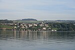
|
Meisterschwanden | ISOS | 47°17′46″N 8°13′49″E / 47.296111111°N 8.230277777°E | |||
Mellikon
| Location | Upload | Photo | Object | Cat. | Coordinates | KGS-Nr | |
|---|---|---|---|---|---|---|---|
| Mellikon | 
|
Schlosskapelle | B | 47°34′00″N 8°21′09″E / 47.566613773°N 8.352518748°E | 15571 | ||
| Mellikon | 
|
Wohnhaus Dorfstrasse 29 | B | 47°34′00″N 8°21′09″E / 47.566784224°N 8.352574843°E | 15572 | ||
Mellingen
| Location | Upload | Photo | Object | Cat. | Coordinates | KGS-Nr | |
|---|---|---|---|---|---|---|---|
| Mellingen | 
|
Iberghof | A | 47°25′04″N 8°16′30″E / 47.41767959°N 8.27512912°E | 175 | ||
| Mellingen | 
|
Stadtkirche Mellingen | B | 258°00′00″N 8°16′29″E / 47418°N 8.27461°E | 174 | ||
| Mellingen | 
|
Stadtarchiv im Rathaus | B | 47°25′06″N 8°16′28″E / 47.4183°N 8.2744°E | 176 | ||
| Mellingen | 
|
Altes Rathaus | B | 47°25′07″N 8°16′26″E / 47.418745°N 8.273762°E | 170 | ||
| Mellingen | 
|
Gemeindescheune | B | 47°25′07″N 8°16′21″E / 47.41853°N 8.272436°E | 15574 | ||
| Mellingen | 
|
Muttergottesstatue am Haus «Zum scharfen Eck« | B | 47°25′07″N 8°16′25″E / 47.41863°N 8.27358°E | 15573 | ||
| Mellingen | 
|
Spittelscheune | B | 47°25′05″N 8°16′29″E / 47.41811°N 8.27486°E | 15575 | ||
| Mellingen | 
|
St. Antoniuskapelle | B | 47°24′55″N 8°16′19″E / 47.415266°N 8.271807°E | 15576 | ||
| Mellingen | 
|
Mellingen | ISOS | 47°25′09″N 8°16′35″E / 47.419166666°N 8.276388888°E | |||
Menziken
| Location | Upload | Photo | Object | Cat. | Coordinates | KGS-Nr | |
|---|---|---|---|---|---|---|---|
| Menziken | 
|
Villa Mathys | A | 47°14′09″N 8°11′36″E / 47.23581749°N 8.193452822°E | 180 | ||
| Menziken | 
|
Alte Säge | B | 47°14′26″N 8°11′14″E / 47.24061°N 8.18733°E | 15577 | ||
| Menziken | 
|
Villa (Haus «Zur Eintracht«) | B | 47°14′12″N 8°11′35″E / 47.23668°N 8.19303°E | 179 | ||
| Menziken | 
|
Villa Concordia | B | 47°14′13″N 8°11′34″E / 47.23688°N 8.19264°E | 178 | ||
Merenschwand
| Location | Upload | Photo | Object | Cat. | Coordinates | KGS-Nr | |
|---|---|---|---|---|---|---|---|
| Merenschwand | 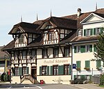
|
Gasthof «Zum Schwanen» | A | 47°15′36″N 8°22′27″E / 47.25992093°N 8.374253574°E | 181 | ||
| Merenschwand | 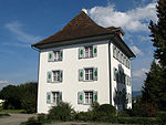
|
Kaplanei | B | 47°15′37″N 8°22′32″E / 47.2604°N 8.37542°E | 15582 | ||
| Merenschwand | 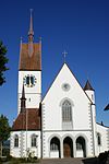
|
Katholische Pfarrkirche | A | 47°15′37″N 8°22′32″E / 47.26018002°N 8.375579414°E | 182 | ||
| Merenschwand | 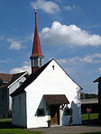
|
Wendelinskapelle (Merenschwand) | B | 47°14′59″N 8°24′11″E / 47.2498°N 8.40305°E | 15584 | ||
| Merenschwand | 
|
Baptist-Fischer-Haus | B | 47°15′28″N 8°22′29″E / 47.257905123°N 8.37478301°E | 15579 | ||
| Merenschwand | 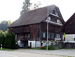
|
Bauernhaus | B | 47°16′21″N 8°21′49″E / 47.27263°N 8.36351°E | 15581 | ||
| Merenschwand | 
|
Dorfbrunnen | B | 47°15′35″N 8°22′30″E / 47.259603689°N 8.374971334°E | 15580 | ||
| Merenschwand | 
|
Spittel | B | 47°15′39″N 8°22′29″E / 47.260722158°N 8.374594539°E | 15578 | ||
| Merenschwand | 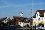
|
Merenschwand | ISOS | 47°15′44″N 8°22′39″E / 47.262222222°N 8.3775°E | |||
Mettauertal
| Location | Upload | Photo | Object | Cat. | Coordinates | KGS-Nr | |
|---|---|---|---|---|---|---|---|
| Mettauertal | 
|
Ehemalige Untervogtei mit Nebenbauten | A | 47°32′50″N 8°09′38″E / 47.54731348°N 8.160574192°E | 123 | ||
| Mettauertal | 
|
Katholische Pfarrkirche | A | 47°33′51″N 8°07′34″E / 47.56426971°N 8.126148829°E | 184 | ||
Möhlin
| Location | Upload | Photo | Object | Cat. | Coordinates | KGS-Nr | |
|---|---|---|---|---|---|---|---|
| Möhlin | 
|
Rappertshäusern | B | 47°35′13″N 7°52′30″E / 47.587072222°N 7.875047222°E | 15591 | ||
| Möhlin | 
|
Fahrgraben, Teil der spätrömischen Rheinbefestigung | A | 47°35′15″N 7°52′24″E / 47.58752767°N 7.873335362°E | 11752 | ||
| Möhlin | 
|
Riburg «Bürkli», Teil der spätrömischen Rheinbefestigung und frühmittelalterliche Befestigung | A | 47°34′51″N 7°50′19″E / 47.580727°N 7.838720661°E | 185 | ||
| Möhlin | 
|
Untere Wehren, Teil der spätrömischen Rheinbefestigung | A | 47°35′12″N 7°53′30″E / 47.58655841°N 7.891605908°E | 11753 | ||
| Möhlin | 
|
St. Leodegar | B | 47°33′29″N 7°50′26″E / 47.55814°N 7.84054°E | 186 | ||
| Möhlin | 
|
Landhaus Joh. Uirban Kym | B | 47°33′07″N 7°51′13″E / 47.55186°N 7.85366°E | 15586 | ||
| Möhlin | 
|
Ökonomiegebäude der ehemalige Untere Mühle | B | 47°33′20″N 7°50′54″E / 47.55561°N 7.84847°E | 187 | ||
| Möhlin | 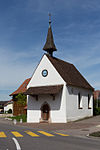
|
St. Fridolinskapelle | B | 47°34′04″N 7°50′24″E / 47.56768°N 7.83989°E | 15588 | ||
| Möhlin | 
|
St. Wendelinskapelle | B | 47°33′12″N 7°51′12″E / 47.55343°N 7.85337°E | 15587 | ||
| Möhlin | 
|
Untere Mühle | B | 47°33′21″N 7°50′53″E / 47.55586°N 7.84819°E | 15585 | ||
| Möhlin | 
|
Wohlfahrtsgebäude | B | 54°00′00″N 7°50′41″E / 47574°N 7.84485°E | 15593 | ||
| Möhlin | 
|
Bata Areal | A | 47°34′12″N 7°50′24″E / 47.56989418°N 7.839968046°E | 9877 | ||
Mönthal
| Location | Upload | Photo | Object | Cat. | Coordinates | KGS-Nr | |
|---|---|---|---|---|---|---|---|
| Mönthal | 
|
Evangelisch-reformierte Pfarrkirche | B | 47°31′04″N 8°08′36″E / 47.51786°N 8.14329°E | 15594 | ||
Möriken-Wildegg
| Location | Upload | Photo | Object | Cat. | Coordinates | KGS-Nr | |
|---|---|---|---|---|---|---|---|
| Möriken-Wildegg | 
|
Schloss Wildegg | A | 47°25′14″N 8°10′13″E / 47.42068349°N 8.170375141°E | 189 | ||
| Möriken-Wildegg | 
|
Gasthof Bären | A | 47°25′04″N 8°10′04″E / 47.41773221°N 8.167697525°E | 9878 | ||
| Möriken-Wildegg | 
|
Katholische Kirche St. Antonius | A | 47°24′57″N 8°10′16″E / 47.41582183°N 8.171103462°E | 9732 | ||
| Möriken-Wildegg | 
|
Kestenberg, bronzezeitliche Höhensiedlung | A | 47°25′27″N 8°12′04″E / 47.42411896°N 8.201077281°E | 188 | ||
| Möriken-Wildegg | 
|
Schloss Wildegg (Bestandteil der Schweizerischen Landesmuseen) | A | 47°25′14″N 8°10′13″E / 47.42068349°N 8.170375141°E | 8605 | ||
| Möriken-Wildegg | 
|
Amslergut | B | 47°25′07″N 8°10′04″E / 47.41865°N 8.16786°E | 15596 | ||
| Möriken-Wildegg | 
|
Ehemalige Kattundruckerei | B | 47°24′58″N 8°10′09″E / 47.41624°N 8.1693°E | 15598 | ||
| Möriken-Wildegg | 
|
Haus Laué + Gartenpavillons | B | 47°25′02″N 8°10′05″E / 47.41709°N 8.16794°E | 15599 | ||
| Möriken-Wildegg | 
|
Hellmühle | B | 47°25′04″N 8°10′02″E / 47.41771°N 8.16724°E | 9879 | ||
| Möriken-Wildegg | 
|
Isler-Haus | B | 47°25′06″N 8°10′10″E / 47.41829°N 8.16934°E | 15600 | ||
| Möriken-Wildegg | 
|
Manufaktur Laué | B | 47°25′01″N 8°10′08″E / 47.4169°N 8.16895°E | 9880 | ||
| Möriken-Wildegg | 
|
Rilliet-Laué-Gut | B | 47°25′04″N 8°10′07″E / 47.41767°N 8.16859°E | 9881 | ||
| Möriken-Wildegg | 
|
Wildegg | ISOS | 47°25′07″N 8°10′13″E / 47.41865°N 8.17015°E | |||
| Möriken-Wildegg | 
|
Wildegg | ISOS | 47°25′07″N 8°10′13″E / 47.41865°N 8.17015°E | |||
Muhen
| Location | Upload | Photo | Object | Cat. | Coordinates | KGS-Nr | |
|---|---|---|---|---|---|---|---|
| Muhen | 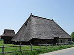
|
Strohdachhaus Muhen | B | 47°20′23″N 8°03′07″E / 47.33977°N 8.05202°E | 192 | ||
| Muhen | 
|
Bauernhaus Alte Strasse 30 | B | 47°19′35″N 8°03′05″E / 47.32646°N 8.051404°E | 15605 | ||
| Muhen | 
|
Einbogenbrücke | B | 47°19′43″N 8°03′19″E / 47.328617°N 8.055213°E | 15604 | ||
| Muhen | 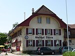
|
Gasthof «Bären« Untermuhen | B | 47°20′27″N 8°03′14″E / 47.34097°N 8.0538°E | 193 | ||
| Muhen | 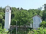
|
Reformierte Kirche (1960/61, Hans Hauri) | B | 47°20′07″N 8°03′20″E / 47.33535°N 8.0555°E | 15609 | ||
| Muhen | 
|
Sog. Schlössli | B | 47°20′26″N 8°03′00″E / 47.34058°N 8.050045°E | 15608 | ||
| Muhen | 
|
Speicher | B | 47°20′23″N 8°03′08″E / 47.33966°N 8.052244°E | 15606 | ||
| Muhen | 
|
Suhrgasse 58 | B | 47°20′35″N 8°03′20″E / 47.342988°N 8.055683°E | 15607 | ||
Mühlau
| Location | Upload | Photo | Object | Cat. | Coordinates | KGS-Nr | |
|---|---|---|---|---|---|---|---|
| Mühlau | 
|
Pfarrkirche St. Anna | B | 47°13′48″N 8°23′22″E / 47.22999°N 8.38955°E | 9882 | ||
| Mühlau | 
|
Dorfbrunnen | B | 47°13′47″N 8°23′21″E / 47.22972°N 8.38913°E | 15601 | ||
Mülligen
| Location | Upload | Photo | Object | Cat. | Coordinates | KGS-Nr | |
|---|---|---|---|---|---|---|---|
| Mülligen | 
|
Ehemalige Mühle | B | 47°27′33″N 8°14′24″E / 47.459073924°N 8.239981822°E | 15610 | ||
Mumpf
| Location | Upload | Photo | Object | Cat. | Coordinates | KGS-Nr | |
|---|---|---|---|---|---|---|---|
| Mumpf | 
|
Chapf, prähistorische Siedlung | A | 47°32′35″N 7°55′14″E / 47.5430909°N 7.920656608°E | 9562 | ||
| Mumpf | 
|
Gasthaus Anker, spätrömisches Kleinkastell, Teil der spätrömischen Rheinbefestigung | A | 47°32′49″N 7°54′58″E / 47.5468869°N 7.916174609°E | 9563 | ||
Murgenthal
| Location | Upload | Photo | Object | Cat. | Coordinates | KGS-Nr | |
|---|---|---|---|---|---|---|---|
| Murgenthal | 
|
Bauernhaus | B | 47°14′48″N 7°52′24″E / 47.246721°N 7.873446°E | 15613 | ||
| Murgenthal | 
|
Bauernhaus | B | 47°16′33″N 7°50′48″E / 47.27579°N 7.84676°E | 15615 | ||
| Murgenthal | 
|
Bauernhaus Gamper | B | 47°16′16″N 7°51′04″E / 47.271161°N 7.851152°E | 15614 | ||
| Murgenthal | 
|
Moosmatt | B | 47°16′35″N 7°50′43″E / 47.276254°N 7.84531°E | 15616 | ||
Muri
Neuenhof
| Location | Upload | Photo | Object | Cat. | Coordinates | KGS-Nr | |
|---|---|---|---|---|---|---|---|
| Neuenhof | 
|
Katholische Kirche St. Josef | B | 47°26′44″N 8°19′56″E / 47.445491°N 8.332127°E | 196 | ||
| Neuenhof | 
|
Speicher | B | 47°26′42″N 8°19′41″E / 47.445025°N 8.328157°E | 15625 | ||
| Neuenhof | 
|
Wohnhaus Zürcherstrasse Nr. 52 | B | 47°27′14″N 8°19′07″E / 47.453862°N 8.318489°E | 15623 | ||
| Neuenhof | 
|
Wohnhaus Zürcherstrasse Nr. 54 | B | 16084 | |||
| Neuenhof | 
|
Wohnhaus Zürcherstrasse Nr. 56 | B | 16085 | |||
| Neuenhof | 
|
Wohnhaus Zürcherstrasse Nr. 58 | B | 16086 | |||
| Neuenhof | 
|
Wohnhaus Zürcherstrasse Nr. 60 | B | 16087 | |||
| Neuenhof | 
|
Wohnhaus Zürcherstrasse Nr. 62 | B | 16088 | |||
| Neuenhof | 
|
Wohnhaus Zürcherstrasse Nr. 64 | B | 16089 | |||
| Neuenhof | 
|
Wohnhaus Zürcherstrasse Nr. 66 | B | 16090 | |||
| Neuenhof | 
|
Wohnhaus Zürcherstrasse Nr. 68 | B | 16091 | |||
| Neuenhof | 
|
Wohnhaus Zürcherstrasse Nr. 70 | B | 16092 | |||
| Neuenhof | 
|
Holzbrücke Wettingen-Neuenhof | B | 47°27′19″N 8°19′06″E / 47.455386°N 8.31826°E | 279 | ||
Niederlenz
| Location | Upload | Photo | Object | Cat. | Coordinates | KGS-Nr | |
|---|---|---|---|---|---|---|---|
| Niederlenz | 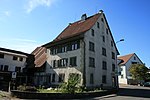
|
Ehemaliges Zehntenhaus Schloss Lenzburg | A | 47°24′06″N 8°10′31″E / 47.40175398°N 8.175401147°E | 9884 | ||
| Niederlenz | 
|
Ehemalige Untervogtei des Klosters Königsfelden | B | 47°24′02″N 8°10′36″E / 47.400645°N 8.176626°E | 15627 | ||
| Niederlenz | 
|
Ehemaliges Zehntenhaus des Klosters Königsfelden | B | 47°24′02″N 8°10′35″E / 47.400601°N 8.176334°E | 15628 | ||
| Niederlenz | 
|
Hetex Areal Fabrikanlage | B | 47°23′57″N 8°10′40″E / 47.399261°N 8.177826°E | 15626 | ||
Niederrohrdorf
| Location | Upload | Photo | Object | Cat. | Coordinates | KGS-Nr | |
|---|---|---|---|---|---|---|---|
| Niederrohrdorf | 
|
Römisch-katholische Pfarrkirche 1970 | B | 47°25′17″N 8°18′18″E / 47.421322°N 8.304963°E | 15630 | ||
Niederwil
| Location | Upload | Photo | Object | Cat. | Coordinates | KGS-Nr | |
|---|---|---|---|---|---|---|---|
| Niederwil | 
|
Katholische Pfarrkirche | B | 47°22′43″N 8°17′39″E / 47.37869°N 8.29422°E | 9885 | ||
| Niederwil | 
|
Ehemaliges Zisterzienserinnenkloster Gnadenthal | A | 47°23′37″N 8°18′10″E / 47.39359532°N 8.302766382°E | 197 | ||

