Category:Ehemalige Mühle (Mülligen)
Jump to navigation
Jump to search
| Object location | | View all coordinates using: OpenStreetMap |
|---|
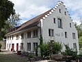
building in Mühlau in the canton of Aargau, Switzerland  | |||||
| Upload media | |||||
| Instance of |
| ||||
|---|---|---|---|---|---|
| Part of | |||||
| Location | Mülligen, Brugg District, Aargau, Switzerland | ||||
| Street address |
| ||||
| Architectural style |
| ||||
| Heritage designation | |||||
 | |||||
Media in category "Ehemalige Mühle (Mülligen)"
The following 7 files are in this category, out of 7 total.
-
 Müli Mülligen AG 02.jpg 2,592 × 1,944; 1.55 MB
-
 Müli Mülligen AG Mühlerad.jpg 1,944 × 2,592; 1.95 MB
-
 Müli Mülligen AG.jpg 2,592 × 1,944; 3.28 MB
-
 Müli Mülligen historischer Ausguss.jpg 2,592 × 1,944; 2.31 MB
-
 Mülligen Müli.JPG 2,816 × 2,112; 2.34 MB
-
 Restaurant Müli Mülligen AG 02.jpg 2,592 × 1,944; 1.28 MB
-
 Restaurant Müli Mülligen AG.jpg 2,592 × 1,944; 2.31 MB


