Category:United Kingdom photographs taken on 2008-03-21
Jump to navigation
Jump to search
| ← | Friday 21 March 2008 | → | ||
| ← | March 2008 | → | ||

United Kingdom photographs taken on 21 March 2008.
Image files should be categorized here automatically using {{taken on}} template. Direct categorisation is also possible, if automatic is impossible.
Subcategories
This category has the following 4 subcategories, out of 4 total.
Media in category "United Kingdom photographs taken on 2008-03-21"
The following 200 files are in this category, out of 1,564 total.
(previous page) (next page)-
 "Windows" onto Cramond Weir - geograph.org.uk - 918695.jpg 640 × 480; 102 KB
-
 'Semis' in Granhams Close - geograph.org.uk - 755383.jpg 640 × 473; 74 KB
-
 'Syntan' on Beverley Beck - geograph.org.uk - 733171.jpg 640 × 480; 79 KB
-
 1066 Country Walk - geograph.org.uk - 733069.jpg 640 × 426; 112 KB
-
 221129 Durham.JPG 2,048 × 1,536; 1.22 MB
-

-
 A clear channel into the reed beds - geograph.org.uk - 756661.jpg 640 × 471; 85 KB
-
 A colourful bridge - geograph.org.uk - 756372.jpg 640 × 480; 98 KB
-
 A colourful bridge - two - geograph.org.uk - 756377.jpg 640 × 475; 84 KB
-
 A gentle curve - Hobson's Brook - geograph.org.uk - 755915.jpg 640 × 467; 83 KB
-
 A hump in the DNA - geograph.org.uk - 755104.jpg 640 × 478; 59 KB
-
 A lonely gate - geograph.org.uk - 756636.jpg 640 × 480; 123 KB
-
 A muddy trail - geograph.org.uk - 745094.jpg 640 × 474; 121 KB
-
 A new gate - geograph.org.uk - 751795.jpg 640 × 477; 127 KB
-
 A new use for a Brickwoods pub - geograph.org.uk - 732546.jpg 640 × 480; 85 KB
-
 A perfect example of coppicing - geograph.org.uk - 745146.jpg 640 × 473; 127 KB
-
 A seat for train spotters^ - geograph.org.uk - 755095.jpg 640 × 478; 65 KB
-
 A severe hedge cut - geograph.org.uk - 756300.jpg 640 × 473; 117 KB
-
 A stormy day at the Long Hole - geograph.org.uk - 732229.jpg 640 × 480; 87 KB
-
 A stormy day at the Long Hole - geograph.org.uk - 732243.jpg 640 × 480; 83 KB
-
 A stormy day at the Long Hole - geograph.org.uk - 732260.jpg 640 × 480; 61 KB
-
 A1303 - geograph.org.uk - 732455.jpg 640 × 480; 72 KB
-
 A14 - geograph.org.uk - 732443.jpg 640 × 480; 70 KB
-
 Abbotts Drive, Canada - geograph.org.uk - 732544.jpg 640 × 427; 137 KB
-
 Abbotts Farm, Canada Road - geograph.org.uk - 732533.jpg 640 × 427; 100 KB
-
 Abbotts Farm, Canada Road - geograph.org.uk - 732542.jpg 640 × 427; 126 KB
-
-

-

-
 After the storm - geograph.org.uk - 771306.jpg 640 × 480; 35 KB
-
 Alfresco loo - geograph.org.uk - 733492.jpg 480 × 640; 138 KB
-
 All Saints Church - geograph.org.uk - 736124.jpg 480 × 640; 88 KB
-
 All Saints Church - geograph.org.uk - 736133.jpg 640 × 480; 88 KB
-
 All Saints Church, Staunton.jpg 640 × 426; 69 KB
-

-
 Allicky Farm - geograph.org.uk - 732805.jpg 640 × 480; 66 KB
-
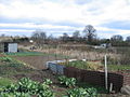
 Allotments at NW corner of Lloyd Park - geograph.org.uk - 736810.jpg 640 × 480; 65 KB
-
-
 An entrance to Nine Wells - geograph.org.uk - 751801.jpg 640 × 481; 146 KB
-
 Ancient oak - geograph.org.uk - 736420.jpg 639 × 479; 173 KB
-
 Anemone Nemorosa - geograph.org.uk - 733348.jpg 640 × 596; 241 KB
-
 Approaching Park Wood - geograph.org.uk - 736353.jpg 639 × 479; 178 KB
-
 Approaching the bridge - geograph.org.uk - 756406.jpg 640 × 469; 55 KB
-
 Approaching the top - geograph.org.uk - 756447.jpg 640 × 473; 69 KB
-
 Archway, Montpellier Mews - geograph.org.uk - 738826.jpg 640 × 480; 86 KB
-

-
 Ashley Hill allotments - geograph.org.uk - 732346.jpg 640 × 480; 112 KB
-
 Atherington Beach - geograph.org.uk - 734775.jpg 640 × 479; 65 KB
-
 Attenborough Nature Reserve - geograph.org.uk - 735621.jpg 640 × 480; 33 KB
-
 Attenborough Nature Reserve - geograph.org.uk - 735631.jpg 640 × 480; 79 KB
-

-
 Auchenvey Burn, Arvie - geograph.org.uk - 732631.jpg 640 × 480; 80 KB
-
 Auchenvey Burn, Loch Plantation - geograph.org.uk - 732641.jpg 640 × 480; 135 KB
-
 Back Hill Mast, Corsock - geograph.org.uk - 732500.jpg 480 × 640; 47 KB
-
 Back to Health Centre - geograph.org.uk - 732605.jpg 640 × 480; 94 KB
-
 Backwater area - geograph.org.uk - 732948.jpg 640 × 480; 70 KB
-
 Baked potato van - geograph.org.uk - 732930.jpg 3,008 × 2,000; 2.74 MB
-

-
 Barbed wire - geograph.org.uk - 732715.jpg 640 × 480; 50 KB
-
 Bedwyn Brail - geograph.org.uk - 738168.jpg 640 × 480; 162 KB
-
 Bell Beck Wood - geograph.org.uk - 732205.jpg 640 × 480; 157 KB
-

-
 Bench on a grey day - geograph.org.uk - 756623.jpg 640 × 466; 115 KB
-
 Bench, Ward Park - geograph.org.uk - 732306.jpg 640 × 480; 106 KB
-
 Bend in the road at Plant Farm - geograph.org.uk - 732552.jpg 640 × 480; 60 KB
-

-
 Beverley Beck and Housing - geograph.org.uk - 733140.jpg 640 × 541; 118 KB
-
 Beverley Beck and Syntan - geograph.org.uk - 733106.jpg 640 × 480; 117 KB
-
 Beverley Beck and the Grovehill Flyover - geograph.org.uk - 733131.jpg 640 × 480; 112 KB
-
 Beverley Beck and the Grovehill Flyover - geograph.org.uk - 733135.jpg 640 × 515; 108 KB
-
 Beverley Beck Footpath - geograph.org.uk - 733108.jpg 480 × 640; 139 KB
-
 Beverley Beck Footpath - geograph.org.uk - 733111.jpg 640 × 480; 127 KB
-
 Beverley Beck Lock - geograph.org.uk - 733118.jpg 480 × 640; 72 KB
-
 Beverley Beck Lock - geograph.org.uk - 733125.jpg 640 × 480; 82 KB
-
 Bike and bus lane on London Road - geograph.org.uk - 732624.jpg 640 × 480; 62 KB
-
 Birdhouse, Ward Park - geograph.org.uk - 732300.jpg 640 × 624; 158 KB
-

-

-

-

-
 Blaenllwynau - geograph.org.uk - 737026.jpg 638 × 475; 97 KB
-
 Blocked byway - geograph.org.uk - 732458.jpg 640 × 480; 71 KB
-

-
 Boathouse and Slipway, Dunaverty - geograph.org.uk - 735882.jpg 640 × 427; 243 KB
-
 Bobbing Village Hall - geograph.org.uk - 733169.jpg 640 × 480; 63 KB
-

-
 Bolsterstone Village Sign - geograph.org.uk - 737404.jpg 640 × 480; 100 KB
-
 Boscombe, gulls around groyne - geograph.org.uk - 732258.jpg 640 × 480; 55 KB
-
 Boscombe-Southbourne, promenade - geograph.org.uk - 732267.jpg 640 × 480; 66 KB
-
 Boundary fence - geograph.org.uk - 737743.jpg 480 × 640; 179 KB
-
 Braehead - geograph.org.uk - 732526.jpg 640 × 426; 73 KB
-
 Bramley Road, London N14 - geograph.org.uk - 735288.jpg 640 × 426; 163 KB
-

-
 Bridge at Fowlmere Watercress Beds 1 - footings.jpg 640 × 480; 132 KB
-
 Bridge by Canal Cottage - geograph.org.uk - 738042.jpg 638 × 475; 83 KB
-
 Bridge Garage - geograph.org.uk - 734352.jpg 479 × 640; 60 KB
-
 Bridge in detail - geograph.org.uk - 756449.jpg 640 × 460; 79 KB
-
 Bridge over Canal - geograph.org.uk - 736247.jpg 640 × 480; 112 KB
-
 Bridge over Hobson's Brook - geograph.org.uk - 755922.jpg 640 × 469; 101 KB
-
 Bridge, Attenborough Nature Reserve - geograph.org.uk - 735638.jpg 640 × 480; 72 KB
-

-
 Broadstone, near Staunton - geograph.org.uk - 736823.jpg 640 × 426; 84 KB
-
 Broadstone, near Staunton - geograph.org.uk - 736831.jpg 640 × 426; 105 KB
-
 Brookpit Lane, Climping - geograph.org.uk - 733309.jpg 479 × 640; 107 KB
-

-
 Bryn Lane, Newtown - Y Drenewydd - geograph.org.uk - 733506.jpg 427 × 640; 71 KB
-
 Buildings at Barnhill - geograph.org.uk - 1083495.jpg 640 × 480; 76 KB
-
 Burnt Out Van - geograph.org.uk - 733893.jpg 479 × 640; 70 KB
-
 Burton Road Culvert - geograph.org.uk - 1071710.jpg 640 × 479; 122 KB
-
 Bus shelter by Christ Church Vicarage - geograph.org.uk - 732015.jpg 640 × 480; 52 KB
-

-
 Bus stop by Purbrook Heath Farm - geograph.org.uk - 732081.jpg 640 × 480; 82 KB
-

-

-
 Bus stops by Christchurch Gardens - geograph.org.uk - 732036.jpg 640 × 480; 72 KB
-
 Bus to Loughborough - geograph.org.uk - 739148.jpg 640 × 481; 168 KB
-

-
 Cambridge Building Society's head office - geograph.org.uk - 732592.jpg 3,008 × 2,000; 2.84 MB
-
 Cambridge Crown Court - geograph.org.uk - 732666.jpg 3,008 × 2,000; 2.93 MB
-
 Cambridge Lodge Hotel - geograph.org.uk - 732996.jpg 3,008 × 2,000; 3.78 MB
-
 St Bene't's Church - geograph.org.uk - 732864.jpg 2,000 × 3,008; 2.54 MB
-

-
 Canada Road, looking past The Rockingham - geograph.org.uk - 732558.jpg 640 × 427; 135 KB
-

-

-
 Car Park in danger of being flooded - geograph.org.uk - 1097510.jpg 640 × 407; 60 KB
-
 Cassley, after the spate - geograph.org.uk - 1134011.jpg 640 × 480; 110 KB
-
 Castle Circus Health Centre - geograph.org.uk - 738059.jpg 640 × 451; 60 KB
-
 Cave on Newgale Beach - geograph.org.uk - 771295.jpg 640 × 480; 68 KB
-
 Cenotaph, Durham Road, Gateshead. - geograph.org.uk - 738781.jpg 640 × 480; 76 KB
-
 Cenotaph, Durham Road, Gateshead. - geograph.org.uk - 738784.jpg 480 × 640; 73 KB
-
 Charlecote Church - geograph.org.uk - 1057640.jpg 640 × 480; 298 KB
-
 Charlecote Church - geograph.org.uk - 1057642.jpg 480 × 640; 299 KB
-
 Charlecote House - geograph.org.uk - 1057627.jpg 640 × 480; 267 KB
-
 Charlecote House - geograph.org.uk - 1057631.jpg 640 × 480; 279 KB
-
 Charlecote House - geograph.org.uk - 1057636.jpg 480 × 640; 262 KB
-
 Charlecote House - geograph.org.uk - 1057644.jpg 640 × 480; 256 KB
-
 Cheney Way - geograph.org.uk - 752942.jpg 640 × 480; 46 KB
-
 Chester - Eastgate clock - geograph.org.uk - 748644.jpg 480 × 640; 84 KB
-

-
 Chisbury - geograph.org.uk - 737732.jpg 640 × 480; 156 KB
-
 Chisbury - geograph.org.uk - 737745.jpg 640 × 480; 160 KB
-
 Chisbury Wood - geograph.org.uk - 737999.jpg 640 × 480; 190 KB
-
 Chisbury Wood - geograph.org.uk - 738015.jpg 640 × 480; 194 KB
-
 Christ Church Vicarage, Widley - geograph.org.uk - 732011.jpg 640 × 480; 80 KB
-
 Christ Church, Widley - geograph.org.uk - 732013.jpg 640 × 480; 119 KB
-
 Church Street, Bishop's Castle - geograph.org.uk - 738313.jpg 640 × 428; 83 KB
-

-
 Civil defences of second world war - geograph.org.uk - 1530961.jpg 640 × 480; 75 KB
-
 Clare College sports ground - geograph.org.uk - 756298.jpg 640 × 478; 134 KB
-
 Clearing in Rannoch Forest - geograph.org.uk - 734547.jpg 640 × 480; 102 KB
-
 Clearing the way - geograph.org.uk - 756365.jpg 640 × 477; 75 KB
-
 Clegdike Drain - geograph.org.uk - 733097.jpg 480 × 640; 152 KB
-
 Cliff top, Handfast Point - geograph.org.uk - 732763.jpg 640 × 480; 129 KB
-
 Cliffs at Fairlight Cove - geograph.org.uk - 735593.jpg 640 × 426; 86 KB
-

-
 Coal levelling - geograph.org.uk - 737240.jpg 640 × 426; 80 KB
-
 Coastal Footpath, Dumbie Point - geograph.org.uk - 736442.jpg 638 × 480; 93 KB
-
 Coastal Railway - panoramio.jpg 533 × 400; 36 KB
-
 Coldburn cottage - geograph.org.uk - 1223654.jpg 640 × 424; 91 KB
-
 Colwick Sidings - geograph.org.uk - 1071709.jpg 640 × 427; 126 KB
-

-

-
 Common above Bedlinog - geograph.org.uk - 737031.jpg 638 × 475; 125 KB
-
 Common Road, near South Cave - geograph.org.uk - 732961.jpg 640 × 480; 165 KB
-

-
 Contented Cat at Dunaverty - geograph.org.uk - 735871.jpg 427 × 640; 290 KB
-
 Contented sheep - geograph.org.uk - 736998.jpg 638 × 475; 88 KB
-
 Continuation of the DNA path - geograph.org.uk - 755118.jpg 640 × 474; 63 KB
-
 Coombe Farm and grounds - geograph.org.uk - 736804.jpg 640 × 480; 51 KB
-
 Copper armadillo^ - geograph.org.uk - 732554.jpg 2,000 × 3,008; 2.64 MB
-
 Corner of Club House - panoramio.jpg 533 × 400; 40 KB
-
 Corpus Playroom - geograph.org.uk - 737368.jpg 2,000 × 3,008; 2.28 MB
-
 Corran Lighthouse - geograph.org.uk - 739164.jpg 640 × 360; 31 KB
-
 Cougar Osborne Ltd, Rope Walk - geograph.org.uk - 734392.jpg 479 × 640; 67 KB
-
 County Infirmary, Newtown, Powys - geograph.org.uk - 733470.jpg 640 × 427; 49 KB
-
 Cowley Road Park and Ride - geograph.org.uk - 732924.jpg 2,592 × 1,944; 1.75 MB
-
 Cows at Llanbradach Fawr - geograph.org.uk - 736606.jpg 638 × 475; 76 KB
-
 Craig, Ironmacannie - geograph.org.uk - 732407.jpg 640 × 480; 100 KB
-
 Cramond Boat Club - geograph.org.uk - 918656.jpg 640 × 480; 86 KB
-
 Cramond village - geograph.org.uk - 918661.jpg 640 × 480; 85 KB
-
 Cramond village - geograph.org.uk - 918664.jpg 640 × 480; 99 KB
-

-
 Crowden Great Brook - geograph.org.uk - 732770.jpg 640 × 480; 102 KB
-
 Crowden Great Brook - geograph.org.uk - 732780.jpg 640 × 480; 96 KB
-
 Cruising under the M1 motorway - geograph.org.uk - 732651.jpg 640 × 383; 67 KB
-
 Cunningham Road - geograph.org.uk - 732644.jpg 640 × 480; 63 KB
-
 Cycle path meets the road - geograph.org.uk - 755115.jpg 640 × 473; 58 KB
-
 Cycle path to Addenbrooke's hospital - geograph.org.uk - 751705.jpg 640 × 474; 73 KB
-
 Cycle path to Addenbrooke's Hospital - geograph.org.uk - 751717.jpg 640 × 456; 74 KB
-
 Cycle path to Shelford - geograph.org.uk - 751712.jpg 640 × 472; 62 KB
-
 Cycle rack - geograph.org.uk - 756642.jpg 640 × 475; 142 KB
-
 Cycle route 51 - geograph.org.uk - 732437.jpg 640 × 480; 68 KB
-
 Cycle route and A14 - geograph.org.uk - 732445.jpg 640 × 480; 68 KB
-
 Cycle Track, Bramley Road, Enfield - geograph.org.uk - 735336.jpg 640 × 426; 152 KB
-
 Cygnus olor & Anas platyrhynchos - geograph.org.uk - 733445.jpg 640 × 454; 138 KB
-
-
 Daffs beside the lane - geograph.org.uk - 738355.jpg 640 × 480; 118 KB
-

-
 Dead tree in Rannoch Forest - geograph.org.uk - 734083.jpg 480 × 640; 112 KB


_Scout_Group_hall,_Canada_Road_-_geograph.org.uk_-_732716.jpg)


_from_Grovehill_Flyover_-_geograph.org.uk_-_732597.jpg)


