Category:United Kingdom photographs taken on 2008-04-21
Jump to navigation
Jump to search
| ← | Monday 21 April 2008 | → | ||
| ← | April 2008 | → | ||

United Kingdom photographs taken on 21 April 2008.
Image files should be categorized here automatically using {{taken on}} template. Direct categorisation is also possible, if automatic is impossible.
Subcategories
This category has only the following subcategory.
Media in category "United Kingdom photographs taken on 2008-04-21"
The following 200 files are in this category, out of 764 total.
(previous page) (next page)-
 1906 Cottages, Ellerby - geograph.org.uk - 775467.jpg 640 × 476; 133 KB
-
 874 miles to John O'Groats - geograph.org.uk - 780115.jpg 640 × 455; 66 KB
-
 A fine old warehouse building - geograph.org.uk - 772682.jpg 640 × 434; 66 KB
-
 A Gala Bunny - geograph.org.uk - 772404.jpg 640 × 480; 74 KB
-
 A gated entrance to Torphins Wood - geograph.org.uk - 773510.jpg 640 × 480; 121 KB
-
-
 A lone tall birk - geograph.org.uk - 773560.jpg 480 × 640; 114 KB
-
 A pond in Gala - geograph.org.uk - 772402.jpg 640 × 480; 121 KB
-

-
 A view of Learney House - geograph.org.uk - 774127.jpg 640 × 480; 118 KB
-
 A1 Services Leeming Bar - geograph.org.uk - 788075.jpg 640 × 480; 70 KB
-

-
 A5202 Royal College Street - geograph.org.uk - 1019606.jpg 640 × 480; 75 KB
-
 A5202 Royal College Street - geograph.org.uk - 783192.jpg 640 × 480; 68 KB
-
 A5202 St. Pancras Way - geograph.org.uk - 1019650.jpg 640 × 480; 97 KB
-
 A701 at Romanno Bridge - geograph.org.uk - 781683.jpg 640 × 480; 67 KB
-
 Abbey Gardens, Bury St Edmunds - geograph.org.uk - 775211.jpg 427 × 640; 109 KB
-
 Abbey Gardens, Bury St Edmunds - geograph.org.uk - 775284.jpg 640 × 427; 130 KB
-
 Aberchalder Swing Bridge - geograph.org.uk - 780366.jpg 640 × 359; 57 KB
-
 Access to the Old Hall - geograph.org.uk - 773269.jpg 480 × 640; 165 KB
-
 Across the rocks to Longships Lighthouse - geograph.org.uk - 780142.jpg 640 × 480; 119 KB
-
 Allitsen Road - geograph.org.uk - 784358.jpg 640 × 480; 108 KB
-
 Allt an Loin - geograph.org.uk - 773876.jpg 640 × 480; 144 KB
-
 Allt an Loin - geograph.org.uk - 774566.jpg 640 × 480; 83 KB
-
 Allt an Loin - geograph.org.uk - 774570.jpg 640 × 480; 77 KB
-
 Allt an Loin - geograph.org.uk - 774574.jpg 640 × 480; 107 KB
-
 Alpacas at Wood Hall farm - geograph.org.uk - 780198.jpg 640 × 480; 113 KB
-
 Arisaig main street - geograph.org.uk - 774503.jpg 640 × 480; 67 KB
-
 Avenue Road, looking north - geograph.org.uk - 784348.jpg 640 × 480; 84 KB
-
 Avenue Road, looking south - geograph.org.uk - 784349.jpg 640 × 480; 84 KB
-
 B7059 leaving Romanno Bridge - geograph.org.uk - 781689.jpg 640 × 480; 60 KB
-
 Bath House, Soho, W1 (2446464839).jpg 1,280 × 960; 370 KB
-
 Bayham Street - geograph.org.uk - 1018956.jpg 640 × 480; 69 KB
-
 Baynes Street - geograph.org.uk - 776506.jpg 640 × 480; 86 KB
-
 Bede Burn Road Jarrow - geograph.org.uk - 1385990.jpg 640 × 480; 75 KB
-
 Beech tree - geograph.org.uk - 772487.jpg 480 × 640; 122 KB
-
 Benty Hill - geograph.org.uk - 781578.jpg 640 × 480; 103 KB
-
 Blackness castle - panoramio.jpg 1,600 × 1,200; 390 KB
-
 Blackness castle(the ship that never sailed) - panoramio.jpg 1,600 × 1,200; 433 KB
-
 Blackthorn near Belfast - geograph.org.uk - 772702.jpg 640 × 414; 48 KB
-
 Blair Castle - geograph.org.uk - 776542.jpg 640 × 480; 40 KB
-
 Blair Castle - geograph.org.uk - 776544.jpg 640 × 480; 42 KB
-
 Blue Boar Farm - geograph.org.uk - 781786.jpg 640 × 480; 72 KB
-
 Boat Lift - Port Solent - geograph.org.uk - 772392.jpg 640 × 480; 67 KB
-

-
 Bogged down in Brackmont - geograph.org.uk - 772771.jpg 640 × 479; 98 KB
-
 Bogsbank Road - geograph.org.uk - 781707.jpg 640 × 480; 46 KB
-
 Bonny Street - geograph.org.uk - 1018969.jpg 640 × 480; 87 KB
-
 Bourton Hall - geograph.org.uk - 772588.jpg 640 × 480; 68 KB
-
 Bourton-On-Dunsmore - geograph.org.uk - 775696.jpg 640 × 523; 119 KB
-
 Bridge at Old Blair - geograph.org.uk - 776545.jpg 640 × 480; 96 KB
-

-
-
 Bridge Of Oich - geograph.org.uk - 781930.jpg 640 × 359; 67 KB
-
 Bridge over dismantled railway - geograph.org.uk - 783385.jpg 640 × 482; 109 KB
-
 Bridge over the Holyhead Road - geograph.org.uk - 774745.jpg 640 × 428; 136 KB
-
 Bridge over the River Alwin - geograph.org.uk - 780979.jpg 640 × 460; 88 KB
-
 Bridge over the River Alwin - geograph.org.uk - 781002.jpg 640 × 480; 73 KB
-
 Bridge to the Abbey Gardens - geograph.org.uk - 775290.jpg 426 × 640; 98 KB
-
 Bridleway north of Bulman's Rigg - geograph.org.uk - 1138489.jpg 640 × 480; 98 KB
-
 Bridleway north of Bulman's Rigg - geograph.org.uk - 1138495.jpg 640 × 480; 122 KB
-
 Brough Law, Ingram Valley - geograph.org.uk - 787465.jpg 640 × 480; 81 KB
-
 Brough Law, Ingram Valley - geograph.org.uk - 787490.jpg 640 × 480; 75 KB
-
 Brownside Moss - geograph.org.uk - 780122.jpg 640 × 480; 117 KB
-
 Brownside Moss - geograph.org.uk - 781566.jpg 640 × 480; 137 KB
-
 Buckie on the beach - geograph.org.uk - 773150.jpg 640 × 530; 111 KB
-
 Buds of May by Waltham Lane - geograph.org.uk - 773017.jpg 640 × 480; 145 KB
-
 Bulls Nose Cliff - geograph.org.uk - 820164.jpg 640 × 480; 97 KB
-
 Bury St Edmunds - Abbey Church.jpg 427 × 640; 91 KB
-
 Bus to Oakham - geograph.org.uk - 778947.jpg 640 × 353; 51 KB
-
 Byroad above Bayles - geograph.org.uk - 781563.jpg 640 × 480; 134 KB
-
 Calveley Arms, Handley, Cheshire - geograph.org.uk - 827783.jpg 640 × 480; 64 KB
-
 Calvert Street - geograph.org.uk - 1006348.jpg 480 × 640; 64 KB
-

-
 Camden Lock Waterbus Stop - geograph.org.uk - 1006886.jpg 640 × 480; 94 KB
-
 Camden Road - geograph.org.uk - 1018960.jpg 640 × 480; 79 KB
-
 Camden Road - geograph.org.uk - 1018964.jpg 640 × 480; 88 KB
-
 Camden Road railway station - geograph.org.uk - 776517.jpg 640 × 480; 105 KB
-
 Camden Street - geograph.org.uk - 1018962.jpg 640 × 480; 90 KB
-
 Camden Town tube station 3.jpg 3,648 × 2,736; 4.43 MB
-
 Camrose Mill - geograph.org.uk - 812462.jpg 640 × 480; 82 KB
-
 Cannon, Blair Castle - geograph.org.uk - 776550.jpg 640 × 480; 85 KB
-
 Castle Hill, Bransholme - geograph.org.uk - 774257.jpg 450 × 640; 92 KB
-
 Castle Hill, Bransholme - geograph.org.uk - 774261.jpg 466 × 640; 104 KB
-
 Cathedral and Abbey ruins - geograph.org.uk - 775303.jpg 416 × 640; 90 KB
-
 Cathedral and Abbey ruins - geograph.org.uk - 775308.jpg 427 × 640; 90 KB
-
 Cawston Farm - geograph.org.uk - 790667.jpg 640 × 480; 62 KB
-
 Cawston-Potford's Dam - geograph.org.uk - 790655.jpg 640 × 480; 56 KB
-
 Chalcot Crescent - geograph.org.uk - 1005423.jpg 640 × 480; 78 KB
-
 Chalcot Road - geograph.org.uk - 1006358.jpg 640 × 480; 77 KB
-
 Chalcot Square - geograph.org.uk - 1005431.jpg 640 × 480; 114 KB
-
 Chalcot Square - geograph.org.uk - 1005437.jpg 640 × 480; 111 KB
-
 Chalcot Square - geograph.org.uk - 1005446.jpg 640 × 480; 92 KB
-
 Chalcot Square - geograph.org.uk - 1005450.jpg 640 × 480; 100 KB
-
 Chalcot Square - geograph.org.uk - 1005457.jpg 640 × 480; 137 KB
-
 Chalcot Square - geograph.org.uk - 1005459.jpg 640 × 480; 120 KB
-
 Chamberlain Street - geograph.org.uk - 1005403.jpg 640 × 480; 88 KB
-
 Charles Lane - geograph.org.uk - 784361.jpg 640 × 480; 88 KB
-
 Church Drive From Boultham Park Road - geograph.org.uk - 1095672.jpg 640 × 480; 90 KB
-
 Church Path - geograph.org.uk - 772635.jpg 640 × 480; 88 KB
-
 Claremont Farm - geograph.org.uk - 788608.jpg 640 × 394; 103 KB
-
 Cliffs at Rubha Hunish - geograph.org.uk - 780862.jpg 480 × 640; 63 KB
-
 Clipstone Colliery 1922-2003 - geograph.org.uk - 1240911.jpg 640 × 428; 71 KB
-
 Coastal view towards Tower Point - geograph.org.uk - 782809.jpg 640 × 480; 75 KB
-
 Confluence of the Lark and Linnet rivers - geograph.org.uk - 775192.jpg 640 × 427; 126 KB
-
 Cordhill Lane towards The Lodge - geograph.org.uk - 785102.jpg 640 × 433; 62 KB
-
 Corner Farm - geograph.org.uk - 772423.jpg 640 × 427; 51 KB
-
 Corrugated farm building - geograph.org.uk - 784367.jpg 640 × 448; 69 KB
-

-
 Country road in east Leicestershire - geograph.org.uk - 783173.jpg 640 × 470; 95 KB
-
 Country road in east Leicestershire - geograph.org.uk - 783174.jpg 640 × 404; 66 KB
-
 Country road in east Leicestershire - geograph.org.uk - 783179.jpg 640 × 502; 78 KB
-
 Country road near Wymondham - geograph.org.uk - 784360.jpg 640 × 428; 83 KB
-
 Country road near Wymondham - geograph.org.uk - 784390.jpg 640 × 504; 70 KB
-
 Country road north of Wymondham - geograph.org.uk - 784368.jpg 640 × 394; 49 KB
-

-

-
 County arcade - geograph.org.uk - 772636.jpg 480 × 640; 120 KB
-
 Covent Garden Underground Station (geograph 788822).jpg 640 × 480; 105 KB
-

-
 Cowslips - geograph.org.uk - 773325 (cropped).jpg 640 × 420; 129 KB
-
 Cowslips - geograph.org.uk - 773325.jpg 640 × 428; 132 KB
-
 Cribb's Lodge - geograph.org.uk - 783134.jpg 640 × 440; 70 KB
-
 Crown Hotel in need of some tlc - geograph.org.uk - 775469.jpg 640 × 480; 219 KB
-

-

-
 Deanfoot Road, West Linton - geograph.org.uk - 781736.jpg 640 × 480; 64 KB
-

-
 Deer grazing at Rhumach - geograph.org.uk - 774499.jpg 640 × 480; 88 KB
-
 Demolished - geograph.org.uk - 772711.jpg 640 × 391; 50 KB
-
 Demolition in Bridge Street, Dromore - geograph.org.uk - 1387375.jpg 640 × 480; 111 KB
-

-
 Derelict Cottage. - geograph.org.uk - 812484.jpg 640 × 480; 72 KB
-
 Derelict house on Gloucester Avenue - geograph.org.uk - 776587.jpg 640 × 480; 56 KB
-
 Designer Outlet - geograph.org.uk - 788083.jpg 640 × 480; 62 KB
-
 Digging round the War Memorial - geograph.org.uk - 772655.jpg 640 × 451; 81 KB
-
 Disused railway bridge near Wymondham - geograph.org.uk - 784362.jpg 640 × 520; 112 KB
-

-
 Doric Temple - geograph.org.uk - 772707.jpg 640 × 457; 62 KB
-
 Dovecote, Abbey Gardens - geograph.org.uk - 775295.jpg 640 × 427; 93 KB
-
 Draycote - geograph.org.uk - 776749.jpg 480 × 640; 128 KB
-
 Draycote Village - geograph.org.uk - 774846.jpg 640 × 480; 130 KB
-
 Draycote Village - geograph.org.uk - 774857.jpg 640 × 480; 128 KB
-
 Draycote Water - geograph.org.uk - 776752.jpg 640 × 480; 85 KB
-
 Draycote Water - geograph.org.uk - 781812.jpg 640 × 480; 73 KB
-
 Draycote Water Western Dam - geograph.org.uk - 775715.jpg 640 × 480; 114 KB
-
 Draycote-Manor Farm - geograph.org.uk - 776745.jpg 640 × 480; 73 KB
-
 Driveway from Learney House - geograph.org.uk - 773480.jpg 640 × 480; 113 KB
-
 Driveway to Stapleford Hall - geograph.org.uk - 785153.jpg 640 × 394; 75 KB
-
 Dunchurch - geograph.org.uk - 776758.jpg 640 × 480; 129 KB
-
 Dunchurch - geograph.org.uk - 776764.jpg 640 × 480; 107 KB
-
 Eamont Street - geograph.org.uk - 784359.jpg 640 × 480; 92 KB
-
-
 East along the Rutland Round - geograph.org.uk - 780055.jpg 640 × 399; 69 KB
-
 East along the Rutland Round footpath - geograph.org.uk - 781527.jpg 640 × 432; 84 KB
-
 East along the Rutland Round footpath - geograph.org.uk - 783122.jpg 640 × 423; 72 KB
-
 East Dudwell - geograph.org.uk - 812488.jpg 640 × 480; 70 KB
-
 Edinburghmosque.jpg 1,951 × 2,775; 783 KB
-
 Edis Street - geograph.org.uk - 1006341.jpg 640 × 480; 89 KB
-
 Egbert Street - geograph.org.uk - 1006314.jpg 640 × 480; 81 KB
-
 Electricity poles - geograph.org.uk - 772827.jpg 640 × 480; 125 KB
-
 Elsworthy Terrace - geograph.org.uk - 776540.jpg 640 × 480; 106 KB
-
 Entering West Linton - geograph.org.uk - 781722.jpg 640 × 480; 60 KB
-
 Entrance to Neidpath Castle - geograph.org.uk - 778154.jpg 640 × 480; 81 KB
-
 Entrance to Scamford Caravan Park - geograph.org.uk - 812474.jpg 640 × 480; 88 KB
-
 Entrance to Stapleford Park - geograph.org.uk - 785152.jpg 640 × 437; 94 KB
-
 Entrance to Summerhill Mill - geograph.org.uk - 812496.jpg 640 × 480; 53 KB
-
 Eroded gravestone - geograph.org.uk - 773296.jpg 480 × 640; 190 KB
-
 Estate building at Learney - geograph.org.uk - 773475.jpg 640 × 480; 120 KB
-
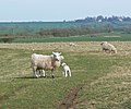 Ewes and lambs near Teigh - geograph.org.uk - 779984.jpg 640 × 535; 88 KB
-

-
 Farmland and sheep near Pickwell - geograph.org.uk - 773098.jpg 640 × 450; 79 KB
-
 Farmland at Frankton - geograph.org.uk - 781792.jpg 640 × 480; 82 KB
-
 Farmland at Frankton - geograph.org.uk - 784521.jpg 640 × 480; 50 KB
-
 Farmland east of Wymondham - geograph.org.uk - 783389.jpg 640 × 490; 76 KB
-
 Farmland in east Leicestershire - geograph.org.uk - 783096.jpg 640 × 495; 94 KB
-
 Farmland in east Leicestershire - geograph.org.uk - 783177.jpg 640 × 422; 56 KB
-
 Field of sunflowers - geograph.org.uk - 772815.jpg 640 × 480; 112 KB
-
 Following track to Romanno Bridge - geograph.org.uk - 781389.jpg 640 × 480; 58 KB
-
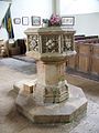 Font, All Saints Church, Broad Chalke - geograph.org.uk - 772614.jpg 480 × 640; 71 KB
-
 Footbridge closed at Land's End - geograph.org.uk - 780124.jpg 463 × 640; 164 KB
-
 Footbridge over the Regent's Canal - geograph.org.uk - 1006881.jpg 640 × 480; 96 KB
-

-
 Footbridge over the Wreigh Burn, Thropton - geograph.org.uk - 780847.jpg 480 × 640; 110 KB
-
 Footbridge to the Haberden - geograph.org.uk - 775151.jpg 640 × 427; 123 KB
-
 Footpath through Woodwell Head - geograph.org.uk - 781535.jpg 640 × 496; 142 KB
-
 Footpath to Market Overton - geograph.org.uk - 780061.jpg 640 × 500; 103 KB
-
 Footpath to Pasture Farm - geograph.org.uk - 783126.jpg 640 × 494; 121 KB
-
 Footpath to the windmill - geograph.org.uk - 784384.jpg 640 × 460; 98 KB
-
 Ford over Fingland Burn - geograph.org.uk - 780271.jpg 640 × 480; 91 KB
-
 Fort George - geograph.org.uk - 780486.jpg 640 × 480; 77 KB
-
 Fort George - geograph.org.uk - 780493.jpg 640 × 480; 72 KB
-
 Fort George - geograph.org.uk - 780502.jpg 640 × 359; 53 KB
-
 Fountains in the Victoria Quarter Arcade - geograph.org.uk - 772641.jpg 640 × 508; 104 KB
-
 Frankton Church - geograph.org.uk - 772597.jpg 640 × 480; 79 KB
-
 Frankton Country Lane - geograph.org.uk - 784516.jpg 640 × 480; 78 KB
-
 Frankton Main Street - geograph.org.uk - 781802.jpg 640 × 480; 67 KB
-
 Gala Policies - geograph.org.uk - 772345.jpg 640 × 480; 119 KB
-
 Galashiels Academy - geograph.org.uk - 772350.jpg 640 × 480; 119 KB
-
 Galashiels Sewage Works - geograph.org.uk - 772663.jpg 640 × 480; 48 KB


.jpg)


_-_panoramio.jpg)


.jpg)

.jpg)


