Category:United Kingdom photographs taken on 2008-03-19
Jump to navigation
Jump to search
| ← | Wednesday 19 March 2008 | → | ||
| ← | March 2008 | → | ||

United Kingdom photographs taken on 19 March 2008.
Image files should be categorized here automatically using {{taken on}} template. Direct categorisation is also possible, if automatic is impossible.
Subcategories
This category has only the following subcategory.
Media in category "United Kingdom photographs taken on 2008-03-19"
The following 200 files are in this category, out of 943 total.
(previous page) (next page)-
 'The Shepherd Inn' on Blackmore Road - geograph.org.uk - 730621.jpg 640 × 433; 53 KB
-
 Newark North Gate railway station 222101.jpg 1,024 × 768; 419 KB
-
 A fine show of wild daffodils - geograph.org.uk - 730569.jpg 640 × 427; 105 KB
-

-
 A liverwort - Pellia epiphylla - geograph.org.uk - 930744.jpg 640 × 640; 118 KB
-
 A March evening in Ellington - geograph.org.uk - 730196.jpg 640 × 427; 223 KB
-
 A patch of wood anemones - geograph.org.uk - 730742.jpg 640 × 481; 198 KB
-

-
 A1068 Road - geograph.org.uk - 730636.jpg 640 × 480; 65 KB
-
 Abandoned quarry at Dancing Ledge - geograph.org.uk - 733837.jpg 640 × 428; 167 KB
-
 Access Road - geograph.org.uk - 730041.jpg 640 × 480; 123 KB
-

-
 Allerthorpe Common - geograph.org.uk - 730871.jpg 640 × 480; 104 KB
-
 Almshouses Gates, Wadsley - geograph.org.uk - 737850.jpg 640 × 426; 94 KB
-
 Anderton Nature Park - geograph.org.uk - 1541209.jpg 640 × 426; 92 KB
-
 Animal tracks - geograph.org.uk - 730578.jpg 640 × 480; 109 KB
-

-

-
-
 Arch, St Stephen's Church, Exeter - geograph.org.uk - 737685.jpg 640 × 460; 53 KB
-

-
 Arndarroch entrance - geograph.org.uk - 730294.jpg 640 × 410; 66 KB
-
 Avenue of trees, Almondbury - geograph.org.uk - 730504.jpg 480 × 640; 126 KB
-
 B and Q car park, Bury St Edmunds - geograph.org.uk - 731053.jpg 640 × 480; 87 KB
-
 B and Q, Bury St Edmunds - geograph.org.uk - 731049.jpg 640 × 480; 81 KB
-
 Backley Bottom - geograph.org.uk - 732282.jpg 640 × 480; 110 KB
-
 Allotment fencing - geograph.org.uk - 730225.jpg 640 × 413; 72 KB
-
 Barrier on bridge - geograph.org.uk - 730303.jpg 427 × 640; 216 KB
-
 Basingstoke signal box - geograph.org.uk - 730460.jpg 640 × 480; 92 KB
-

-

-
 Beacon Hill, Chatham - geograph.org.uk - 731753.jpg 640 × 480; 72 KB
-
 Beardmore Hotel Grounds - geograph.org.uk - 731868.jpg 640 × 428; 76 KB
-
 Beaufort theatre - geograph.org.uk - 771227.jpg 640 × 480; 60 KB
-
 Beechwood Avenue, Gillingham - geograph.org.uk - 737164.jpg 640 × 480; 100 KB
-
 Beeley Wood Industrial Site - geograph.org.uk - 737791.jpg 640 × 427; 70 KB
-
 Beverley and Barmston Drain - geograph.org.uk - 730435.jpg 640 × 480; 86 KB
-
 Beverley and Barmston Drain - geograph.org.uk - 730439.jpg 640 × 480; 104 KB
-
 Beverley and Barmston Drain - geograph.org.uk - 730443.jpg 640 × 480; 86 KB
-
 Beverley and Barmston Drain - geograph.org.uk - 730448.jpg 640 × 480; 96 KB
-
 Bishops Palace - geograph.org.uk - 811323.jpg 640 × 480; 85 KB
-

-
 Blackcap, East Sussex, the top (geograph 730168).jpg 640 × 480; 98 KB
-

-
 Blue Lake at Golwen slate quarry - geograph.org.uk - 849214.jpg 640 × 480; 94 KB
-
 Boats moored on the River Hull - geograph.org.uk - 730431.jpg 640 × 480; 67 KB
-
 Bournemouth, Southcote Road - geograph.org.uk - 731743.jpg 640 × 480; 69 KB
-
 Bournemouth, Southcote Road Depot - geograph.org.uk - 731744.jpg 640 × 480; 75 KB
-
 Bradford Beck - geograph.org.uk - 730455.jpg 640 × 480; 126 KB
-
 Bratley Wood - geograph.org.uk - 732268.jpg 640 × 480; 141 KB
-

-
 Bridge at Otterspool - geograph.org.uk - 730700.jpg 640 × 480; 84 KB
-
 Bridge Farm, Romsey Road, West Wellow - geograph.org.uk - 730026.jpg 640 × 427; 136 KB
-
 Bridge on Scurf Dike - geograph.org.uk - 730406.jpg 640 × 479; 80 KB
-
 Bridge over Afon Dulas - geograph.org.uk - 730763.jpg 640 × 480; 98 KB
-
 Bridge over Bradford Beck - geograph.org.uk - 730498.jpg 640 × 480; 124 KB
-

-

-
 Bridge Street, Reading - geograph.org.uk - 737126.jpg 640 × 480; 123 KB
-
 Brockenbarrow Farm - geograph.org.uk - 731627.jpg 464 × 640; 139 KB
-
 Bryn Seion Methodist Chapel, Trevor - geograph.org.uk - 731482.jpg 640 × 443; 72 KB
-
 Building a new pedestrian crossing - geograph.org.uk - 730417.jpg 640 × 460; 60 KB
-
 Bury St.Edmunds railway station - geograph.org.uk - 731043.jpg 640 × 480; 65 KB
-

-
 Bus terminus - geograph.org.uk - 730747.jpg 640 × 480; 79 KB
-
 Buttons, Lower Common Road, West Wellow - geograph.org.uk - 729808.jpg 640 × 427; 122 KB
-
 Cairn near Cam Sgriob - geograph.org.uk - 729716.jpg 640 × 480; 100 KB
-
 Cairn on the Beacons Way - geograph.org.uk - 729880.jpg 461 × 640; 78 KB
-
 Cairn on the Beacons Way - geograph.org.uk - 729884.jpg 640 × 480; 64 KB
-
 Cairn on the ridge of Craig Cwareli - geograph.org.uk - 729908.jpg 640 × 480; 66 KB
-
 Cam Sgriob Summit - geograph.org.uk - 729721.jpg 640 × 480; 107 KB
-
 Canal Footbridge, Dalmuir - geograph.org.uk - 731886.jpg 640 × 428; 111 KB
-

-
-
 Carved dragon, Nowton Park - geograph.org.uk - 978286.jpg 640 × 480; 119 KB
-
 Carved dragon, Nowton Park - geograph.org.uk - 978292.jpg 640 × 480; 138 KB
-
 Carved dragon, Nowton Park - geograph.org.uk - 978297.jpg 480 × 640; 125 KB
-
 Carved panda, Nowton Park - geograph.org.uk - 978276.jpg 640 × 480; 99 KB
-
 Castle Drogo, south-east side - geograph.org.uk - 742542.jpg 640 × 480; 82 KB
-
 Castle Road, Chatham - geograph.org.uk - 731807.jpg 640 × 481; 96 KB
-

-
 Cefn Cottage, Llantood - geograph.org.uk - 729714.jpg 640 × 469; 128 KB
-
 Ceiriog Forest - geograph.org.uk - 844281.jpg 640 × 425; 86 KB
-
 Cemetery - Ninelands Lane - geograph.org.uk - 730328.jpg 640 × 432; 59 KB
-
 Chapel ruins, Abercynafon - geograph.org.uk - 729872.jpg 640 × 480; 91 KB
-
 Chapel ruins, Abercynafon - geograph.org.uk - 729876.jpg 640 × 480; 92 KB
-

-
 Cherry blossom, Southernhay - geograph.org.uk - 737811.jpg 480 × 640; 111 KB
-
 Chesham Bois, Bricky Pond - geograph.org.uk - 730280.jpg 640 × 480; 120 KB
-
 Chesham Bois, The War Memorial - geograph.org.uk - 730301.jpg 640 × 480; 116 KB
-
 Chesil Bank - geograph.org.uk - 738136.jpg 640 × 428; 131 KB
-
 Chubb's (detail), Wolverhampton - geograph.org.uk - 730497.jpg 640 × 463; 140 KB
-
 Church Hill, Luton, Chatham - geograph.org.uk - 731388.jpg 640 × 480; 78 KB
-
 Church in Rhosllanerchrugog - geograph.org.uk - 729829.jpg 640 × 480; 61 KB
-
 Church Street, Reading - geograph.org.uk - 737121.jpg 480 × 640; 115 KB
-
 Circle of tree stumps, Nowton Park - geograph.org.uk - 981112.jpg 640 × 480; 119 KB
-
 Circle of tree stumps, Nowton Park - geograph.org.uk - 981115.jpg 640 × 480; 99 KB
-
 Clachbain Farm - geograph.org.uk - 729710.jpg 640 × 480; 80 KB
-
 Clay residues - geograph.org.uk - 729705.jpg 480 × 640; 144 KB
-
 Cleared woodland - geograph.org.uk - 844389.jpg 640 × 425; 83 KB
-
 Clifton House - geograph.org.uk - 730441.jpg 640 × 480; 90 KB
-
 Clifton Terrace - geograph.org.uk - 730438.jpg 640 × 476; 108 KB
-
 Close up of the feet - geograph.org.uk - 906954.jpg 480 × 640; 103 KB
-
 Clytha Park 1.jpg 640 × 480; 96 KB
-
 Clytha Park 2.jpg 640 × 480; 82 KB
-
 Clytha Park 3.jpg 640 × 480; 96 KB
-
 Co-op Funeral Service - Main Street - geograph.org.uk - 730648.jpg 640 × 480; 70 KB
-
 Coast path north of Pen Pistyll - geograph.org.uk - 729658.jpg 640 × 480; 80 KB
-
 Coedley roundabout - geograph.org.uk - 744765.jpg 640 × 480; 75 KB
-

-
 Connaught Road, Chatham - geograph.org.uk - 731379.jpg 640 × 480; 65 KB
-
 Cornworthy, footpath to East Cornworthy - geograph.org.uk - 731212.jpg 640 × 427; 252 KB
-
 Cornworthy, the Barberry Water valley - geograph.org.uk - 731210.jpg 640 × 427; 137 KB
-

-
 Coxlease Farm, Fawley - geograph.org.uk - 735653.jpg 640 × 427; 149 KB
-

-
 Cross Street, Reading - geograph.org.uk - 737129.jpg 480 × 640; 121 KB
-
 Crown Heights - geograph.org.uk - 730442.jpg 640 × 475; 83 KB
-
 Crown Heights - geograph.org.uk - 730446.jpg 480 × 640; 93 KB
-

-
 Daffodils at Decoy - geograph.org.uk - 730384.jpg 480 × 640; 123 KB
-
 Dagmar Road, Chatham - geograph.org.uk - 731370.jpg 640 × 480; 64 KB
-
 Dalmuir Court Reflection - geograph.org.uk - 731878.jpg 428 × 640; 92 KB
-
 Dalmuir Drop Lock - geograph.org.uk - 731877.jpg 640 × 428; 67 KB
-
 Darfield allotment sunset - geograph.org.uk - 730236.jpg 640 × 480; 51 KB
-

-
 Dayspring Church - Main Street - geograph.org.uk - 730649.jpg 640 × 470; 69 KB
-
 Deanery Place, Exeter - geograph.org.uk - 737859.jpg 480 × 640; 70 KB
-
 Deep Clough Footbridge-Signpost - geograph.org.uk - 733843.jpg 640 × 479; 153 KB
-
 Delicate wood anemones - geograph.org.uk - 730744.jpg 516 × 640; 158 KB
-
 Derwent Reservoir - Railway Remains - geograph.org.uk - 734562.jpg 640 × 480; 72 KB
-

-

-
 Diana Road, Chatham - geograph.org.uk - 731809.jpg 640 × 480; 58 KB
-
 Distance Marker, Forth and Clyde Canal - geograph.org.uk - 731898.jpg 640 × 428; 137 KB
-
 Distant view of Castle Drogo - geograph.org.uk - 742544.jpg 640 × 480; 96 KB
-
 Dittisham, by the Ferry Boat inn - geograph.org.uk - 731166.jpg 640 × 427; 141 KB
-
 Dittisham, Dittisham Mill - geograph.org.uk - 731209.jpg 640 × 427; 183 KB
-
 Dittisham, Lower Dittisham - geograph.org.uk - 731172.jpg 640 × 427; 145 KB
-
 Dittisham, on the ferry to Greenway Quay - geograph.org.uk - 731173.jpg 640 × 427; 117 KB
-
 Dittisham, the landing stage - geograph.org.uk - 731168.jpg 640 × 427; 111 KB
-
 Dittisham, towards East Cornworthy - geograph.org.uk - 731214.jpg 640 × 427; 109 KB
-
 Dittisham, towards Greenway Quay - geograph.org.uk - 731161.jpg 640 × 427; 120 KB
-
 Dittisham.jpg 640 × 427; 123 KB
-
 Domino's Pizza, Chatham Hill - geograph.org.uk - 737158.jpg 640 × 480; 64 KB
-
 Dove House boundary fence - geograph.org.uk - 730331.jpg 640 × 455; 72 KB
-
 Drilling Corn - geograph.org.uk - 737673.jpg 1,744 × 1,308; 1.2 MB
-

-
 Dry Stream Bed - geograph.org.uk - 1738986.jpg 2,592 × 1,944; 2.43 MB
-
 Dumbarton Road Bridge, Dalmuir - geograph.org.uk - 731875.jpg 640 × 428; 98 KB
-
 Early bluebells, Bishopstone - geograph.org.uk - 729922.jpg 640 × 480; 155 KB
-

-

-
 East Garforth Railway Station - geograph.org.uk - 730110.jpg 640 × 480; 63 KB
-
 East Midlands Trains Class 153 Lincoln.jpg 1,024 × 768; 256 KB
-
 Eastnor Castle from the Obelisk - geograph.org.uk - 907008.jpg 640 × 465; 87 KB
-
 Eastnor Park north of the obelisk - geograph.org.uk - 907047.jpg 640 × 480; 62 KB
-
 Eclipse Park, Maidstone - geograph.org.uk - 731281.jpg 640 × 492; 82 KB
-
 Eglwys Llanddeusant - geograph.org.uk - 730650.jpg 640 × 428; 68 KB
-
 Eglwys Llanddeusant - geograph.org.uk - 730653.jpg 640 × 428; 56 KB
-
 Eglwys Llanddeusant - geograph.org.uk - 730657.jpg 640 × 428; 121 KB
-
 Eglwys Pabo Sant Llanbabo - geograph.org.uk - 733272.jpg 640 × 428; 78 KB
-
 Eglwys Pabo Sant Llanbabo - geograph.org.uk - 733277.jpg 640 × 428; 60 KB
-

-
 Ellington Church - geograph.org.uk - 730324.jpg 640 × 423; 183 KB
-
 Endsleigh Street, London WC1 - geograph.org.uk - 731434.jpg 640 × 496; 101 KB
-

-
 Entrance to Edgar's Field - geograph.org.uk - 736905.jpg 640 × 480; 187 KB
-

-

-
 Euston Gardens, London WC1 - geograph.org.uk - 731452.jpg 640 × 379; 112 KB
-
 George's Meeting House, Exeter - geograph.org.uk - 737695.jpg 480 × 640; 79 KB
-
 Exit from the Blue Lake - geograph.org.uk - 849211.jpg 640 × 480; 45 KB
-
 Fallen tree at Kingsteignton, Devon.jpg 531 × 434; 140 KB
-
 Farm Buildings next to Raglan Castle - geograph.org.uk - 769048.jpg 640 × 480; 99 KB
-
 Farm buildings next to Raglan castle - geograph.org.uk - 770614.jpg 640 × 480; 63 KB
-
 Farm road near Decoy - geograph.org.uk - 730387.jpg 640 × 480; 90 KB
-
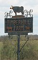 Farm sign - geograph.org.uk - 730719.jpg 412 × 640; 74 KB
-
 Farmland and woodland, Fawley - geograph.org.uk - 737108.jpg 640 × 480; 142 KB
-
 Farmland, Fawley - geograph.org.uk - 737094.jpg 640 × 480; 149 KB
-
 Farmland, Fawley - geograph.org.uk - 737111.jpg 640 × 480; 118 KB
-
 Fferm Wynt Llyn Alaw Wind Farm - geograph.org.uk - 733255.jpg 640 × 428; 52 KB
-
 Fferm Wynt Llyn Alaw Wind Farm - geograph.org.uk - 733259.jpg 640 × 428; 41 KB
-
 Fferm Wynt Llyn Alaw Wind Farm - geograph.org.uk - 733280.jpg 640 × 428; 27 KB
-
 Fferm Wynt Llyn Alaw Wind Farm - geograph.org.uk - 733284.jpg 640 × 428; 33 KB
-
 Fferm Wynt Llyn Alaw Wind Farm - geograph.org.uk - 733286.jpg 640 × 428; 35 KB
-
 Fferm Wynt Llyn Alaw Wind Farm - geograph.org.uk - 733310.jpg 640 × 428; 78 KB
-
 Field at end of The Drove, West Wellow - geograph.org.uk - 729832.jpg 640 × 427; 127 KB
-

-
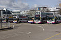 FirstGroup buses in Buchanan Bus Station, Glasgow 19 March 2008.jpg 640 × 428; 87 KB
-

-
 Football fields, Romsey Road, West Wellow - geograph.org.uk - 730012.jpg 640 × 427; 143 KB
-

-
 Footpath and woods, Nowton Park - geograph.org.uk - 981495.jpg 480 × 640; 150 KB
-
 Footpath between industrial units. - geograph.org.uk - 730409.jpg 640 × 462; 66 KB
-
 Footpath by a small sub-station - geograph.org.uk - 730692.jpg 640 × 480; 136 KB
-
 Footpath heading to Ceiriog Forest - geograph.org.uk - 844407.jpg 640 × 425; 67 KB
-
 Footpath Junction near Decoy - geograph.org.uk - 730330.jpg 640 × 480; 87 KB
-
 Footpath next to a Copse - geograph.org.uk - 730396.jpg 480 × 640; 181 KB
-
 Footpath on the moor - geograph.org.uk - 1739015.jpg 2,048 × 1,360; 1.96 MB


.jpg)


,_Wolverhampton_-_geograph.org.uk_-_730497.jpg)


