Category:San Joaquin Valley
Appearance
southern part of the Central Valley in California, United States | |||||
| Upload media | |||||
| Instance of | |||||
|---|---|---|---|---|---|
| Part of | |||||
| Location | California, Pacific States Region | ||||
| Located in or next to body of water | |||||
 | |||||
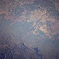
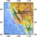
English: The San Joaquin Valley — the southern sub-region of the immense Central Valley of California, located south of the Sacramento–San Joaquin River Delta. The Sacramento Valley is the northern sub-region.
Español: Valle de San Joaquín — el área del Valle Central de California que yace sur del delta del río San Joaquín en Stockton, en California central.
Subcategories
This category has the following 45 subcategories, out of 45 total.
*
B
- Buena Vista Oil Field (3 F)
C
D
E
- Edison Oil Field (4 F)
- Elk Hills Oil Field (7 F)
F
- Farmersville, California (8 F)
- Fruitvale Oil Field (3 F)
G
H
K
- Kern River Oil Field (14 F)
M
- Mendota, California (4 F)
- Mountain View Oil Field (2 F)
P
- Panoche Hills (43 F)
S
- Semitropic Oil Field (2 F)
T
- Tejon Ranch (25 F)
Media in category "San Joaquin Valley"
The following 164 files are in this category, out of 164 total.
-
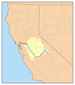
Map california central valley.jpg 300 × 367; 59 KB
-
"San Joaquin Valley, California - Contract Labor" - NARA - 532157.tif 3,000 × 2,998; 8.58 MB
-
Map of the San Joaquin, Sacramento and Tulare Valleys 1873.jpg 1,083 × 1,536; 314 KB
-
1st Annual Fresno Lesbian-Gay Pride '91 (17790567134).jpg 6,832 × 4,480; 8.79 MB
-
1st Annual Fresno Lesbian-Gay Pride '91 (17792495103).jpg 6,816 × 4,496; 9.79 MB
-
1st Annual Fresno Lesbian-Gay Pride '91 (17792502033).jpg 6,832 × 4,496; 9.78 MB
-
1st Annual Fresno Lesbian-Gay Pride '91 (17792591523).jpg 6,832 × 4,480; 9.19 MB
-
1st Annual Fresno Lesbian-Gay Pride '91 (18227059079).jpg 6,848 × 4,480; 9.65 MB
-
1st Annual Fresno Lesbian-Gay Pride '91 (18227072489).jpg 6,832 × 4,480; 10.02 MB
-
1st Annual Fresno Lesbian-Gay Pride '91 (18414897111).jpg 6,848 × 4,480; 9.28 MB
-
California State Route 99.svg 576 × 672; 1.62 MB
-
Abroniapogonantha.jpg 200 × 150; 11 KB
-
Agricultural land use and wildlife in the San Joaquin Valley, 1796-1930 - overview (IA agriculturalland00sacr).pdf 1,187 × 1,612, 344 pages; 7.61 MB
-
The agroforestry demonstration program in the San Joaquin Valley - progress report (IA agroforestrydemo00sacr).pdf 1,204 × 1,616, 212 pages; 6.49 MB
-
Albert Bierstadt A View From Sacramento.jpg 800 × 583; 115 KB
-
Almonds Maturing on Trees.jpg 3,872 × 2,592; 2.07 MB
-
America Kelsey - romance of the great San Joaquin Valley (IA americkelseyroma00mattrich).pdf 745 × 1,091, 154 pages; 6.35 MB
-
Breaking the Delta, San Joaquin Valley, with Caterpillar Tractor.jpg 3,744 × 2,439; 1.52 MB
-
California US Congressional District 21 (since 2013).tif 2,016 × 998; 3.1 MB
-
California views. No. 3. Mt. Diablo, San Joaquin Valley LCCN2003663833.jpg 5,869 × 3,042; 2.51 MB
-
California's Central Valley.JPG 2,048 × 1,169; 962 KB
-
California, eólicas 1989 01.jpg 1,045 × 705; 466 KB
-
California, eólicas 1989 02.jpg 1,013 × 663; 692 KB
-
California, eólicas 1989 03.jpg 989 × 620; 553 KB
-
California, eólicas 1989 04.jpg 1,028 × 668; 731 KB
-
CALIFORNIA--KINGS RIVER - NARA - 542517.jpg 2,004 × 3,000; 5.25 MB
-
CALIFORNIA--NEAR FRESNO - NARA - 542508.jpg 2,005 × 3,000; 4.55 MB
-
CALIFORNIA--SAN JOAQUIN VALLEY - NARA - 542510.jpg 3,000 × 2,045; 3.23 MB
-
CALIFORNIA--SAN JOAQUIN VALLEY - NARA - 542541.jpg 2,009 × 3,000; 5.59 MB
-
CALIFORNIA--SAN JOAQUIN VALLEY - NARA - 542553.jpg 3,000 × 2,042; 5.47 MB
-
CALIFORNIA-KINGS RIVER - NARA - 542517.jpg 2,004 × 3,000; 1.76 MB
-
CALIFORNIA-SAN JOAQUIN VALLEY - NARA - 542510.jpg 3,000 × 2,045; 865 KB
-
CALIFORNIA-SAN JOAQUIN VALLEY - NARA - 542516.jpg 3,000 × 2,068; 2 MB
-
CALIFORNIA-SAN JOAQUIN VALLEY - NARA - 542532.jpg 1,992 × 3,000; 2.01 MB
-
CALIFORNIA-SAN JOAQUIN VALLEY - NARA - 542541.jpg 2,009 × 3,000; 2.09 MB
-
CALIFORNIA-SAN JOAQUIN VALLEY - NARA - 542553.jpg 3,000 × 2,042; 1.89 MB
-
California's natural wildlands legacy - San Joaquin Valley (IA californiasnatur01unit).pdf 1,275 × 1,672, 4 pages; 780 KB
-
CENTRAL CALIFORNIA - NARA - 542521.jpg 2,015 × 3,000; 5.01 MB
-
CENTRAL CALIFORNIA - NARA - 542589.jpg 3,000 × 2,012; 3.08 MB
-
CENTRAL CALIFORNIA - NARA - 542631.jpg 3,000 × 2,021; 3.3 MB
-
Central valley in august.JPG 3,264 × 1,138; 552 KB
-
Central valley project-01.png 3,125 × 3,750; 4.78 MB
-
Centralvalley.JPG 2,592 × 1,944; 561 KB
-
Centralvalleyfog.JPG 3,472 × 2,604; 1.57 MB
-
Charles Koppel Californian Rider.jpg 872 × 563; 106 KB
-
Chowchilla California (49395056997) (cropped).jpg 1,961 × 1,520; 1.59 MB
-
Chowchilla California and San Joaquin Valley (49395056997).jpg 3,600 × 2,400; 3.91 MB
-
Coalinga, California (20961419513).jpg 4,000 × 3,000; 2.17 MB
-
CottonPickersWantedSignLange.jpg 511 × 363; 73 KB
-
CVPSouthernCanalsUSBR.jpg 1,224 × 1,584; 1.58 MB
-
Day of Decision (9186686221).jpg 4,726 × 3,131; 6.79 MB
-
Day of Decision (9186687615).jpg 4,928 × 3,264; 7.15 MB
-
Day of Decision (9186691359).jpg 4,928 × 3,264; 6.67 MB
-
Day of Decision (9186693263).jpg 4,928 × 3,264; 5.29 MB
-
Day of Decision (9189488338).jpg 4,928 × 3,264; 5.85 MB
-
Day of Decision (9189489606).jpg 4,928 × 3,264; 6.88 MB
-
Day of Decision (9189491870).jpg 4,928 × 3,264; 4.51 MB
-
Dinuba, El Monte Way 1907.jpg 1,600 × 994; 270 KB
-
San Joaquin Valley, California-Erosion by Maynard Dixon, 1921.jpg 842 × 640; 146 KB
-
DonPedroReservoirPlain.jpg 639 × 639; 352 KB
-
1983californiamap.png 179 × 181; 24 KB
-
Erosion Effects - California - DPLA - 86709823a121fb18adcc5d34b7e3bf4a.jpg 4,759 × 3,876; 2.47 MB
-
Ground water in San Joaquin Valley, California (1916) (14759368996).jpg 1,424 × 4,736; 779 KB
-
Ground water in San Joaquin Valley, California (1916) (14782013262).jpg 1,404 × 4,736; 801 KB
-
Guide leaflet (1901) (14579375590).jpg 3,536 × 1,752; 1.57 MB
-
Gwsanjoaquin.jpg 228 × 494; 24 KB
-
HAHL D137 Yokuts Tu'e lodges.png 2,433 × 1,419; 1.64 MB
-
Hindu laborers tending a field in San Joaquin Valley Island.jpg 1,536 × 1,024; 148 KB
-
Img0297New WAPA Path 15 500 kV.JPG 2,048 × 1,536; 648 KB
-
Isabella lake STS51F-42-34.jpg 624 × 639; 68 KB
-
Kern River Oil Field aerial.jpg 3,648 × 2,736; 1.2 MB
-
Kettleman City Protest.jpg 800 × 462; 87 KB
-
Large flock of sheep laying (mostly) in a field, ca.1900 (CHS-1418).jpg 5,143 × 3,879; 1.58 MB
-
Map of central California with Cymric Oil Field.jpg 3,300 × 2,550; 1.12 MB
-
Map of the San Joaquin, Sacramento and Tulare Valleys 1873 - Tulare Valley.jpg 2,384 × 1,885; 2.3 MB
-
California Central Valley Grasslands map.svg 1,712 × 1,992; 338 KB
-
California Central Valley county map.svg 621 × 733; 504 KB
-
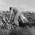
Migratory field worker picking cotton in San Joaquin Valley, California, 3c22717.jpg 2,937 × 2,925; 3.16 MB
-
Migratory field worker picking cotton in San Joaquin Valley, California, 3c22717.tif 4,096 × 3,272; 12.78 MB
-
Mojave Desert, Tehachapi Mountains, and San Joaquin Valley (California) – satellite image.jpg 8,824 × 5,336; 13.03 MB
-
Mokelumnemap.jpg 1,005 × 532; 257 KB
-
Muir Woods National Monument Road Trip (32919093217).jpg 3,000 × 2,250; 3.59 MB
-
NorthernSanJoaquinValleyOilGasFields.png 1,035 × 599; 381 KB
-
Five Team of Wagon, San Joaquim Valley, Calif (NYPL b12647398-68980).tiff 2,360 × 1,569; 10.6 MB
-
Oil, wine, and snow-capped mountains.jpg 5,616 × 3,744; 5.28 MB
-
Pictorial map of Fresno County and mid-California's Garden of the Sun. LOC 76690912.jpg 11,651 × 7,491; 15.23 MB
-
Pumpjacks, San Joaquin Valley, California.jpg 4,416 × 2,183; 2.65 MB
-
Red flower bush San Joaquin Valley.jpg 375 × 500; 67 KB
-
Ridge Route ca 1920 4.jpg 1,066 × 652; 114 KB
-
Right turn over San Joaquin Valley - Flickr - brewbooks (1).jpg 3,264 × 2,448; 2.84 MB
-
Right turn over San Joaquin Valley - Flickr - brewbooks (2).jpg 3,264 × 2,448; 2.64 MB
-
Right turn over San Joaquin Valley - Flickr - brewbooks (3).jpg 3,264 × 2,448; 2.7 MB
-
Right turn over San Joaquin Valley - Flickr - brewbooks (4).jpg 3,264 × 2,448; 2.69 MB
-
Right turn over San Joaquin Valley - Flickr - brewbooks (5).jpg 3,264 × 2,448; 2.64 MB
-
Right turn over San Joaquin Valley - Flickr - brewbooks.jpg 3,264 × 2,448; 3.18 MB
-
San Joaquin River and I-5.jpg 4,416 × 1,703; 2.05 MB
-
San Joaquin River USGS.jpg 567 × 388; 418 KB
-
San Joaquin Valley "Traveling Library" (1972).jpg 1,439 × 1,068; 1.22 MB
-
San Joaquin Valley - Flickr - brewbooks (2).jpg 3,264 × 2,448; 2.42 MB
-
San Joaquin Valley - panoramio.jpg 4,734 × 1,787; 5.57 MB
-
San Joaquin Valley amd Canal, CA 8-10 (28261966063).jpg 1,532 × 572; 483 KB
-
San Joaquin Valley farms - Flickr - brewbooks.jpg 3,264 × 2,448; 2.52 MB
-
Sanger Flume House 1890s.png 900 × 643; 605 KB
-
SanJoaquin watershed.png 300 × 341; 56 KB
-
SanJoaquinDrop.jpg 499 × 1,247; 171 KB
-
The San Joaquin Valley (IA sanjoaquinvalley00sanj).pdf 1,235 × 1,833, 24 pages; 1.57 MB
-
SanJoaquinValleyBuildingPanamaCaliforniaExpo1915.jpg 840 × 427; 296 KB
-
SanJoaquinValleyCountiesBuildingFrontPanamaCaliforniaExpo1915.jpg 1,911 × 672; 790 KB
-
Shuteye Peak Lookout - Interior facing South.jpg 4,032 × 3,024; 2.47 MB
-
Sierra nevada schematic.svg 1,276 × 816; 5 KB
-
SoCal Watershed.jpg 1,070 × 798; 525 KB
-
SouthernSanJoaquinValleyOilGasFields.png 853 × 605; 352 KB
-
Tehachapi Mountains (Transverse Ranges) California – labeled satellite image.png 4,313 × 3,924; 31.85 MB
-
Tehachapi Mountains (Transverse Ranges), California – satellite image.jpg 4,313 × 3,924; 7.54 MB
-
Tejon Pass, 1868.jpg 2,541 × 1,694; 1.54 MB
-
Temblor Range, California (20959888414).jpg 4,000 × 3,000; 2.24 MB
-
The California fruits and how to grow them; (1910) (14595028320).jpg 2,800 × 1,650; 1.38 MB
-
Through Ellis Island to San Joaquin valley, California.wav 1 min 18 s; 6.57 MB
-
TulareBasinMap.jpg 4,167 × 4,167; 16.33 MB
-
Tulare Valley, California; gathering flowers in February, (Boston Public Library).jpg 1,500 × 1,004; 192 KB
-
Tularebasinmapnew-01.png 2,083 × 2,083; 1.3 MB
-
Tule Fog California - 2005.jpg 2,400 × 3,200; 1.73 MB
-
View of the verdant San Joaquin Valley near Gustine in Merced County, California LCCN2013631653.tif 6,396 × 4,455; 163.08 MB
-
Visalia Transit 2011.jpg 710 × 466; 142 KB
-
Wea03347 - Flickr - NOAA Photo Library.jpg 2,048 × 1,536; 1.38 MB
-
West San Joaquin Valley agriculture (IA westsanjoaquinva00wash).pdf 1,202 × 1,622, 164 pages; 3.19 MB
-
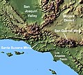
Wpdms shdrlfi020l santa susana mountains.jpg 300 × 270; 44 KB
-
Wpdms usgs photo sacramento delta 2.jpg 700 × 520; 81 KB
-
CA 10 certified.pdf 1,275 × 1,650; 932 KB
-
California US Congressional District 10 (since 2013).tif 2,016 × 998; 2.97 MB
-
California US Congressional District 22 (since 2013).tif 2,016 × 998; 3.01 MB
-
California US Congressional District 23 (since 2013).tif 2,016 × 998; 2.93 MB


