Category:Fruitvale Oil Field
Appearance
underneath Bakersfield, California | |||||
| Upload media | |||||
| Instance of | |||||
|---|---|---|---|---|---|
| Location | California, Pacific States Region | ||||
 | |||||
Media in category "Fruitvale Oil Field"
The following 3 files are in this category, out of 3 total.
-
FruitvaleAerial.png 2,750 × 2,125; 9.04 MB
-
FruitvaleOilField.jpg 3,300 × 2,550; 1.23 MB
-
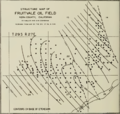
FruitvaleOilFieldStructureMap.png 612 × 583; 192 KB
Categories:
- Oil fields of Kern County, California
- San Joaquin Valley
- Sedimentary basins of the United States
- Kern River Beds Formation
- Oil fields associated with the Etchegoin Formation
- Chanac Formation
- 42-O Sand (geologic formation)
- Oil fields associated with the Santa Margarita Formation (United States)
- Granite formations in California
- Oil fields in California


