Category:Sacramento Valley (California)
Jump to navigation
Jump to search
Northern part of the Central Valley in California, United States of America  | |||||
| Upload media | |||||
| Instance of | |||||
|---|---|---|---|---|---|
| Part of | |||||
| Location | California, Pacific States Region | ||||
| Located in or next to body of water | |||||
 | |||||
English: The Sacramento Valley of California
Subcategories
This category has the following 9 subcategories, out of 9 total.
Media in category "Sacramento Valley (California)"
The following 46 files are in this category, out of 46 total.
-
 22 of 'Three Years in California ... With illustrations' (11034284934).jpg 1,194 × 1,977; 438 KB
-
 California State Route 99.svg 576 × 672; 1.62 MB
-
 Aerial view of Watts-Woodland Airport and surrounding area.jpg 3,264 × 2,448; 5.21 MB
-

-

-
 Bank Swallows in Sac. Valley (19133257423).jpg 640 × 427; 310 KB
-
 Biennial report of the Board of State Harbor Commissioners for (1936) (14591870769).jpg 2,960 × 1,524; 1.23 MB
-
 Bierstadt Albert Sacramento River Valley.jpg 1,920 × 1,200; 235 KB
-
 CA20 Colusa County.JPG 1,280 × 960; 322 KB
-
 California a guide to the Golden state - Harvesting Tomatoes in Sacramento Valley.jpg 2,531 × 1,448; 2.12 MB
-
 California fish and game (19890351694).jpg 1,732 × 2,086; 436 KB
-
 California fish and game (20505384692).jpg 2,864 × 1,768; 1.56 MB
-
 California fish and game (20519317471).jpg 2,067 × 3,340; 503 KB
-
 California views. No. 5. Sacramento Valley LCCN2003663835.jpg 5,843 × 3,059; 2.35 MB
-
 Capay Valley.jpg 4,288 × 2,848; 9.4 MB
-
 Clouds-Great Valley.jpg 3,264 × 2,448; 1.87 MB
-
 HAHL D129 Earth lodges in the Sacramento Valley.png 1,963 × 1,459; 1.47 MB
-
 Graylodgewildlifearea.jpg 1,485 × 1,024; 487 KB
-
 Marshall Diggs 1906.png 216 × 356; 83 KB
-
 NRCSCA06001 - California (953)(NRCS Photo Gallery).jpg 2,100 × 1,500; 5.01 MB
-
 NRCSCA06005 - California (957)(NRCS Photo Gallery).tif 2,100 × 1,500; 12.04 MB
-
 NRCSCA06028 - California (997)(NRCS Photo Gallery).tif 1,500 × 2,100; 12.05 MB
-
 NRCSCA06040 - California (1021)(NRCS Photo Gallery).tif 2,100 × 1,500; 12.05 MB
-
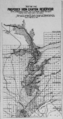 Proposed Iron Canyon Reservoir.png 231 × 437; 135 KB
-
 Sacramento rice fields.jpg 4,288 × 3,216; 8.53 MB
-
 Sacramento Valley and Colusa.jpg 3,264 × 2,448; 1.42 MB
-
 Sacramento Valley Development Association 2.jpg 4,373 × 5,575; 2.99 MB
-
 Sacramento Valley Development Association.jpg 3,704 × 4,858; 5.88 MB
-
 Sacramento Valley flood risk reduction infrastructure (6167778156).jpg 7,200 × 10,800; 10.48 MB
-
 Sacramento Valley Sunset.jpg 4,248 × 2,810; 872 KB
-
 Sacramento Valley, CA (1) 8-2010.jpg 1,536 × 1,152; 522 KB
-
 Sacramento Valley, CA (2).jpg 1,500 × 722; 339 KB
-
 Sacramento valley-001.jpg 960 × 1,280; 188 KB
-
 Sacramento Valley-causeway crime spree.jpg 3,300 × 2,056; 1.55 MB
-

-
 SacramentoValleyBuildingPanamaCaliforniaExpo1915.jpg 845 × 425; 318 KB
-
 Sierras from the Sacramento Valley.png 4,032 × 3,024; 7.95 MB
-
 California AD-03 (2011).svg 2,951 × 2,370; 147 KB
-
 California SD-04 (2011).svg 1,450 × 1,680; 55 KB
-
 The Great West.jpg 414 × 512; 51 KB
-
 Williams 1936 Aerial Photo.jpg 3,024 × 4,032; 5.55 MB
-
 Woodland Geological Survey.jpg 2,936 × 3,615; 2.54 MB
-
 Yolo Bypass Refuge.jpg 3,072 × 2,304; 1.14 MB
-

-
 CA 3 certified.pdf 1,275 × 1,650; 1.21 MB
-
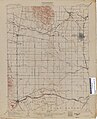
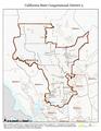
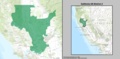 California US Congressional District 3 (since 2013).tif 2,016 × 998; 3.1 MB
.jpg)


_(14595442669).jpg)
.jpg)
.jpg)
_(14591870769).jpg)


.jpg)
.jpg)
.jpg)


(NRCS_Photo_Gallery).jpg)


.jpg)

_8-2010.jpg)
.jpg)


.svg)
.svg)


