Category:Kaweah River
Jump to navigation
Jump to search
river in the United States of America .JPG) | |||||
| Upload media | |||||
| Instance of | |||||
|---|---|---|---|---|---|
| Located in protected area | |||||
| Location | Tulare County, California, Pacific States Region | ||||
| Length |
| ||||
| Mouth of the watercourse | |||||
| Tributary |
| ||||
 | |||||
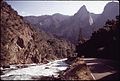
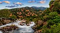
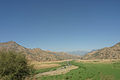
English: The Kaweah River, a tributary of the San Joaquin River in Tulare County, central-eastern California. The river flows from the Sierra Nevada, in Kings Canyon and Sequoia National Parks, to the San Joaquin Valley.
Subcategories
This category has the following 2 subcategories, out of 2 total.
E
T
- Terminus Dam (4 F)
Media in category "Kaweah River"
The following 20 files are in this category, out of 20 total.
-
 KaweahRiver.jpg 958 × 685; 155 KB
-
 Marble Fork Kaweah Forest.jpg 1,024 × 768; 171 KB
-
 BICYCLING ON ROAD TO MINERAL KING - NARA - 542735.jpg 3,000 × 2,034; 4.76 MB
-
 Dinner by the River (50601078768).jpg 5,568 × 3,132; 26.31 MB
-
 FMIB 39558 South Fork of Kaweah River, Near Alles' Ranch.jpeg 571 × 959; 161 KB
-

-

-
 Kaweah River 02.JPG 2,048 × 1,360; 2.35 MB
-
 Kaweah river basin.png 1,346 × 1,000; 1.56 MB
-
 Kaweah River.jpg 3,072 × 2,048; 970 KB
-
 KaweahRiverBetterMap.jpg 839 × 601; 194 KB
-
 KaweahRiverMap.jpg 679 × 684; 275 KB
-

-
 Marble Fork Kaweah River kz01.jpg 2,144 × 3,216; 1.54 MB
-
 Sequoia National Park - Kaweah River and Pumpkin Hollow Bridge.JPG 3,173 × 2,222; 3.13 MB
-
 Sequoia National Park - Kaweah River from Pumpkin Hollow Bridge.JPG 3,456 × 2,115; 3.3 MB
-
 St. Johns River Visalia.jpg 1,018 × 655; 268 KB
-
 Topographic map of Kaweah River.JPG 1,118 × 779; 316 KB
-
 TulareBasinMap.jpg 4,167 × 4,167; 16.33 MB
-
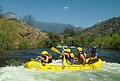 Whitewater Rafting Surfing.jpg 2,720 × 1,847; 1.19 MB


.jpg)


_(14766115175).jpg)


