Category:SVG maps of Latvia
Jump to navigation
Jump to search
This category is for SVG format maps which include Latvia.
Subcategories
This category has the following 5 subcategories, out of 5 total.
Media in category "SVG maps of Latvia"
The following 31 files are in this category, out of 31 total.
-
 Cities and towns of Latvia.svg 1,220 × 720; 1.56 MB
-
 COVID-19 Outbreak Cases in Latvia.svg 1,300 × 820; 298 KB
-
 Historical regions of Latvia mk.svg 1,220 × 720; 990 KB
-
 Historical regions of Latvia.svg 1,220 × 720; 689 KB
-
 Kurzeme location Latvia.svg 1,220 × 720; 447 KB
-
 Kurzemes vēlēšanu apgabals.svg 1,219 × 721; 5.47 MB
-
 Latgale location Latvia.svg 1,220 × 720; 447 KB
-
 Latgales vēlēšanu apgabals.svg 1,219 × 721; 5.47 MB
-
 Latvia 1929-1938.svg 450 × 456; 497 KB
-
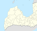
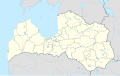 Latvia adm location map.svg 1,304 × 821; 216 KB
-
 Latvia administrative divisions labelled.svg 4,880 × 2,880; 1.83 MB
-
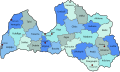
 Latvia administrative divisions.svg 1,220 × 720; 1.57 MB
-
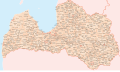
 Latvia districts named.svg 1,124 × 668; 140 KB
-
 Latvia regions map for wikivoyage.svg 1,052 × 620; 1.42 MB
-
 Latvijas novadi un pagasti.svg 1,220 × 722; 5.34 MB
-
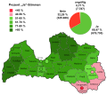 Lettland EU-Mitgliedschaft Abstimmung.svg 649 × 576; 530 KB
-
 LITHUANIA LATVIA INTERCONNECTOR-en.svg 1,600 × 1,178; 48 KB
-
 LITHUANIA LATVIA INTERCONNECTOR.svg 1,600 × 1,178; 48 KB
-
 Locator map of Latvia.svg 680 × 520; 661 KB
-
 LV Coast location map.svg 702 × 592; 145 KB
-
 Map of cases of COVID-19 in Latvia by region, continued.svg 1,300 × 820; 320 KB
-
 Map of cases of COVID-19 in Latvia by region.svg 1,300 × 820; 320 KB
-
 Mapa da Letónia (OCHA).svg 254 × 254; 1.06 MB
-
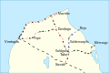
 Rail transport map of Latvia (closed lines).svg 1,000 × 680; 1.84 MB
-
 Stende-Ventspils.svg 744 × 498; 41 KB
-
 Sēlija location Latvia.svg 1,220 × 720; 447 KB
-
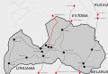 Third Est-Lat Link.svg 2,156 × 1,492; 33 KB
-
 Vidzeme location Latvia.svg 1,220 × 720; 447 KB
-
 Vidzemes vēlēšanu apgabals.svg 1,219 × 721; 5.47 MB
-
 Zemgale location Latvia.svg 1,220 × 720; 447 KB
-
 Zemgales vēlēšanu apgabals.svg 1,219 × 721; 5.47 MB


.svg)


.svg)