Category:Road signs in England
Jump to navigation
Jump to search

Constituent countries of the United Kingdom: England · Northern Ireland · Scotland · Wales – British Crown dependencies: Bailiwick of Guernsey · Isle of Man · Jersey
British overseas territories: Anguilla · Bermuda · British Virgin Islands · Falkland Islands · Gibraltar
British overseas territories: Anguilla · Bermuda · British Virgin Islands · Falkland Islands · Gibraltar
Subcategories
This category has the following 59 subcategories, out of 59 total.
Media in category "Road signs in England"
The following 174 files are in this category, out of 174 total.
-
 2014 A1 changing to motorway.jpg 2,190 × 1,412; 1.49 MB
-
 2014 A1 road sign Maltby.jpg 2,000 × 1,500; 1.43 MB
-
 2023-09-14 Prohibition sign Clifton Suspension Bridge.jpg 6,000 × 4,000; 4.37 MB
-
 A ford on the Shell Brook. - geograph.org.uk - 6970.jpg 640 × 480; 163 KB
-
 A1(M) sign at junction 1, South Mimms.jpg 400 × 539; 39 KB
-
 A1(M) south of Peterborough.jpg 4,608 × 3,456; 7.31 MB
-
 A1245 - geograph.org.uk - 601860.jpg 640 × 455; 82 KB
-
 A20 Road - geograph.org.uk - 1710676.jpg 1,024 × 683; 125 KB
-
 A4071 at Cawston - geograph.org.uk - 1360558.jpg 640 × 428; 92 KB
-
 A4151 east of Littledean - geograph.org.uk - 1640314.jpg 640 × 480; 243 KB
-
 A417 towards Ledbury (showing roadsign) - geograph.org.uk - 503016.jpg 640 × 482; 113 KB
-
 A466 Hereford Road, Buckholt - geograph.org.uk - 1399781.jpg 640 × 480; 234 KB
-
 A681 Bacup Road - geograph.org.uk - 509167.jpg 640 × 480; 111 KB
-
 A82 Longman Road (8463744084).jpg 1,280 × 960; 135 KB
-
 All Saints from the A128 - geograph.org.uk - 1701909.jpg 1,522 × 1,179; 360 KB
-
 Approaching a ford on Bradcar Road - geograph.org.uk - 1761826.jpg 640 × 480; 176 KB
-
 Approaching Scarrow Beck ford - geograph.org.uk - 521125.jpg 480 × 640; 111 KB
-

-
 Avoid London (2005-07-07).jpg 2,315 × 1,736; 386 KB
-
 B1172 Road Signs.jpg 5,184 × 3,888; 9.72 MB
-
 B4077 near Alstone Fields Farm - geograph.org.uk - 1537592.jpg 640 × 480; 227 KB
-
 Bagden Hill - Steep Hill 20^ - geograph.org.uk - 1428863.jpg 640 × 400; 102 KB
-
 Bagden Hill - Steep Hill 20^ - geograph.org.uk - 1428864.jpg 640 × 400; 126 KB
-
 Bawtry A614 road sign.jpg 3,000 × 4,000; 2.3 MB
-
 Benkid77 A56 1 250709.JPG 3,648 × 2,736; 3.53 MB
-
 Beware of low flying motorcycles.jpg 1,594 × 1,600; 465 KB
-
 Bi-lingual road sign, A420, Swindon - geograph.org.uk - 411187.jpg 640 × 480; 98 KB
-
 Blanchland, Northumberland.jpg 2,460 × 1,846; 670 KB
-
 Bowness - panoramio.jpg 2,560 × 1,920; 340 KB
-
 Brand new sign - geograph.org.uk - 709561.jpg 480 × 640; 73 KB
-
 Bridge on Strethall Road (geograph 3209608).jpg 640 × 480; 83 KB
-
 Brightly lit chevrons - geograph.org.uk - 1712153.jpg 1,600 × 1,067; 428 KB
-

-
 Broadmoor - Steep Hill 1-8 - geograph.org.uk - 1429856.jpg 640 × 400; 104 KB
-
 Burcott Road - Steep Hill 14^ - geograph.org.uk - 1426767.jpg 640 × 400; 88 KB
-
 Burcott Road - Steep Hill 14^ - geograph.org.uk - 1426773.jpg 640 × 400; 104 KB
-
 Bus Sign - Flickr - ozz13x.jpg 3,240 × 4,320; 2.35 MB
-
 Byway warning sign.jpg 1,076 × 1,440; 284 KB
-
 Caution, jumping amphibians - geograph.org.uk - 1231610.jpg 640 × 420; 96 KB
-
 Chick Hill - Steep Hill 25^ - geograph.org.uk - 1430874.jpg 640 × 400; 101 KB
-
 Chipstead Way - Steep Hill 12^ - geograph.org.uk - 1427096.jpg 640 × 400; 85 KB
-
 Clevedon MMB 81 M5.jpg 3,678 × 1,806; 1.66 MB
-
 Clevedon MMB 87 M5.jpg 3,545 × 2,064; 1.23 MB
-
 Clevedon MMB 88 M5.jpg 3,588 × 2,046; 1.55 MB
-
 Clevedon MMB A3 M5.jpg 3,559 × 2,234; 2.09 MB
-
 Clevedon MMB A4 M5.jpg 3,625 × 2,139; 2.29 MB
-
 Craster Harbour - geograph.org.uk - 590802.jpg 640 × 480; 74 KB
-
 Crossroad on the B4077 - geograph.org.uk - 1448366.jpg 640 × 426; 121 KB
-
 Crouch Hill - geograph.org.uk - 1600248.jpg 640 × 480; 116 KB
-
 Cycling Squirrels^ - geograph.org.uk - 241519.jpg 434 × 638; 82 KB
-
 Cyclists rejoin carriageway - geograph.org.uk - 5995197.jpg 1,024 × 768; 182 KB
-

-
 East Devon , Country Lane - geograph.org.uk - 3885065.jpg 4,288 × 2,848; 4.65 MB
-
 Ena Road - Steep Hill 17^ - geograph.org.uk - 1425698.jpg 640 × 400; 73 KB
-
 Ena Road - Steep Hill 17^ - geograph.org.uk - 1425705.jpg 640 × 400; 81 KB
-
 Flickr - ronsaunders47 - GREEN FOR GO. WHITE FOR STOP..jpg 3,008 × 2,000; 1.23 MB
-
 Frankley Services, M5 - geograph.org.uk - 864925.jpg 640 × 479; 108 KB
-
 Give Way sign.JPG 4,000 × 3,000; 1.89 MB
-
 Great North Road mileages (Gosforth) - geograph.org.uk - 411977.jpg 408 × 306; 42 KB
-
 Grim - geograph.org.uk - 501106.jpg 640 × 480; 117 KB
-
 Hartley Hill - Steep Hill 15^ - geograph.org.uk - 1427046.jpg 640 × 400; 77 KB
-
 Henfold Lane - Steep Hill 17^ - geograph.org.uk - 1429883.jpg 640 × 400; 104 KB
-
 Henfold Lane - Steep Hill 17^ - geograph.org.uk - 1429894.jpg 640 × 400; 123 KB
-
 Holyhead Road, Wednesbury - sign - Metro Gt. Western St 325 yds (37653747885).jpg 4,608 × 3,456; 5.89 MB
-
 Humbers2.png 1,451 × 855; 2.13 MB
-
 Innovative scheme to tackle accident blackspot wins award (52082940275).jpg 1,733 × 1,197; 784 KB
-
 Intersection of Rigg Lane and Cock Lane - geograph.org.uk - 256179.jpg 640 × 480; 119 KB
-
 Iron Acton railway station MMB 04.jpg 3,780 × 2,514; 2.66 MB
-
 John Ball - Birmingham City Centre walk 3 - 1960s - 18.jpg 1,024 × 560; 109 KB
-
 John Ball - Birmingham City Centre walk 3 - 1960s - 19.jpg 1,024 × 540; 93 KB
-
 Level crossing on Clementhorpe Lane, Gilberdyke - geograph.org.uk - 5048936.jpg 1,200 × 799; 375 KB
-
 Liable to Tidal Flooding - geograph.org.uk - 143730.jpg 640 × 480; 325 KB
-
 Littleton Panell.JPG 2,272 × 1,704; 1.15 MB
-
 LTN modal filter 'road open to' sign.jpg 6,000 × 4,000; 15.8 MB
-
 M27 DLS Tel cropped.jpg 1,152 × 2,583; 514 KB
-
 M27 DLS Tel.JPG 1,944 × 2,592; 395 KB
-
 M27 DLS.JPG 1,944 × 2,592; 229 KB
-
 M6 roadsign - geograph.org.uk - 554749.jpg 640 × 480; 107 KB
-
 Main Road Junction - geograph.org.uk - 277335.jpg 640 × 429; 78 KB
-
 Montpellier Street - panoramio.jpg 1,080 × 1,660; 218 KB
-
 Newtown Town Lane signage.JPG 3,712 × 2,088; 3.29 MB
-
 Nidd village scarecrows 2023-10-14 K (19).JPG 5,184 × 3,456; 7.49 MB
-
 Nidd village scarecrows 2023-10-14 K (20).JPG 5,184 × 3,456; 7.45 MB
-
 Norland Scarecrow Festival 2012 05.jpg 2,118 × 3,230; 4.27 MB
-
 Norland Scarecrow Festival 2012 28.jpg 2,435 × 3,653; 5.06 MB
-
 Northwood - geograph.org.uk - 90204.jpg 640 × 480; 166 KB
-
 Nottingham MMB I3 Hathern Green.jpg 3,933 × 2,571; 3.79 MB
-
 On the border - geograph.org.uk - 1269017.jpg 640 × 480; 236 KB
-
 P1600164 (49279969757).jpg 2,784 × 3,712; 5.1 MB
-
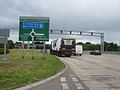
 Peterborough Queensgate Roundabout Sign.jpg 1,597 × 1,306; 608 KB
-
 Piltdown sign.jpg 1,600 × 2,400; 2.05 MB
-
 Prittle Brook Greenway marker post.jpg 1,936 × 2,761; 1.13 MB
-
 Public bridleway to Cromer (4991372843).jpg 2,596 × 1,948; 568 KB
-
 Redselective.jpg 322 × 476; 138 KB
-
 Road Direction Sign in Oxfordshire, England.jpg 3,456 × 4,608; 4.05 MB
-
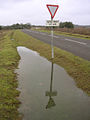
 Road liable to flooding^ - geograph.org.uk - 561516.jpg 640 × 414; 103 KB
-
 Road signs, County Road, Swindon - geograph.org.uk - 1099338.jpg 640 × 480; 139 KB
-
-
 Road.sign.arp.750pix.jpg 750 × 624; 108 KB
-
 Roadsign at Cashmoor - geograph.org.uk - 260693.jpg 480 × 640; 73 KB
-
 Roadworks at Shotwick - geograph.org.uk - 872564.jpg 640 × 480; 102 KB
-
 Rugby-Cosford Lane - geograph.org.uk - 1319768.jpg 640 × 480; 63 KB
-
 Seahouses MMB 31.jpg 4,689 × 2,775; 2.13 MB
-
 Sheep sign.jpg 2,136 × 2,848; 1.28 MB
-
 Shilbottle sign modified to say Shitbottle.jpg 1,160 × 800; 159 KB
-
 Signpost on the A523 - geograph.org.uk - 1707259.jpg 1,600 × 1,067; 364 KB
-
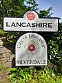 Silverdale boundary sign.jpg 3,000 × 4,000; 3.94 MB
-

-
 SLOW - Concealed Sign - geograph.org.uk - 1343125.jpg 640 × 480; 131 KB
-
 Southampton coach station reversing coaches warning sign 2.JPG 3,712 × 2,088; 3.01 MB
-
 Southampton coach station reversing coaches warning sign.JPG 3,712 × 2,088; 3.17 MB
-
-
 St Brendans Roundabout (7965347154).jpg 1,280 × 960; 815 KB
-
 St George Bradford, Wielka Brytania (3).jpg 4,608 × 3,456; 1.85 MB
-
 The A523 near Adlington - geograph.org.uk - 1707110.jpg 1,600 × 1,067; 413 KB
-
 The bin men cometh, Great Gidding - geograph.org.uk - 1168812.jpg 640 × 480; 100 KB
-
-

-
 The lane above Froxfield - geograph.org.uk - 257611.jpg 640 × 480; 145 KB
-
 Traffic sign, Wellington - geograph.org.uk - 1391110.jpg 480 × 640; 77 KB
-
 UK on the Way 032DSC 0036 (48967573033).jpg 1,618 × 1,081; 972 KB
-
 UK snow February 2, 2009 img006.jpg 3,147 × 3,603; 5.36 MB
-
 Unusual sign in Madeley Road - geograph.org.uk - 1466991.jpg 640 × 480; 83 KB
-
 Various signs for Barton - geograph.org.uk - 1722204.jpg 1,600 × 1,067; 259 KB
-
 Victory Crossing up HST.jpg 1,024 × 768; 246 KB
-
 Wall painting - geograph.org.uk - 1399759.jpg 640 × 426; 46 KB
-
 Warning sign at dusk - geograph.org.uk - 440861.jpg 444 × 640; 61 KB
-

-
 Welcome to George Eliot Country - geograph.org.uk - 227249.jpg 640 × 480; 44 KB
-
 Welcome to Littledean - geograph.org.uk - 741187.jpg 640 × 480; 179 KB
-
 Welcome to Pembridge - geograph.org.uk - 1354421.jpg 640 × 480; 102 KB
-
 Woking Bradfield Close York Road road ahead closed sign September 2009 2.JPG 3,328 × 1,872; 1.9 MB
-
 Wrynose Pass - 1983 - geograph.org.uk - 2240576.jpg 2,272 × 1,514; 807 KB
-
 A19 road sign - geograph.org.uk - 199710.jpg 640 × 480; 106 KB
-
 A417 East approaching Ampney Crucis - geograph.org.uk - 293497.jpg 640 × 480; 117 KB
-
 Access to High Cliffe - geograph.org.uk - 459289.jpg 640 × 480; 137 KB
-
 Alderbrook Road - Steep Hill 1-7 - geograph.org.uk - 1429901.jpg 640 × 400; 111 KB
-
 Alderbrook Road - Steep Hill 1-7 - geograph.org.uk - 1429917.jpg 640 × 400; 101 KB
-
 Anne Hathaway meets Mary Arden - geograph.org.uk - 60572.jpg 640 × 480; 128 KB
-

-

-

-
 B4465 Westerleigh Road - geograph.org.uk - 1499277.jpg 640 × 550; 132 KB
-
 Barhatch Lane - Steep Hill 21^ - geograph.org.uk - 1429948.jpg 640 × 400; 89 KB
-
 Barhatch Lane - Steep Hill 21^ - geograph.org.uk - 1429952.jpg 640 × 400; 108 KB
-
 Beginning of Bolderwood Ornamental Drive - geograph.org.uk - 625340.jpg 427 × 640; 122 KB
-

-
 Bug Hill - Steep Hill 15^ - geograph.org.uk - 1428799.jpg 640 × 400; 132 KB
-
 Burnt Houses - geograph.org.uk - 273294.jpg 640 × 479; 96 KB
-
 Chipstead Way - Steep Hill 12^ - geograph.org.uk - 1427054.jpg 640 × 400; 116 KB
-
 Coast Hill - Steep Hill 12^ - geograph.org.uk - 1438437.jpg 640 × 400; 103 KB
-
 Coast Hill - Steep Hill 12^ - geograph.org.uk - 1438444.jpg 640 × 400; 95 KB
-
 Crawleyside - geograph.org.uk - 501413.jpg 480 × 640; 119 KB
-
 Crocknorth Road - Steep Hill 10^ - geograph.org.uk - 1429801.jpg 640 × 400; 76 KB
-
 Zeals - geograph.org.uk - 5479.jpg 640 × 427; 249 KB
-
 Fosse no-way - geograph.org.uk - 118501.jpg 640 × 480; 57 KB
-
 Fullers Wood Lane - Steep Hill 11^ - geograph.org.uk - 1429811.jpg 640 × 400; 100 KB
-
 Green Street Village Limits - geograph.org.uk - 22117.jpg 640 × 479; 107 KB
-

-
 High Barn Road - Steep Hill 1-7 - geograph.org.uk - 1429785.jpg 640 × 400; 128 KB
-
 Hornecourt Hill - Steep Hill 12^ - geograph.org.uk - 1429871.jpg 640 × 400; 101 KB
-
 Imber Range sign - geograph.org.uk - 537803.jpg 640 × 477; 71 KB
-
 Imber to Heytesbury road, Imber range - geograph.org.uk - 537680.jpg 640 × 477; 79 KB
-
 Long-term road closure - geograph.org.uk - 302151.jpg 640 × 437; 55 KB
-
 Near Melchborne - geograph.org.uk - 383243.jpg 640 × 480; 143 KB
-
 Now they tell me^ - geograph.org.uk - 98946.jpg 640 × 480; 147 KB
-

-
 Pershore Road, Breedon Cross - geograph.org.uk - 227308.jpg 640 × 480; 54 KB
-
 Sign and hedge - geograph.org.uk - 443707.jpg 640 × 480; 102 KB
-
 Solihull - geograph.org.uk - 63047.jpg 640 × 480; 155 KB
-
 Superfluous sign^ - geograph.org.uk - 483296.jpg 640 × 427; 123 KB
-
 The approach to Beltoft - geograph.org.uk - 225824.jpg 640 × 480; 105 KB
-
 Warning - lots of signs ahead - geograph.org.uk - 464977.jpg 640 × 477; 84 KB
-
 West access to Winston village - geograph.org.uk - 459290.jpg 640 × 480; 82 KB


_sign_at_junction_1,_South_Mimms.jpg)
_south_of_Peterborough.jpg)


_-_geograph.org.uk_-_503016.jpg)


.jpg)


.jpg)


.jpg)


_-_geograph.org.uk_-_411977.jpg)


.jpg)

.jpg)


.JPG)
.JPG)


.jpg)


.jpg)


.jpg)
.jpg)


.jpg)


