Category:Road signs in Bedfordshire
Jump to navigation
Jump to search
Ceremonial counties of England: Bedfordshire · Berkshire · Buckinghamshire · Cambridgeshire · Cheshire · Cornwall · Cumbria · Derbyshire · Devon · Dorset · Durham · East Riding of Yorkshire · East Sussex · Essex · Gloucestershire · Greater London · Greater Manchester · Hampshire · Herefordshire · Hertfordshire · Kent · Lancashire · Leicestershire · Lincolnshire · Merseyside · Norfolk · North Yorkshire · Northamptonshire · Northumberland · Nottinghamshire · Oxfordshire · Rutland · Shropshire · Somerset · South Yorkshire · Staffordshire · Suffolk · Surrey · Tyne and Wear · Warwickshire · West Midlands · West Sussex · West Yorkshire · Wiltshire · Worcestershire
City-counties: City of London
Former historic counties:
Other former counties:
City-counties: City of London
Former historic counties:
Other former counties:
Subcategories
This category has the following 3 subcategories, out of 3 total.
F
- Fingerposts in Bedfordshire (13 F)
M
- Milestones in Bedfordshire (27 F)
S
- Street signs in Bedfordshire (6 F)
Media in category "Road signs in Bedfordshire"
The following 13 files are in this category, out of 13 total.
-

-
 Ford and uneven road warning sign in Sutton.JPG 2,604 × 3,472; 2.3 MB
-
 Henlow Camp station geograph-3668319-by-Ben-Brooksbank.jpg 2,342 × 1,314; 4.27 MB
-
 Information overload - geograph.org.uk - 1285466.jpg 640 × 480; 98 KB
-
 Row of houses and club - geograph.org.uk - 727092.jpg 640 × 480; 51 KB
-
 The Spinney (51006575333).jpg 3,024 × 4,032; 7.29 MB
-

-
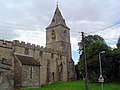 Yelden church - geograph.org.uk - 497431.jpg 640 × 480; 78 KB
-

-
 Farm nameboard. - geograph.org.uk - 174529.jpg 640 × 480; 179 KB
-
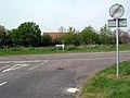
 Road near Thurleigh - geograph.org.uk - 406074.jpg 640 × 480; 83 KB
-
 View towards Northend - geograph.org.uk - 406028.jpg 640 × 480; 90 KB
-
 Village sign, Wilstead, Beds - geograph.org.uk - 190881.jpg 640 × 480; 410 KB


.jpg)


