Category:Road signs in Scotland
Jump to navigation
Jump to search

Constituent countries of the United Kingdom: England · Northern Ireland · Scotland · Wales – British Crown dependencies: Bailiwick of Guernsey · Isle of Man · Jersey
British overseas territories: Anguilla · Bermuda · British Virgin Islands · Falkland Islands · Gibraltar · Montserrat
British overseas territories: Anguilla · Bermuda · British Virgin Islands · Falkland Islands · Gibraltar · Montserrat
Subcategories
This category has the following 29 subcategories, out of 29 total.
- Bilingual road signs in Scotland (25 F)
- Warning road signs in Scotland (37 F)
A
- Road signs in Aberdeen (4 F)
- Road signs in Aberdeenshire (69 F)
- Road signs in Argyll and Bute (34 F)
C
E
- Road signs in East Lothian (10 F)
- Road signs in Edinburgh (45 F)
F
- Road signs in Fife (15 F)
G
- Road signs in Glasgow (29 F)
H
- Road signs in Highland council area (160 F)
I
- Road signs in Inverclyde (12 F)
M
- Road signs in Midlothian (9 F)
N
- Road signs in North Ayrshire (7 F)
P
- Road signs in Perth and Kinross (15 F)
R
- Road signs in Renfrewshire (8 F)
S
W
- Road signs in West Lothian (11 F)
Media in category "Road signs in Scotland"
The following 147 files are in this category, out of 147 total.
-
 16-11-16-Glasgow Airport-RR2 7305.jpg 4,288 × 2,592; 5.58 MB
-
 A road sign for Berwick - geograph.org.uk - 1513446.jpg 427 × 640; 133 KB
-
 A road sign on Gala Water Bridge - geograph.org.uk - 1271511.jpg 640 × 456; 135 KB
-
 A1 northbound - geograph.org.uk - 2955743.jpg 640 × 480; 45 KB
-
 A7 - A720 Roundabout Sign.jpg 496 × 509; 36 KB
-
 A701 crossing Smid Hope Burn - geograph.org.uk - 400932.jpg 640 × 480; 87 KB
-
-
 A79 Road Sign - geograph.org.uk - 1413729.jpg 640 × 480; 79 KB
-
 A82 - Longman Roundabout (8463745652).jpg 1,280 × 960; 136 KB
-
 A82 - Longman Roundabout (8463745824).jpg 1,280 × 960; 129 KB
-
 A835 Contin VMS (6866201198).jpg 1,280 × 960; 814 KB
-
 A835 Contin VMS (6866202268).jpg 1,280 × 960; 883 KB
-
 A835 Ice warning signs at Braemore Jucntion (25419559771).jpg 5,182 × 2,739; 6.6 MB
-
 A890 Auchtertyre (7012328147).jpg 1,280 × 960; 970 KB
-
 A9 Bus & HGV lane sign (12576019163).jpg 3,264 × 2,448; 1.03 MB
-
 A9 Bus & HGV lane sign (12576029363).jpg 3,264 × 2,448; 929 KB
-
 A914, Muirhead - geograph.org.uk - 1623218.jpg 640 × 480; 70 KB
-
 Ae village sign and road. - geograph.org.uk - 1503207.jpg 640 × 480; 113 KB
-
 Ae village sign and road. - geograph.org.uk - 1503230.jpg 640 × 480; 106 KB
-

-
 Amey Road Sign - geograph.org.uk - 714905.jpg 640 × 479; 85 KB
-
 Approach to Howe - geograph.org.uk - 479356.jpg 521 × 384; 43 KB
-
 Approaching Tealing from the west - geograph.org.uk - 12164.jpg 640 × 480; 118 KB
-
 Auchnarrow approach. - geograph.org.uk - 242340.jpg 640 × 426; 82 KB
-
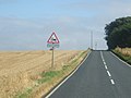
 B7007 beneath Whiteside Law - geograph.org.uk - 1691648.jpg 640 × 480; 110 KB
-
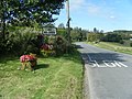
 Bankfoot junction (8125805931).jpg 1,280 × 960; 137 KB
-
 Benbecula South Uist Causeway 1.jpg 640 × 480; 80 KB
-
 Beresford Terrace, Ayr - geograph.org.uk - 5754684.jpg 2,865 × 1,839; 743 KB
-
 Bilingual road sign - geograph.org.uk - 1843871.jpg 640 × 480; 94 KB
-
 Bridgend - geograph.org.uk - 1762752.jpg 580 × 640; 331 KB
-
 Brown signs - geograph.org.uk - 680884.jpg 480 × 640; 76 KB
-

-
 C class road - geograph.org.uk - 781420.jpg 640 × 480; 131 KB
-
 Castle Street, Stranraer - geograph.org.uk - 6208509.jpg 2,910 × 1,888; 843 KB
-
 Caution - Blind Corners.jpg 2,204 × 1,676; 901 KB
-
 Charlotte Auerbach Road, Edinburgh.JPG 3,088 × 2,056; 1.53 MB
-
 Clydeford Road (A763) approaching roundabout (geograph 6968406).jpg 1,024 × 768; 204 KB
-
 Crossroads - for plane and cars^ - geograph.org.uk - 84928.jpg 640 × 480; 53 KB
-
 Don't panic - geograph.org.uk - 546035.jpg 640 × 480; 61 KB
-
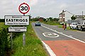 Eastriggs - geograph.org.uk - 465490.jpg 640 × 427; 96 KB
-

-
 Entering Eshaness - geograph.org.uk - 534815.jpg 640 × 480; 66 KB
-
 Exeunt omnes - geograph.org.uk - 480233.jpg 540 × 383; 41 KB
-
 Farm Traffic sign at Broadmuir - geograph.org.uk - 537113.jpg 640 × 480; 60 KB
-
 Forestry road sign - geograph.org.uk - 499769.jpg 640 × 480; 196 KB
-
 Gelston - geograph.org.uk - 444307.jpg 640 × 480; 124 KB
-
 Glasgow Road (A724) approaching roundabout (geograph 6967343).jpg 800 × 600; 113 KB
-
 Glashvin Quiraing Flodigarry geograph-3215081-by-Ben-Brooksbank.jpg 843 × 488; 504 KB
-
 Green Fields - geograph.org.uk - 411226.jpg 640 × 480; 81 KB
-
 Hebridean Bus on the A859 - geograph.org.uk - 153670.jpg 640 × 480; 79 KB
-
 High Street, Ayr - geograph.org.uk - 2868042.jpg 1,280 × 856; 132 KB
-
 Junction in Freswick - geograph.org.uk - 480349.jpg 640 × 480; 117 KB
-
 Junction of B847 and B846 - geograph.org.uk - 1436874.jpg 640 × 619; 97 KB
-
 Junction of road to Appletreehall - geograph.org.uk - 283408.jpg 640 × 480; 48 KB
-
 Junction Road signs. - geograph.org.uk - 518860.jpg 640 × 480; 114 KB
-
 King Street - geograph.org.uk - 3291130.jpg 1,600 × 1,200; 483 KB
-
 Kirkconnel - geograph.org.uk - 466431.jpg 640 × 418; 104 KB
-
 Lane to Laikenbuie holiday cottages. - geograph.org.uk - 244236.jpg 640 × 426; 134 KB
-
 Lesmahagow - Turn Left.jpg 1,244 × 833; 388 KB
-
 Longformacus, Scottish Borders - geograph.org.uk - 699118.jpg 640 × 480; 93 KB
-
 Lyth junction at Westerloch - geograph.org.uk - 479308.jpg 640 × 480; 120 KB
-
 M8 crosses the B763 - geograph.org.uk - 1264241.jpg 640 × 480; 116 KB
-
 Multiple signs - geograph.org.uk - 830377.jpg 640 × 480; 116 KB
-
 NC500 Caravan warning.jpg 3,377 × 1,953; 672 KB
-
 Crossing the Nith by bridge - geograph.org.uk - 533090.jpg 640 × 480; 116 KB
-
 North Strand Street, Stranraer - geograph.org.uk - 4027578.jpg 1,831 × 1,124; 366 KB
-
 North Strand Street, Stranraer - geograph.org.uk - 5851238.jpg 2,897 × 1,893; 531 KB
-
 Old RAC Road Sign - geograph.org.uk - 385619.jpg 634 × 472; 176 KB
-

-
 Old Sign Post - geograph.org.uk - 250285.jpg 640 × 480; 124 KB
-
 Otters Crossing, Eriskay.jpg 3,264 × 2,448; 2.08 MB
-
 Pentland Hills 2000-05-14.jpg 2,856 × 1,016; 976 KB
-
 Pentland Hills2 2000-05-14.jpg 1,800 × 1,200; 458 KB
-

-
 Polmadie slip road onto the M74 (geograph 5260044).jpg 1,600 × 1,200; 237 KB
-
 Road junction - geograph.org.uk - 1548093.jpg 640 × 480; 116 KB
-
 Road sign - geograph.org.uk - 340454.jpg 480 × 640; 75 KB
-
-
 Road sign Isle of Lewis.JPG 2,435 × 1,624; 864 KB
-
 Road sign on A920 - geograph.org.uk - 1211171.jpg 640 × 550; 80 KB
-
 Road sign on the A859 - geograph.org.uk - 1322682.jpg 640 × 480; 63 KB
-
 Road sign on the A941 - geograph.org.uk - 1346304.jpg 640 × 454; 55 KB
-
 Road Sign on the Midsteeple - geograph.org.uk - 401566.jpg 480 × 640; 101 KB
-
 Road to Govig - geograph.org.uk - 209960.jpg 640 × 427; 98 KB
-
 Road to Nowhere - geograph.org.uk - 220198.jpg 480 × 640; 106 KB
-
 Road to Old Blair and Glenfender - geograph.org.uk - 541537.jpg 640 × 480; 208 KB
-
 Road to Twatt, off the A966 - geograph.org.uk - 954207.jpg 640 × 480; 70 KB
-
 Roadside signs - geograph.org.uk - 178373.jpg 640 × 480; 85 KB
-

-
 Roadworks and traffic on the M90 - geograph.org.uk - 3063209.jpg 3,264 × 2,448; 3.39 MB
-
 Rumbling Brigde - geograph.org.uk - 568092.jpg 480 × 640; 126 KB
-
 Sandgate, Ayr - geograph.org.uk - 257903.jpg 640 × 469; 130 KB
-
 SCO-Ashkirk-A7 highway 2018.jpg 2,048 × 1,536; 1.6 MB
-
 Scottish Gaelic road sign on Harris.jpg 3,264 × 2,448; 2.96 MB
-
 ScottishLabourOut-Stornoway-Scotland-20100407.jpg 810 × 810; 300 KB
-
 ScottishLiberalDemocratsNoEntry-Stornoway-Scotland-20100407.jpg 759 × 987; 324 KB
-
 Shhhh^ - geograph.org.uk - 204171.jpg 640 × 480; 98 KB
-
 Sign for Barra Ferry, South Uist - geograph.org.uk - 249972.jpg 640 × 427; 88 KB
-
 Sign for Cumlaquoy road - geograph.org.uk - 237273.jpg 640 × 425; 102 KB
-
 Sign, Folda - geograph.org.uk - 1535665.jpg 480 × 640; 92 KB
-
 Signpost at Bayhead - geograph.org.uk - 708781.jpg 640 × 480; 87 KB
-
 Signpost at Junction - geograph.org.uk - 361910.jpg 640 × 482; 99 KB
-
 Signpost, West Saltoun - geograph.org.uk - 2901740.jpg 640 × 360; 189 KB
-
 Signs at Longformacus - geograph.org.uk - 618778.jpg 640 × 480; 120 KB
-
 Skye Road Sign Sheep 01.jpg 1,024 × 683; 343 KB
-
 Snow Gates - geograph.org.uk - 1002814.jpg 640 × 428; 79 KB
-
 St John Street, Stranraer - geograph.org.uk - 5642046.jpg 2,592 × 1,728; 2.01 MB
-
 St Michaels crossroads - geograph.org.uk - 175133.jpg 640 × 424; 71 KB
-
 Stadium Road at Longman Roundabout (8462645493).jpg 1,280 × 960; 153 KB
-
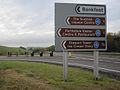
 Strathclyde Region.jpg 1,174 × 644; 120 KB
-
 The A1 at Grantshouse - geograph.org.uk - 1779942.jpg 640 × 427; 139 KB
-
 The B7016 to Braehead - geograph.org.uk - 930715.jpg 640 × 480; 82 KB
-
 The Border into DumfriesandGalloway - geograph.org.uk - 512702.jpg 640 × 480; 95 KB
-
 The Road to Luskentyre - geograph.org.uk - 1242223.jpg 640 × 429; 82 KB
-
 Three Streets, Stranraer - geograph.org.uk - 5142320.jpg 1,920 × 1,280; 1.16 MB
-
 To the old sawmill at Tarryblake. - geograph.org.uk - 255757.jpg 640 × 426; 132 KB
-

-
 Traffic sign - geograph.org.uk - 2326792.jpg 640 × 239; 88 KB
-
 Tummel bridges (8125813143).jpg 1,280 × 960; 178 KB
-
 Twatt Orkney Road Sign.JPG 2,448 × 3,264; 3.76 MB
-
 Twatt road sign.jpg 1,704 × 2,272; 1.17 MB
-
 Twatt sign.jpg 1,704 × 2,272; 852 KB
-
 Twenty's Plenty - Speed Sign - Glasgow, Scotland.jpg 4,000 × 3,000; 2.67 MB
-
 Tyndrum(1).jpg 640 × 479; 70 KB
-
 Welcome to Lochans - geograph.org.uk - 412775.jpg 640 × 427; 80 KB
-
 Welcome to Moscow! (in Scotland) (3410378204).jpg 4,320 × 2,868; 4.35 MB
-
 Wellington Square, Ayr - geograph.org.uk - 2867578.jpg 1,280 × 856; 109 KB
-
 Wellington Square, Ayr - geograph.org.uk - 2876301.jpg 1,600 × 1,200; 483 KB
-
 West Kilbride sign.jpg 1,408 × 1,056; 716 KB
-
 Which way now^ - geograph.org.uk - 274906.jpg 597 × 400; 124 KB
-
 A trip through Morvern - geograph.org.uk - 625492.jpg 640 × 480; 55 KB
-
 Drymen - geograph.org.uk - 250376.jpg 640 × 479; 58 KB
-
 Just one mile to Tombae. - geograph.org.uk - 242320.jpg 640 × 426; 91 KB
-
 Narrow bridge - geograph.org.uk - 102425.jpg 467 × 640; 191 KB
-
-
 New Luce Road, Barrhill - geograph.org.uk - 313503.jpg 640 × 480; 72 KB
-
 Old road sign - geograph.org.uk - 213953.jpg 640 × 480; 96 KB
-
 Passing place - geograph.org.uk - 145511.jpg 640 × 480; 204 KB
-
 Road sign - geograph.org.uk - 104893.jpg 640 × 421; 46 KB
-

-
 Road sign to the settlement of Pottie - geograph.org.uk - 104153.jpg 640 × 417; 67 KB
-
 Roadsign by Hazlebank. - geograph.org.uk - 347506.jpg 640 × 426; 173 KB
-
 The C39 Road near Timsgearraidh - geograph.org.uk - 490494.jpg 640 × 425; 63 KB
-

-
 Traffic problems are not new.. - geograph.org.uk - 55054.jpg 640 × 480; 81 KB
-
 Ultra-short 30MPH limit - geograph.org.uk - 202414.jpg 640 × 480; 77 KB
-
 Weak Wall^ - geograph.org.uk - 53666.jpg 640 × 427; 145 KB


.jpg)

.jpg)
.jpg)
.jpg)
.jpg)
.jpg)
.jpg)
.jpg)
.jpg)


.jpg)


_approaching_roundabout_(geograph_6968406).jpg)


_approaching_roundabout_(geograph_6967343).jpg)


.jpg)


.jpg)


.jpg)


.jpg)

_(3410378204).jpg)


