Category:Old maps of the Philippines
Jump to navigation
Jump to search
Deutsch: Alte Karten der Philippinen
English: Old maps of the Philippines
Use the appropriate category for maps showing all or a large part of Philippines. See subcategories for smaller areas:
| If the map shows | Category to use |
|---|---|
| Philippines on a recently created map | Category:Maps of the Philippines or its subcategories |
| Philippines on a map created more than 70 years ago | Category:Old maps of the Philippines or its subcategories |
| the history of Philippines on a recently created map | Category:Maps of the history of the Philippines or its subcategories |
| the history of Philippines on a map created more than 70 years ago | Category:Old maps of the history of the Philippines or its subcategories |
Subcategories
This category has the following 2 subcategories, out of 2 total.
M
- Old maps of Mindanao (20 F)
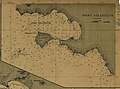
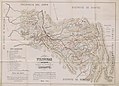
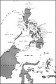
Media in category "Old maps of the Philippines"
The following 16 files are in this category, out of 16 total.
-
-

-
 Carte des mers de Canton au Cambodge et aux Philippines - btv1b53103906m (1 of 2).jpg 17,324 × 14,264; 36.87 MB
-
 455 of 'A Visit to the Philippine Islands. (With plates.)' (11237369725).jpg 1,348 × 1,051; 212 KB
-
-
 Admiralty Chart No 2578 Eastern Part of the Sulu or Mindoro Sea, Published 1867.jpg 16,643 × 10,883; 58.42 MB
-
 Admiralty Chart No 3816 Verde Island Passage, Published 1937.jpg 16,230 × 11,084; 21.59 MB
-
 Admiralty Chart No 928 Sulu Archipelago, Published 1879.jpg 16,185 × 10,882; 53.99 MB
-
 Admiralty Chart No 948 Balabac Strait, Published 1870.jpg 10,888 × 16,454; 53.98 MB
-
 Carta General (en dos hojas) del Archipíelago Filipino (1875 and 1902).tif 22,860 × 30,116; 842.79 MB
-
 Malaysia and the Pacific archipelagoes BHL20474397.jpg 1,264 × 2,787; 415 KB
-
 Map of Davao Province - NARA - 50925930.jpg 8,640 × 14,703; 8.67 MB
-
 Map of Southern Philippines - NARA - 50925928.jpg 12,388 × 8,992; 22.86 MB
-
 Philippine Island - Miscellaneous - NARA - 68156024.jpg 5,360 × 6,895; 6.29 MB
-

-
 Southwest Pacific Area around Celebes Sea.jpg 1,024 × 1,539; 200 KB
_4254,_by_Manila_Sub_Office,_United_States_Coast_and_Geodetic_Survey_(cropped).jpg)
_Luzon,_Philippines_nautical_chart_4254,_by_Manila_Sub_Office,_United_States_Coast_and_Geodetic_Survey.jpg)
.jpg)
%27_(11237369725).jpg)
.jpg)


_(14578100549).jpg)
