Category:Old maps of Macau
Jump to navigation
Jump to search
Media in category "Old maps of Macau"
The following 101 files are in this category, out of 101 total.
-
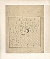
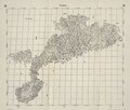
Guang Yutu 1558 Vol 1 Pg 47 Guangdong 1.jpg 4,380 × 4,658; 4.04 MB
-
Fen ye yu tu. LOC 2002626777-16.jpg 4,272 × 5,080; 1.9 MB
-
Fen ye yu tu. LOC 2002626777-16.tif 4,272 × 5,080; 62.09 MB
-
The Kingdome of China newly augmented by I.S. 1626.jpg 12,701 × 9,978; 29.59 MB
-
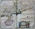
"Quantung, Imperii Sinarum provincia duodecima" (22240445622).jpg 3,598 × 3,006; 2.12 MB
-
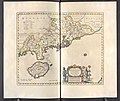
Qvantvng - Atlas Maior, vol 11, map 24 - Joan Blaeu, 1667 - BL 114.h(star).11.(24).jpg 4,000 × 3,351; 1.93 MB
-
Macao 1668 Joan Blaeu 05003 BnF.jpg 4,912 × 3,264; 4.59 MB
-
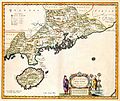
Atlas Van der Hagen-KW1049B13 048-QVANTVNG, IMPERII SINARVM PROVINCIA DVODECIMA.jpeg 5,500 × 4,620; 3.12 MB
-
Der Jesuiten-Atlas der Kanghsi-Zeit - China und die Aussenlaender LOC 74650033-31.jpg 9,669 × 8,228; 8.69 MB
-
Der Jesuiten-Atlas der Kanghsi-Zeit - China und die Aussenlaender LOC 74650033-31.tif 9,669 × 8,228; 227.61 MB
-
Kouang-Toung - par Jean-Baptiste d'Anville - btv1b53009299t.jpg 6,495 × 5,141; 5.62 MB
-
Province de Quang-Tong - (tirée du P. Duhalde) - btv1b85951154.jpg 10,496 × 7,978; 12.95 MB
-
Province du Quang-tong (French map of Guangdong Province, China, 1735).jpg 5,700 × 4,308; 3.41 MB
-
Anville Nouvel atlas de la Chine - Page46 quang tong.jpg 4,600 × 3,720; 5.83 MB
-
Da Qing fen sheng yu tu LOC 2002626726-16.jpg 5,296 × 4,515; 2.26 MB
-
Da Qing fen sheng yu tu LOC 2002626726-16.tif 5,296 × 4,515; 68.41 MB
-
1764 Bellin Map of Macao China.jpg 2,103 × 2,628; 832 KB
-
A Plan of the City and Harbour of Macao.jpg 1,124 × 1,536; 1.3 MB
-
Zhi li ge sheng yu di quan tu - Zhang Zongjing - btv1b53103898v (33 of 69).jpg 5,137 × 4,427; 2.83 MB
-
BOELEN(1836) T3 p218 DE RIVIER TIGRIS AN DE STAD CANTON.jpg 4,789 × 2,143; 4.92 MB
-
BOELEN(1836) T3 p286 SCHETS VAN DE HAVEN VAN MACAO.jpg 2,004 × 2,525; 2.45 MB
-
Admiralty Chart No 1263 Entrance to the Canton River, Published 1840.jpg 15,068 × 11,389; 18.94 MB
-
Guangdong quan tu LOC gm71005120.jpg 13,026 × 10,962; 17.63 MB
-
Hunan Guangdong he tu. LOC gm71005129.jpg 9,297 × 9,186; 8.78 MB
-
Hunan Guangdong he tu. LOC gm71005129.tif 9,297 × 9,186; 244.34 MB
-
Huang chao zhi sheng di yu quan tu - btv1b531099218 (21 of 38).jpg 6,177 × 4,548; 3.81 MB
-
Guangdong quan sheng shui lu yu tu LOC gm71005159.jpg 14,152 × 11,530; 22.07 MB
-
Guangdong quan sheng shui lu yu tu LOC gm71005159.tif 14,152 × 11,530; 466.84 MB
-
Map-macao-1889.png 2,107 × 3,000; 9.47 MB
-
Tian xia zong yu tu. LOC 2002626780-17.jpg 3,865 × 3,150; 1.15 MB
-
Tian xia zong yu tu. LOC 2002626780-17.tif 3,865 × 3,150; 34.83 MB
-
STANFORD(1917) p15-16 PLATE 1. KWANGTUNG (14597113490).jpg 4,790 × 3,795; 8.54 MB
-
1935 Guangdong sheng you.png 1,444 × 2,004; 6.48 MB
-
AMH-5171-NA Map of Macao, Amy and Quemoy.jpg 2,400 × 1,694; 490 KB
-
AMH-6721-KB Map of China and Korea.jpg 2,400 × 2,187; 1,001 KB
-
AMH-7965-KB Map of the mouth of the Canton River (cropped).jpg 1,752 × 2,336; 858 KB
-
AMH-7965-KB Map of the mouth of the Canton River.jpg 1,846 × 2,400; 891 KB
-
AMH-8181-KB Three charts of the Chinese coast near Kanton (cropped).jpg 1,536 × 2,048; 653 KB
-
AMH-8181-KB Three charts of the Chinese coast near Kanton.jpg 1,715 × 2,400; 759 KB
-
Asia noviter delineata - Macao.jpg 1,420 × 1,070; 217 KB
-
Compagnie des indes orientales 1006853.jpg 2,128 × 1,904; 1.57 MB
-
D559- N° 411. La rivière de Canton et Macao. - liv3-ch14.png 980 × 1,502; 114 KB
-
Du Halde - Description de la Chine - Carte de l entree de Canton.jpg 1,755 × 2,764; 952 KB
-
Macao, Macau, plan de la ville et du port de Macao. par N.B. Ingénieur de la Marine,.jpg 2,848 × 3,581; 2.27 MB
-
Macau 1889.jpg 7,132 × 10,388; 19.41 MB
-
Macau in Livro das Plantas de Todas as Fortalezas.jpg 6,038 × 4,166; 6.2 MB
-
Macau oldmap.jpg 552 × 372; 60 KB
-
Map of Hong Kong and Macau 1760.JPG 1,632 × 1,224; 427 KB
-
Map of Macao 1936.png 1,211 × 1,299; 720 KB
-
Map of Macao boundary.jpg 1,488 × 1,057; 862 KB
-
Map of Macao.jpg 768 × 1,024; 115 KB
-
Map of Macau (1934).png 819 × 799; 998 KB
-
Mapa Diocese Macau 1894.jpg 1,910 × 1,474; 518 KB
-
Mapa Peninsula Macau 1889.gif 512 × 694; 222 KB
-
MapaMacau1912.jpg 631 × 908; 81 KB
-
Mappa da barra de Macao LOC 89696137.jpg 4,889 × 8,400; 5.06 MB
-
Mappa da barra de Macao LOC 89696137.tif 4,889 × 8,400; 117.5 MB
-
Meyers b9 s0474 b2.png 383 × 494; 102 KB
-
Mission du Kouang-tong.jpg 2,362 × 1,473; 3.6 MB
-
Pearl River Entrance 1922.jpg 13,216 × 12,000; 18.01 MB
-
Plan de la Ville de Macao - Cazablanc.png 748 × 629; 854 KB
-
Plan de la Ville de Macao et de Ses Environs aux Portugais.png 1,536 × 1,136; 2.65 MB
-
Plan de la Ville et du Port de Macao.jpg 950 × 1,180; 1.13 MB
-
Plan de la Ville et du Port de Macao.png 1,032 × 1,332; 843 KB
-
Plan du Typa, ou de Macao (18951885193).jpg 3,776 × 5,256; 3.15 MB
-
Reconhecimento hydrográphico (sic) do pôrto e rada de Macau. LOC 89696066.jpg 6,396 × 8,477; 7.45 MB
-
Reconhecimento hydrográphico (sic) do pôrto e rada de Macau. LOC 89696066.tif 6,396 × 8,477; 155.12 MB
-
Situationskärtchen von Kanton, Makao, Hongkong.jpg 966 × 1,233; 207 KB
-
Ville et Port de Macao.png 870 × 970; 1.86 MB
-
Xcantonplan.jpg 800 × 1,067; 179 KB
-
七省沿海圖-新安至陽江.png 2,748 × 1,024; 4.17 MB
-
澳門香港航海圖(香港部份)Macau Nautical Chart (Hong Kong), 1810.jpg 720 × 559; 69 KB
-
皇清地理圖八十一及八十二.jpg 4,096 × 3,463; 2.68 MB

