Category:Old maps of Nepal
Jump to navigation
Jump to search
Subcategories
This category has the following 2 subcategories, out of 2 total.
Media in category "Old maps of Nepal"
The following 66 files are in this category, out of 66 total.
-

-
 'The Steam House' by Léon Benett 019.jpg 474 × 700; 106 KB
-
-

-
 Der Jesuiten-Atlas der Kanghsi-Zeit - China und die Aussenlaender LOC 74650033-15.jpg 10,004 × 9,130; 8.59 MB
-
 Der Jesuiten-Atlas der Kanghsi-Zeit - China und die Aussenlaender LOC 74650033-15.tif 10,004 × 9,130; 261.32 MB
-
 1748 Homann Heirs Map of India and Southeast Asia - Geographicus - India-hmhr-1748.jpg 4,354 × 5,000; 8.23 MB
-
 1780 Raynal and Bonne Map of Northern India - Geographicus - IndeSuperieure-bonne-1780.jpg 2,500 × 1,746; 1.27 MB
-

-
 8 of 'On India's Frontier; or Nepal, the Gurkhas' mysterious land' (11231179016).jpg 1,163 × 1,833; 304 KB
-

-
-
 An accurate map of Hindostan or India, from the best authorities. NYPL1404033.tiff 6,299 × 5,248; 94.6 MB
-
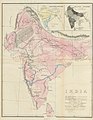
 Brit IndianEmpireReligions3.jpg 1,534 × 1,241; 2.33 MB
-

-
 Carte du K2.jpg 2,756 × 2,052; 1.33 MB
-

-
 China Nepal border.png 1,070 × 764; 319 KB
-

-
 D061- Tibet -liv2-ch11.png 1,454 × 1,896; 483 KB
-
 D189- Inde des origines bouddhiques -liv2-ch12.png 1,448 × 1,420; 368 KB
-
 Map of India showing the distribution of langages - Beames 1868.jpg 1,400 × 1,383; 266 KB
-
 Egnazio Danti - Tibet, Nepal and Northern Hindustan - Google Art Project.jpg 3,299 × 9,409; 15.65 MB
-
 GARWOOD MAP 640x617 148a.jpg 640 × 617; 109 KB
-
 Hindoostan (20118721954) (cropped).jpg 1,594 × 669; 1.27 MB
-
 Hindoostan (20118721954).jpg 2,000 × 1,956; 3.66 MB
-
 Hindoostan map 1814.jpg 2,489 × 2,430; 5.97 MB
-
 Hindostan 1814.jpg 1,483 × 1,275; 405 KB
-
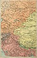
 Historical Map of Sikkim in northeastern India.jpg 4,510 × 3,916; 14.76 MB
-
 India and Inner Asia.jpg 1,393 × 1,130; 396 KB
-
 India China transportation - 1942-1943.jpg 3,690 × 1,747; 1.22 MB
-
 India, Nepal, China border.jpg 2,149 × 1,686; 935 KB
-
 Joppen1907India1805a-21-es.svg 1,208 × 1,448; 2.78 MB
-
 Map India and Pakistan 1-250,000 Tile NF 44-14 Philibhit.jpg 5,000 × 3,765; 3.51 MB
-
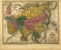
 Map of Asia, Mitchell's School Atlas LOC 2007633727-13 (cropped).jpg 3,117 × 2,378; 1.79 MB
-

-
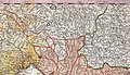
 Map of Greater Nepal (with part of ceded territory).jpg 8,841 × 3,225; 3.91 MB
-
 Map of India by Wyld James.jpg 2,400 × 3,471; 2.72 MB
-
 Map of Ming Chinese empire 1415 (cropped).jpg 1,440 × 2,178; 389 KB
-
 Map of Ming Chinese empire 1415.jpg 1,577 × 2,339; 451 KB
-
 Map of Nepal in 1782.png 3,392 × 1,765; 3.89 MB
-
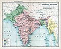
 Map of the partition of British India.jpg 5,152 × 4,777; 2.71 MB
-

-
-
 Map of Tibet in 1782, Hindoostan (20118721954) (cropped).jpg 1,114 × 455; 593 KB
-

-

-
 Mitchell's school atlas LOC 2007633727-13.jpg 3,402 × 2,814; 1.97 MB
-
 Mitchell's school atlas LOC 2007633727-13.tif 3,402 × 2,814; 27.39 MB
-
 Nepal mandala map.jpg 829 × 379; 477 KB
-
 Nepal. LOC 2001627649.jpg 2,534 × 3,270; 704 KB
-
 Nepal. LOC 2001627649.tif 2,534 × 3,270; 23.71 MB
-
 Nepal. LOC 2001627650.jpg 2,511 × 3,268; 896 KB
-
 Nepal. LOC 2001627650.tif 2,511 × 3,268; 23.48 MB
-
 Nepal. LOC 2005631070.jpg 2,404 × 3,026; 788 KB
-
 Nepal. LOC 2005631070.tif 2,404 × 3,026; 20.81 MB
-
 Old map of India, from the British Library.jpg 2,034 × 3,021; 1.35 MB
-
 Ost-Indien Mit Den Inseln.jpg 5,304 × 4,331; 7.17 MB
-
 Pacific Theater Areas;map1.JPG 1,199 × 873; 351 KB
-
 Pieni 2 0791 China.png 514 × 437; 611 KB
-
 Punjab, Kashmir, Far-west Nepal.jpg 1,669 × 2,172; 728 KB
-
 Sheet 50 Nepal-China border alignment (1979).jpg 6,253 × 3,369; 3.8 MB
-
 Statical and general map of India (Sheet-12).jpg 4,520 × 3,848; 2.41 MB
-
 Vorder-Indien oder das Indo-Britische Reich.jpg 5,683 × 4,568; 8.96 MB
-
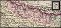
 West Nepal and Oudh.jpg 1,686 × 2,224; 932 KB
-
 Политическая карта Азии начало XX века.jpg 3,194 × 2,128; 1.54 MB
.jpg)

.jpg)
%27_(11180098823).jpg)


.jpg)
_(16584586909).jpg)

.jpg)

_south_east.jpg)

_By_Major_James_Rennell.jpg)


_(cropped).jpg)
.jpg)


.jpg)
_with_parts_of_Tibet,_India_and_Nepal,_from-_Stanford%27s_map_of_the_empires_of_China_and_Japan_with_the_adjacent_parts_of_the_Russian_Empire,_India,_Burma_etc._LOC_2006458442_(cropped).jpg)

.jpg)


.jpg)
.jpg)
.jpg)


.jpg)
.jpg)


.jpg)
,_from-_1748_Homann_Heirs_Map_of_India_and_Southeast_Asia_-_Geographicus_-_India-hmhr-1748_(cropped).jpg)
_(cropped).jpg)